A wee adventure

Stage 133, 27th July: Morar to Kylesmorar

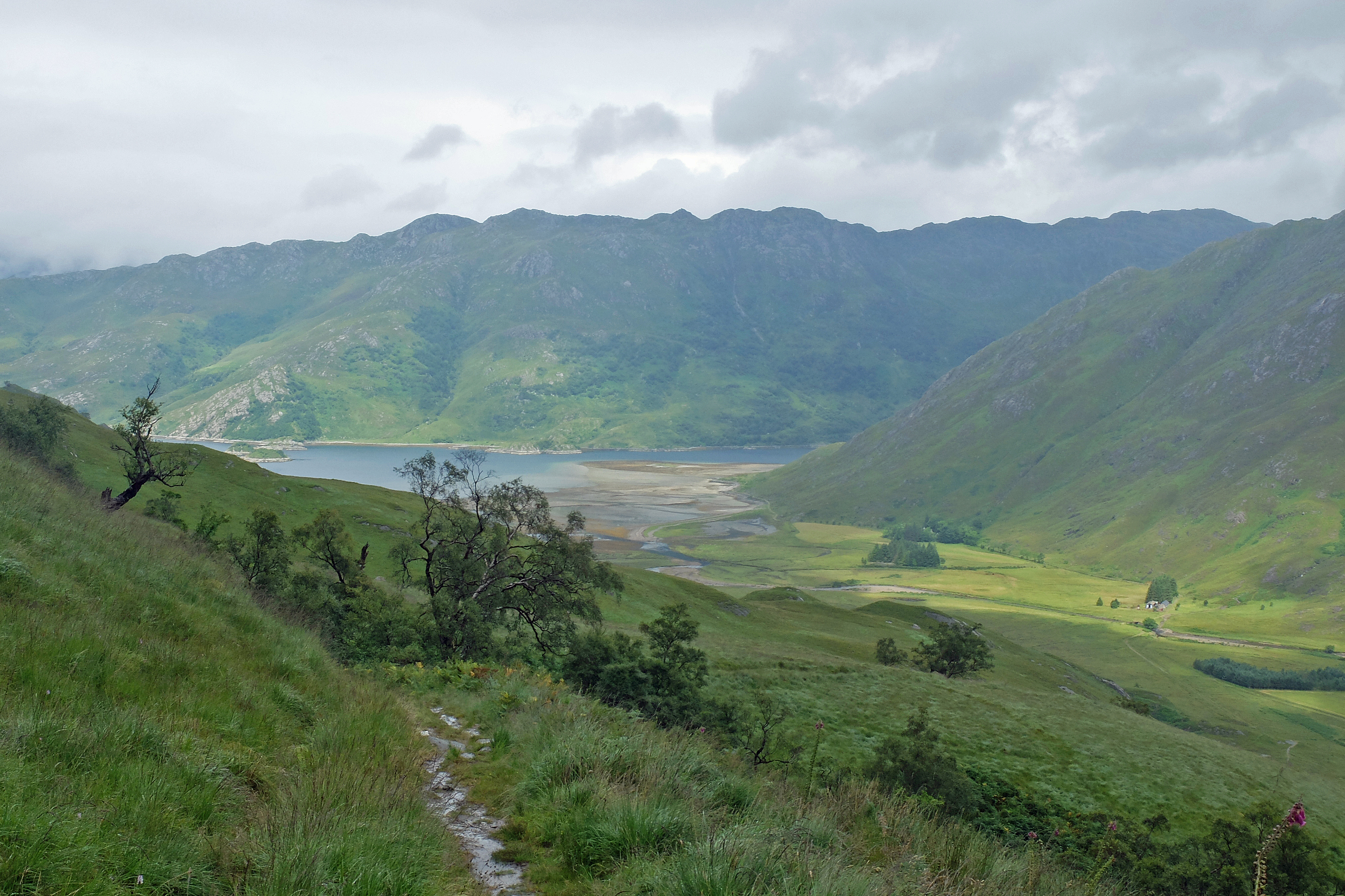
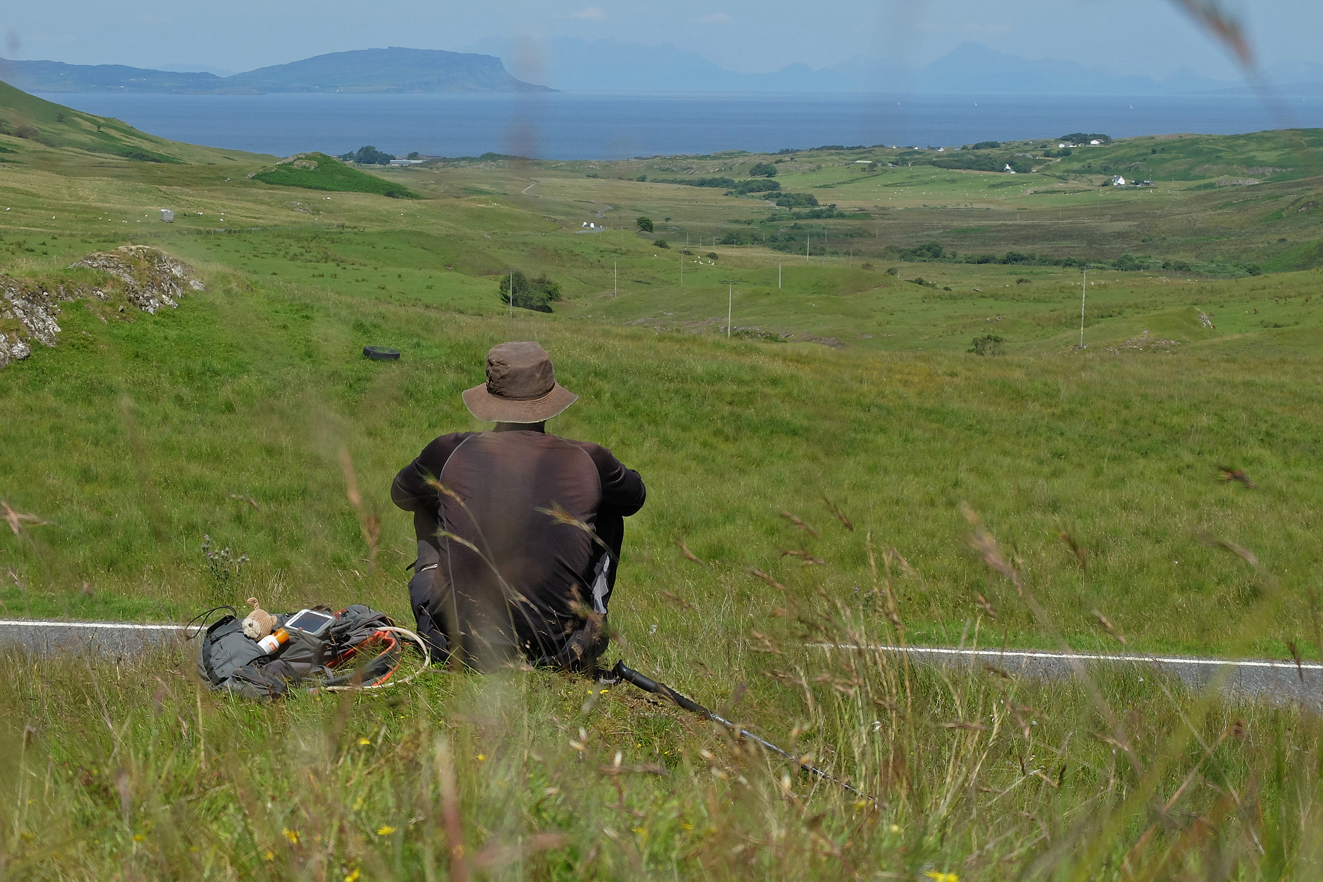
After their hefty drive up from the home counties Ray and Suzie were now safely aboard Snickers. I squeezed my kit into my 38 litre rucksack for two nights in the remotest part of the British mainland. It was all expensive lightweight kit, much of it generously given to me by my friends and work colleagues when I left the corporate world behind last September. The waterproofs had already been tested many times, but the tent, the sleep mat and other bits and bobs hadn’t had a unified run out. Ray and Suzie headed out to Plockton for a couple of days peace and it all felt very comfortable as I headed out East along the North shore of Loch Morar, but it soon dawned on me why I had decided not to do the entire walk with a big rucksack as my hips began to ache and grind. I am not military trained, nor am I in my twenties or thirties, so simple daysack normality made a great deal of sense to me when I planned this venture. Today, with no vehicle access even vaguely possible, needs must.

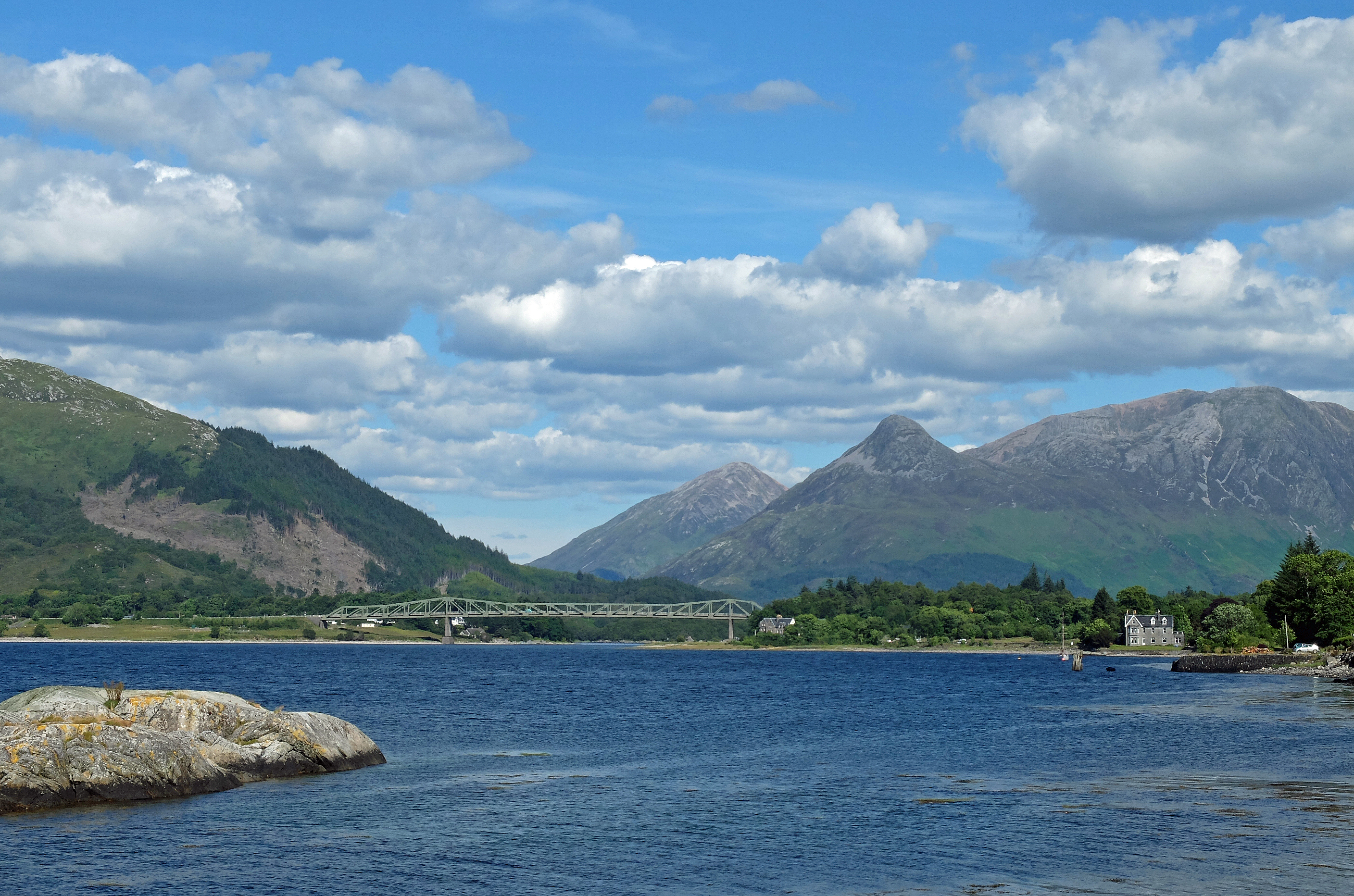
It didn’t help that the sky was very grey and heavy with over-saturated clouds.  Even though the persistent rain was on my back, it wasn’t a pleasant walk. But as I began the rise northwards over the pass towards Tarbet the rain ceased and the landscape opened up and down the loch. By the time I reached the three house hamlet of Tarbet my hips were killing me.

I crawled my way over the headland for another mile to Kylesmorar and dumped the rucksack to look for a suitable place to pitch my tent. As I peered over the brow of the hill a house came into view and three people were sitting outside enjoying the sunshine which had now said hello. I too went over to say hello and was immediately offered a cold beer. Not one to refuse, I sat down for a few minutes to chat to the family on holiday from Lancashire. Edna their cockatoo then picked her way up my leg and sat on my shoulder. Things were beginning to feel more than a little surreal.

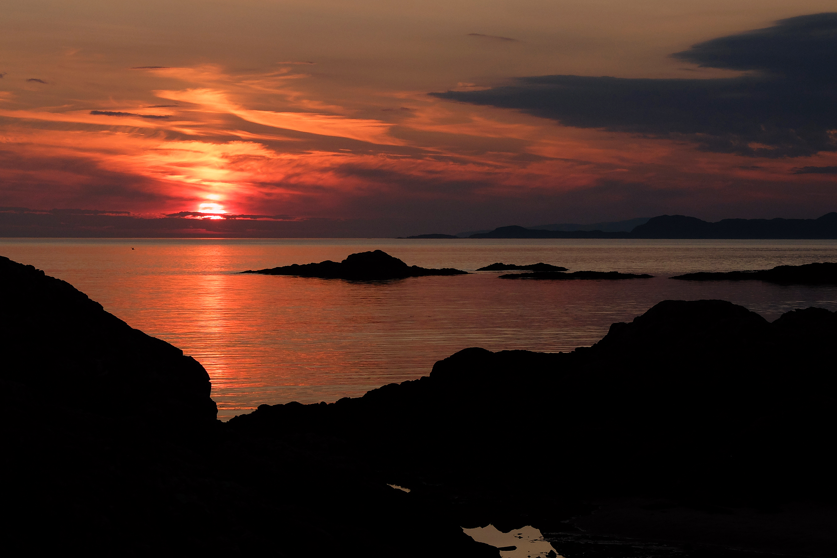
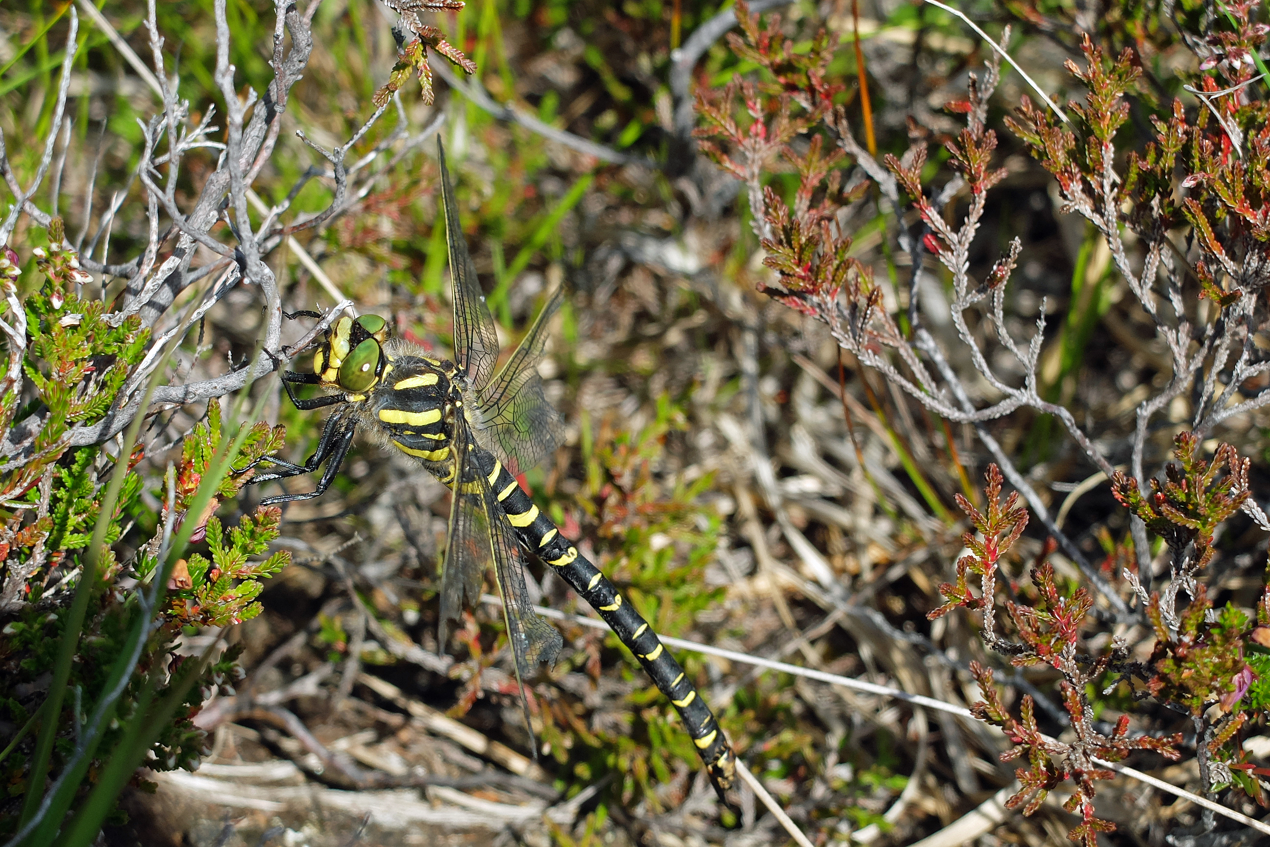
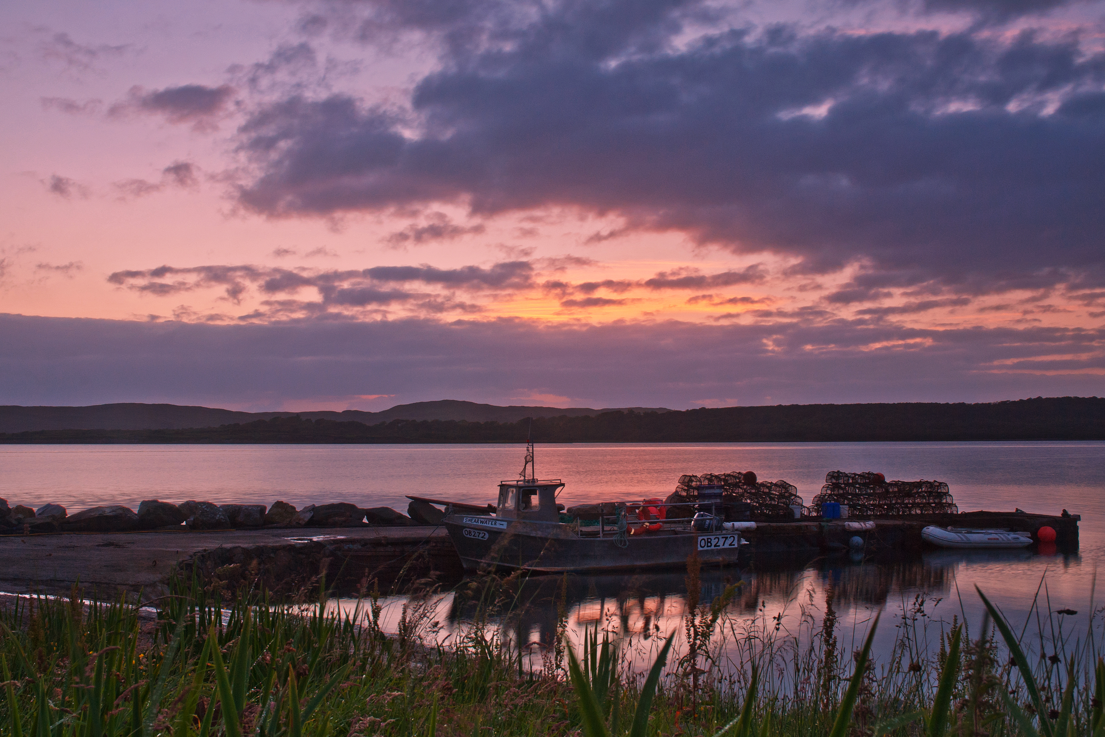
I made my way back to my rucksack and found a cracking spot within earshot of a waterfall and supplemented by the gentle lapping of waves on the foreshore. All was well….except for the midges! The little sods were everywhere and in thick clouds too. The tent was up in record time and my kit was thrown in with me rapidly behind it. A few dozen of the evil little mites made it inside with me and I quickly got a sweat on in a sealed tent, in the sunshine as the few that made it inside were disposed of. Up until recently I had behaved like a buddhist monk with wildlife. My footsteps avoided beetles, dodged caterpillars and skipped over slugs and snails. But now midges, mosquitoes and clegs were fair game. Soon the outside of the tent was beginning to turn black with a single but intense layer of midge. I cooked my dinner inside and managed to cool off by opening a vent, just enough. But as the sun began to set I knew I had to suffer for my art and get my backside outside for a photograph of the sunset. It was worth it, but I did ask the sun to drop below the horizon a little quicker than usual tonight.

DSCF2803

Stage 134, 28th July: Kylesmorar to Inverie (twice)

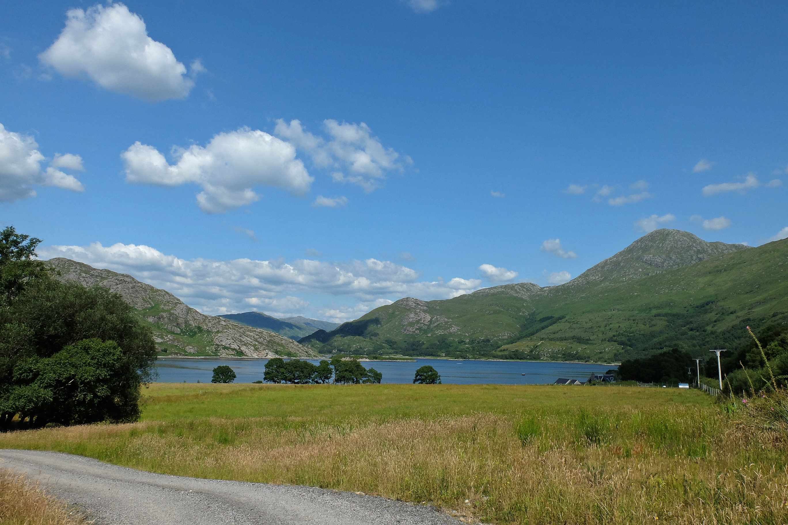
Morning didn’t bring a huge respite from the midges, but gave me enough of a window to break camp, appreciate the beauty of my camp site a little and make my way back towards Tarbet for a ferry across to Knoydart. During my scuffle with the midges I had managed to shorten my rucksack and felt a complete idiot for not adjusting it properly yesterday. My hips breathed a sigh of relief.

As I dropped back down into Tarbet a wild sounding woman on horseback approached with two photographers edging up the other side of a small field. I sat down on the slipway as she dismounted the horse and the men called it for an arty  snap as it galloped towards them over the field. The photographers then vanished into a farmhouse and the now horseless woman offered me inside for a cup of tea. I followed Mandy into the kitchen as she loudly scolded two misbehaving dogs. I found the two photographers now sitting silently at their macbooks feverishly responding to emails as Mandy and I chatted not three feet away. I left them a couple of my calling cards, but they barely said a word as London and possibly Cameron Mackintosh, the estate owner, was beckoning. I thought it all a little sad that in such an idyllic remote place they had to spend their time dictated to by London pace but I was tempted to play them my daughter’s singing on my iPod to see if she could get a starring role in a West End show.

DSCF2816

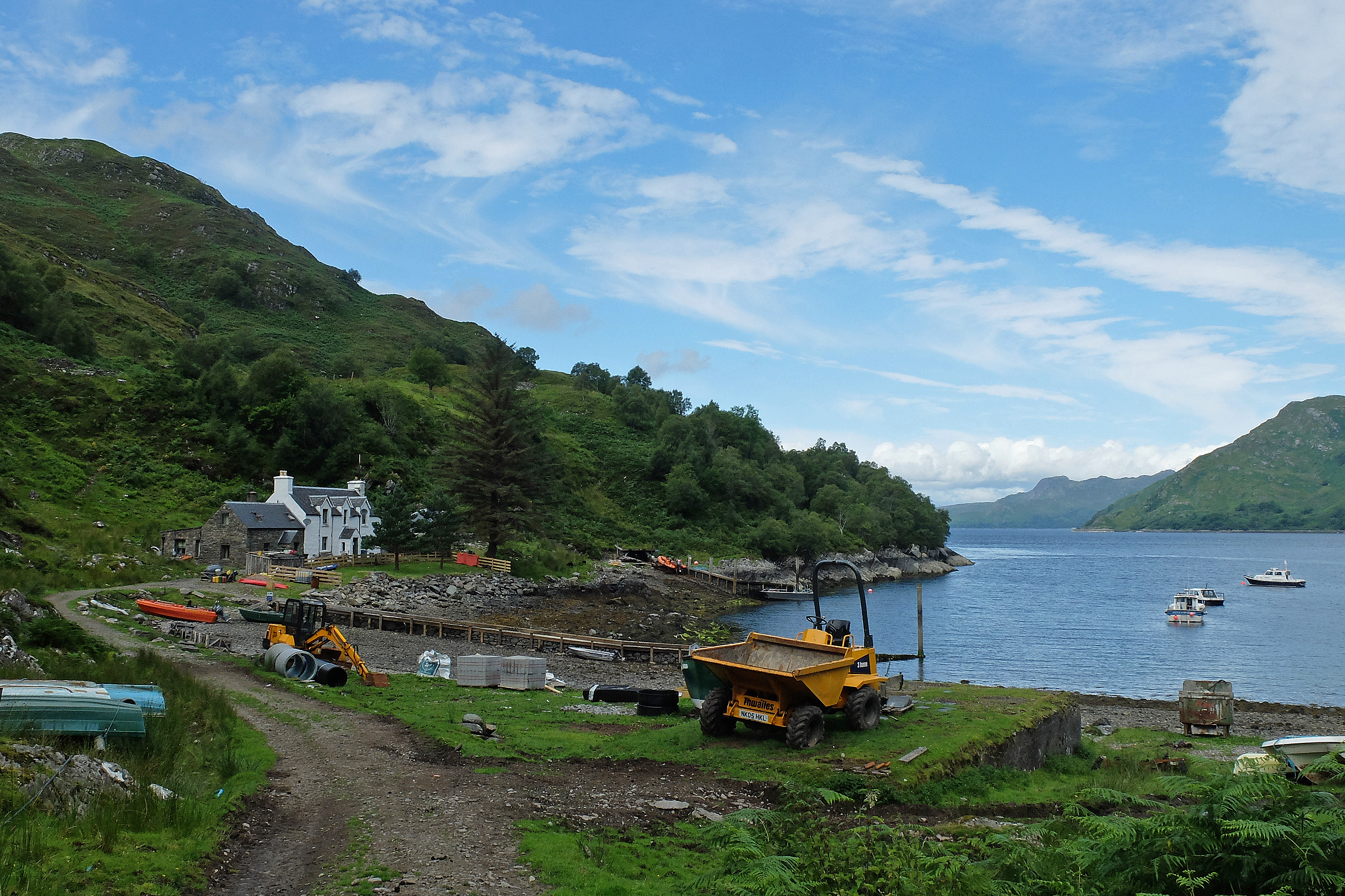
I wandered around Tarbet in its entirety in two minutes and chatted to two locals who made up the other residents of the hamlet. We passed a few minutes with idle conversation as I kept them from their work and we watched two children of one of them messing about in an inflatable kayak in the bay. Minor panic set in when the little girl fell in, but her brother who had, till then, been successfully winding her up, rescued her with little fuss.

The Post Ferry sped me across to Knoydart. It was an unplanned ferry but one that met my rules and I had decided to take after conversation with Tommy the Knoydart based ranger advising me that there really wasn’t an easy safe route around from Kylesmorar, especially with a big rucksack.

I arrived in Inverie, the only significant village on the Knoydart peninsula. I strolled down the sole tarmac road with advanced warning from Twitter that they were expecting me. The door of the Tea Room welcomed me with a hand written sign in the window and I walked in to thank them. Free lunch was offered and I gladly accepted a haggis and cheese sub and a cup of tea. I sat outside in the lunchtime warmth to eat and Mark introduced himself as the chef at The Old Forge just down the road. We chatted about my walk and how he, a Black Country man, had found his way to Knoydart. We even managed to talk about something I hadn’t talked about in ages, cricket. Tommy the ranger then turned up and we all discussed where I could spend the night. Tommy offered his garden in Airor but also suggested the bunkhouse down the road. As I wandered off to empty my rucksack Mark, having discussed something with Tommy, called after me and I now had free bed and board for the night nearby. Wow – how was that for a fantastic welcome.

DSCF2829

It was now nearly 3:30pm and I still wanted to walk the fourteen mile loop up the West coast of Knoydart to Airor and Inverguseran. I marched out with a happy stride and was back in the pub at The Old Forge by 8pm. Even the portion of fish and chips was too big for me and this was the first meal to beat my appetite so far this year. I might have sunk a pint or two more than I normally would but conversation with the locals was easy and very welcoming and if it wasn’t for the heavy walk out of Knoydart in the morning I could have sunk a few more. A good day, a good night.

Stage 135, 29th July: Inverie to Kinloch Hourn

After saying my thanks and goodbyes to Mark, I felt a desire to do the same with the ladies at the Tea Room. I popped in for a quick sausage and egg roll and reluctantly made my way out into the drizzle and midges about half past ten. The people of Knoydart had all proven themselves to be incredibly welcoming and generous and so it would prove with the donations that appeared on my virgin money giving page over the coming days.

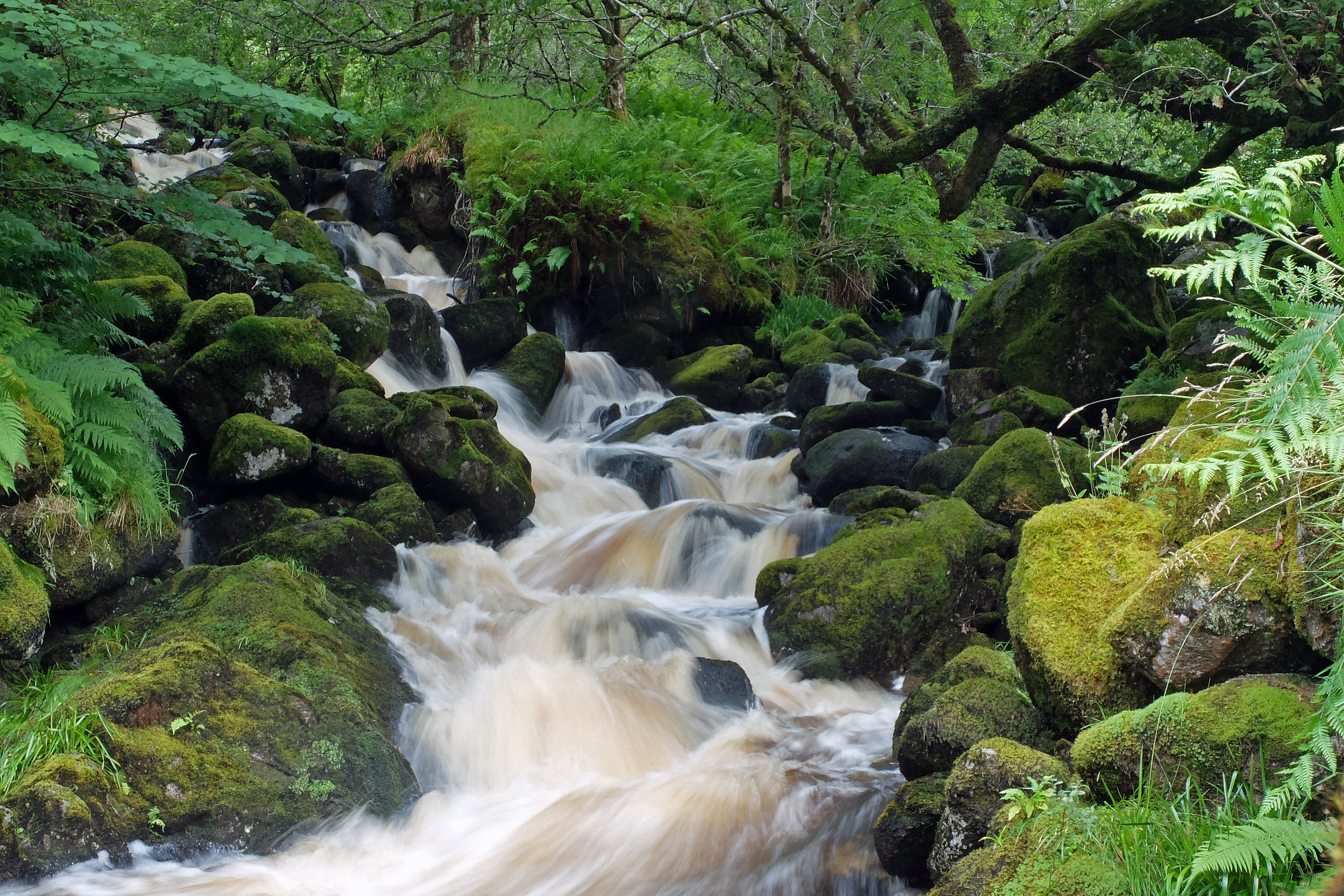
I headed up the Inverie River to Loch an Dubh-Lochain with a now comfortably adjusted rucksack. The clouds were still very heavy and draped themselves over every mountain top in sight. The waterfalls were full and the path was sodden, but my spirits were great as I climbed 1,500ft up and over the pass heading North for Barrisdale Bay. I met more people walking into Knoydart than I had expected and despite the weather, all were more than happy to spend a few minutes chatting.

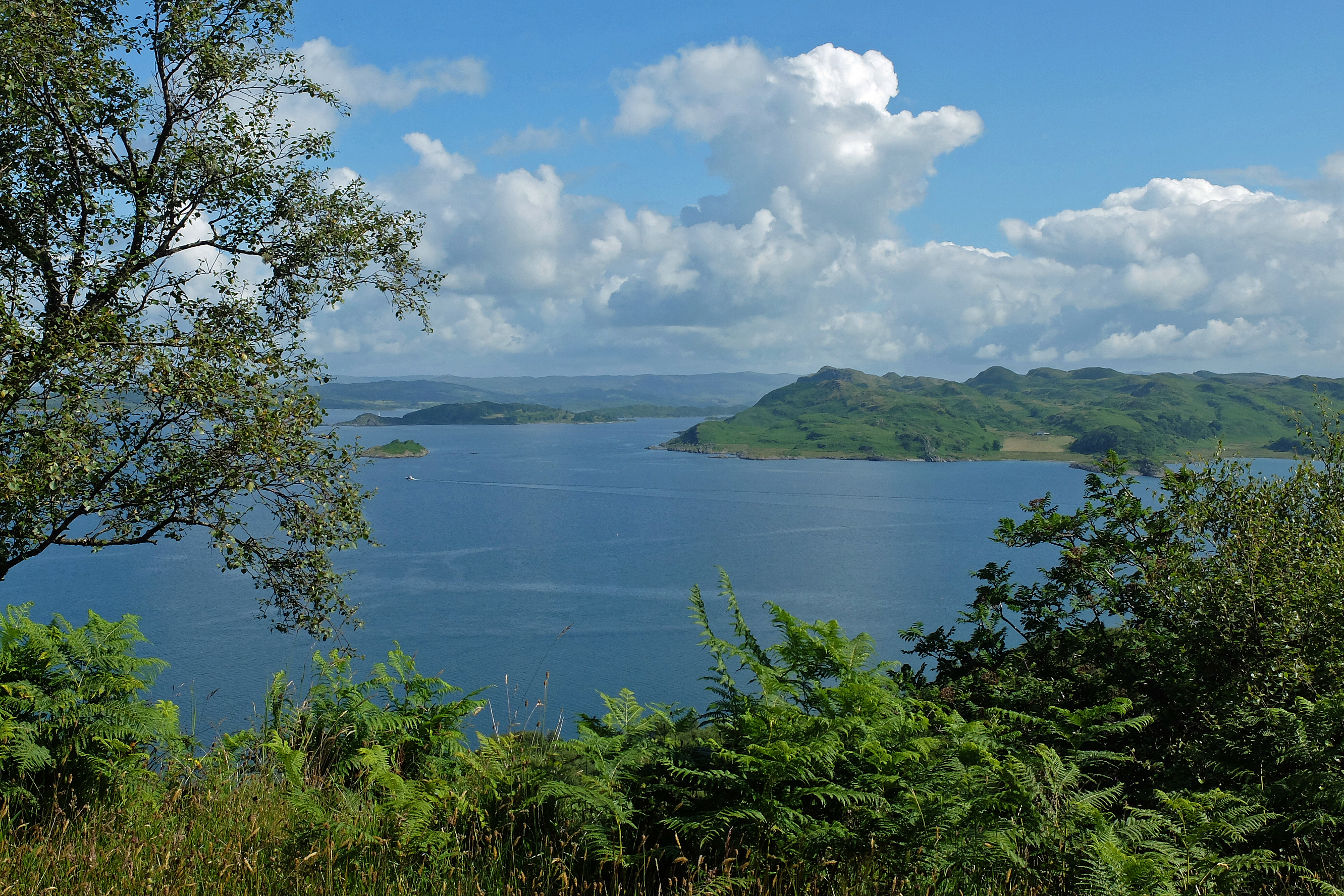
Once down into Barrisdale Bay the clouds parted and the bay shone with dappled sunlight. I headed East along Loch Hourn and Loch Beag with three small but tough climbs to finish the day. By the time I heard Ray calling out my name over the loch I was glad to find familiar comfort. The day had been a hardcore walk over rough ground, bog, mud, across streams and had a fair few steep climbs and stunning views. It was undoubtedly easier than many walks I had completed early in Cornwall but it had it all and now ranks as one of my best walks to date and the three days together as one of, if not the, highlight of my journey so far.

DSCF2916


Ice cream weather

Stage 130, 23rd July: Dorlin to Alisary

My mistake late yesterday afternoon had identified that the ‘Silver Walk’ coast path was actually open and did not end up in the middle of nowhere as my OS map indicated. So I decided not to continue my route along the road and instead go back and start the path again. Geoff, Lorna and Cally dropped me off at Castle Tioram and I made my way along the path hugging the rock face. It was a juicy up and down scramble over and under fallen trees, around rocky outcrops and though muddy stream crossings and it was enough to raise my heart beat above its normal road-plodding rate.

It was very warm and the air was completely still. I soon had a good sweat on and as I wasn’t being dripped on from the heavens, I counted my blessings. It was by far and away the warmest day of the year so far and if my forecast from home was right as usual then I knew more was to come.

Eventually I rejoined the main A861 for eleven miles of hot black tarmac. By the time I reached Glenuig I was really looking forward to a pit stop for a cold drink and an ice cream. But it was a Wednesday, my luck was out and it was closed. Likewise I could see snickers parked up from the previous night and only a few yards away. It too was closed and  locked up, so I couldn’t even raid the fridge. Hence, it was back to the black stuff and a bit of dodging in and out of the shade for a bit of respite as I made my way North along the shore of Loch Ailort. Geoff met me at Alisary with a cold can in his hands. He was becoming a very good bloke to know.

DSCF2709

Stage 131, 24th July: Alisary to Arisaig

After a sticky and muggy night in the van an even warmer day greeted me. This was undoubtedly going to be the hottest day of the year and if the temperature didn’t quite reach thirty degrees, it certainly felt like it. Was this really Northwest Scotland? To compensate and with a very short day originally planned for the 25th, I decided I would even out the next two days and thus chop the mileage down today.

As I set out I could almost feel the tarmac temperature rising minute by minute through the soles of my boots. My feet were beginning to cook nicely. Though not hugely busy, it was a good stretch of ‘A’ road for a while and when there were no cars, vans, coaches or trucks to insult my ears there were very few sounds above those of my footsteps and a rhythmic squeak in my rucksack. I couldn’t listen to my iPod or radio, as I needed to listen out for approaching traffic. But the silence was broken by the eerie creaks and groans of the steel roadside armco barrier as it expanded with the heat supplemented by the tiny electrical snaps of gorse seed-pods popping open.

At Borrodale I escaped the road for some woodland shade and a few miles of track. I missed out the headland at Ardnish as it only seemed to have one way in and out and backtracking is not something that felt like fun today. Geoff and Lorna would later tell me that I had missed one of the best beaches in Scotland……damn! So I emerged at Arisaig for an early day and a village overrun with visitors. Though Lorna declined my offer, it was definitely time to buy Geoff a Magnum whilst I indulged myself with another pot of Mackie’s Honeycomb. If I had been ten minutes later the shop freezer would have been empty, so my luck was in today.

DSCF2733

Stage 132, 25th July: Arisaig to Mallaig

The baking weather continued but, unless I was acclimatising myself to the Scottish tropics, it felt a little cooler today. I walked out of Arisaig and around the Keppoch headland trying to follow a little-used but OS marked path. I found it, lost it, found it, lost it, found it again and then lost it completely as I zig-zagged my way through trees, bracken and scrub before eventually emerging in a deep boggy field edged with a barbed wire fence too flimsy to climb and too well barbed to deter straddling. I walked up and down the fence line like a caged tiger looking for a way out without putting sharp rusty wire into my groin. I made the road intact and raised my arms in disbelief as I found the path emerging less than a hundred yards from where I had made my escape. I was discovering that OS maps aren’t always as accurate as I once thought.

At Traigh, I caught Geoff affably chatting, as oft is his want, to two old golfers as he teed off on a cracking little 9-hole links course. I would liked to have swapped places for a round myself but my handicap would probably double the par score these days. It was then more road and more road to Morar and Mallaig. The area was positively heaving with visitors and was very different to the wilds of Morvern and Ardnamurchan. It was dotted with campsites all displaying ‘site full’ signs and the roadside verges along the water’s edge were lined with campervans. Foreign voices dominated, but as there were no sunbeds for the Germans to reserve, it seemed to retain an air of peaceful respectability in an area of sandy coves and family safe shallows.

I stopped in Mallaig and dodged the American tourists lingering for a ride on the Hogwarts Express. I had a quick Mint Magnum which almost melted in the queue to pay and made my way around the harbour to the end of the road and a meeting with Geoff, Lorna and a friendly patterdale terrier. It was a warm evening sitting on the harbour edge with fish and chips and a Mackie’s Toffee Apple cone. A lone sky rat watched me with its beady eyes, but my chips and ice cream stayed safe.

Rest Day, 26th July: Nr Arisaig

After a grand evening with Geoff and Lorna, it was time to say another thankful goodbye. They undoubtedly had the best week of weather so far and now rain was in the air. I had made two more new friends and had thoroughly enjoyed their company, their generosity and their enthusiasm. They headed off for a night of hotel luxury nearby as the heavens opened and I finished my laundry to wait for Ray and Susie to arrive.


Paradise continued

Rest Days, 19th & 20th July: Kilchoan

I had always planned to have an extra day off in West Ardnamurchan. Not only is it my favourite place on earth (so far), but – if you allow me to sound pretentious for a second – it’s also my spiritual home. I have spent many happy days up here either with my family or as a student performing geological mapping, utilising my very own “guesstimate and wing-it” methodology.

With Sue and Diesy handing over to Geoff and Lorna this weekend, I left the handover logistics to them to suit their needs. Hence Sue and Diesy stayed an extra day to wait for Geoff to pick up Sue’s car in Onich on the way over late on Sunday. So unfortunately a wet Saturday saw Sue and Diesy increasingly tapping their feet as the weekly chores of blogging, tidying, uploading photos and route planning dominated the weekend.

At one point during a brief lull in the rain we spotted what was quite clearly a geology student sitting on a wet outcrop in the field behind the campsite. A quick chat over the fence established our early judgement to be a correct one and we discovered that a group from Aberdeen University were staying in the village. We arranged to meet up in the pub that evening.

Hugh, Lindsey and James were there as promised and were joined by Hamza Yassin, a wildlife photographer working on the estate. We chatted about the vagaries of geological mapping techniques and I equally lingered on the topic of wildlife photography as Hamza showed us some of the most stunning wildlife photos I had seen in a very long time. A grand evening in grand company.

Sunday saw yet more chores to catch up with, though mainly involved the frustrating process of trying to route plan online via a pathetic internet connection. I nipped up to the village to use the showers and bumped into Hamza again whilst waiting for a vacant cubicle.

That evening Geoff and Lorna arrived with their labrador Cally. We all took the dogs down to Mingary Pier and…..bumped into Hamza again. Hamza has an incredibly enthusiastic and colourful personality. His Sudanese origins, Northamptonshire accent and matted dreadlocks didn’t easily pigeon-hole him at all. But his bubbly personality and passion for zoology and photography was infectious. Geoff and I stayed for some considerable time leaning up against the pier waiting room wall chatting idly till dusk.

Stage 128, 21st July: Kilchoan to Achateny

A beautiful warm day for a beautiful walk as Sue and Diesy joined me for the morning. As we walked up the Pier Road into Kilchoan, Hamza drove up and stopped to say goodbye, his regular appearances were beginning to feel like a scene from Hamish Macbeth.

On the road to the lighthouse and my second compass point target of the Western most point of the British mainland, we spotted a Golden Eagle soaring up and riding the thermals, seemingly circling us in a half-mile radius. We met up with Geoff and Lorna at the lighthouse and Geoff handed out some raspberries as Lorna bought me a tub of Mackie’s Honeycomb ice cream to celebrate. I had celebrated my South compass point with Sharpie. I had shared Land’s End with Alec, Graham and Sara and now the West too was shared with friends and I lingered for a while trying to get a decent photo of the lighthouse which didn’t repeat anything I had taken on previous visits.

Next, it was onwards and off-road across the small white sandy bay of Bay Macneil, through the pretty hamlet of Portuairk and up and over a small pass to cross the best beach I had seen so far at Sanna Bay. I might be biased but Sanna is just gorgeous. The soft white sand is usually wind-swept and devoid of people but today it was positively heaving with nearly a dozen families spread across its entire length. It was as busy as I had ever seen it, yet still blissfully quiet. Its crystal clear turquoise waters could easily have doubled for a top Caribbean resort if it wasn’t for the fact that the water temperature is conducive to hypothermia and shrivelled extremities.

DSCF2626

I sat with Geoff, Lorna and Sue to eat my marmite and dairylea sandwiches as Diesy stared me out with food love and Cally roamed the beach searching for food among the families settled along the dune line. I left them all to it and said my goodbyes to Sue and Diesy who were heading home with my sincere thanks for another week of great support and headed off over the dunes for the heather and bogs of the barren North Ardnamurchan coastline track to Fascadale and Achateny.

The evening was spent introducing Geoff to the herd of Red Deer at Braehouse and whale watching at sunset at the lighthouse. Geoff’s record with wildlife is apparently legendary in his village and for the first time the Red Deer were absent and despite the mill-pond waters around the lighthouse, our sightings consisted of a lone seal trolling along the water’s edge. But the clear and distant view out to both the inner and even outer Hebrides was awe-inspiring as was the lengthy conversation with a couple from Bath who were staying in the keeper’s cottage. We left long after a disappointing sunset as darkness settled in long after 11pm.

Stage 129. 22nd July: Achateny to Dorlin

It was even warmer as I set off around the foreshore to Kilmory where I met up with a wild camping honeymoon couple sitting out in front of their tent at the top of the beach. We chatted briefly as I’d never want to disturb a honeymoon couple for too long and I wandered up the lane East towards Ockle. Hamza drove past and waved a last goodbye.

At Ockle the road ended at a ramshackle cluster of old cottages and holiday lets. I joined a track up over ‘Brae’ towards the Singing Sands. A beautiful yet deserted climb through bracken, bog and over a pass with dragonflies, butterflies and damselflies showing me the way. The damselflies in particular were giving me a fine show. I never knew they came in so many colours as reds, oranges, blues, silvers and yellows flitted about my feet.

DSCF2650

Once over the pass I dipped down into the forest and out onto the beach at Singing Sands. The sand squeaked beneath my feet but failed to raise a tune. The Whistling Sands I walked across in North Wales had failed to whistle too, so if I ever come across a Humming Sands I won’t expect too much.

Back onto the forest track I eventually emerged at Kentra Bay a wide expanse of sand and inaccessible mud. I thus joined the road to Acharacle and made my first mistake for a while. I had decided to walk an extra five miles as a planned loop up to Dorlin, Castle Tioram and back down to Acharacle.

DSCF2701

Once through Dorlin I discovered that the ‘Silver Walk’ coast path was open all the way across the South shore of Loch Moidart. However, my phone signal was non-existent and my rendezvous with Geoff was back in Acharacle. So I dived back inland and up over a steep hill, through deep bogs and head high bracken to meet up with him. My fluid stock was now a vacuum pack as I sucked the last drop from it and my exhaustion was complete. Geoff and Lorna’s company was very welcome.


Para….Para….Paradise!

Stage 125, 16th July: Kinlochteacuis to Strontian

I started out early despite the forecast of heavy rain for the entire day. I elected for head to toe waterproofs even though the discomfort of claggy legs debate had still not been settled. In this instance it was a wise choice as the track up Beinn Ghormaig was very boggy and barely a single step was a dry one.

In the driving rain I was equally driven to follow the track on my map up into the cloud and over 1,300ft. In doing so I was blind to the route I had plotted and when the track abruptly abandoned me in the middle of a moor it dawned on me that I had made an error and I either had to backtrack a mile and climb again or try to rediscover the path further ahead and somewhere down below. I voted for some proper map use and contoured round to find a burn to follow steeply down towards fog hazed landmarks. I was already angry at myself for making an error, so when I slipped on my backside and bent my second walking pole double, pulling my shoulder in the process, my anger was complete and the barrage of expletives which rumbled down the hillside were hopefully muffled by the thick cloud and persistent heavy drizzle now soaking its way into every nook and cranny.

Eventually I rediscovered my path, but not before falling twice more and to top it all I then tripped over a log hidden in the deep wet grass and fell forward with a juicy wet face plant. If anyone had been able to hear me, other than the red deer gazing at me disdainfully, I’m sure they would have concluded that I was suffering from Tourette’s. The deer turned, flashed their white rumps and bounded off into the forest with an almost mocking display of agility and aptitude. Altogether I had now doubled my tally of falling over on this walk and I had done it in twenty minutes.

My path became a track once more and I followed it East along the South shore of Loch Sunart through the dripping and sodden Sunart Oakwoods, remnants of the ancient temperate rainforest which used to cover so much of Britain. I was very tired by the time I rejoined the road and the last six miles into Strontian were the hardest I had experienced for some weeks. At least the rain had eased and I was able to remove my claggy overtrousers and, with a new pair of boots, I was pleasantly surprised that my feet were still relatively dry. I picked up a discarded newspaper from the roadside to catch up with the sport. I had not been able to listen to anything for a few days, as the radio signal had been non-existent, so I was a little annoyed to have missed yet at the same time cheered to read of Root and Anderson’s record last wicket stand at Lords. And to cheer me further the rain filled skies had at least filled the loch-side waterfalls turning them into raging torrents.

DSCF2498

Stage 126, 17th July: Strontian to Glenmore

There were no map reading skills required today or waterproofs. Instead I had just a long warm and sunny road walk, now purposefully back West along the North shore of Loch Sunart, once again striking through the now drier Sunart Oakwoods. Occasionally the woods would clear as I rounded a small bay or inlet. Each time they did I was rewarded with a new peaceful view back across to Morvern and another mirror like pool to check for otter activity. Unfortunately I saw none. However, between Strontian and Salen I did come across a Pine Martin trotting along the road towards me. He was a new sighting for me and we both froze in unison. I reached for my camera but by the time I had raised it to my eye, he was already trotting away and into the bracken. In moments like these I wished to have carried my big SLR camera with its long telephoto lens, but the practicality of doing so just doesn’t work and my little compact camera has done me grand so far, so I musn’t complain.

Walking along the tiny winding and undulating B road towards the isolated communities of West Ardnamurchan, I couldn’t help but amaze myself at the buses, builders trucks, cement lorries and huge tippers using it. I sent Sue a sniggering and taunting text warning her of a huge tipper wagon heading her way as she would be driving up behind me to meet me at the rendezvous point. But then I remembered….it was my motorhome she was driving.

DSCF2504

The day ended at ‘Nadurra’, the Ardnamurchan Natural History Centre at Glenmore. Snickers was in one piece, but I’m not so sure Sue was. Diesy was clearly stressed too, but I suspect Sue’s language in getting there may have upset him. We distressed with a pot of tea and a Mint Feast. I ate mine as if greeting an absent but very old friend and I drove back to the campsite in the process spotting a female Hen Harrier flying across our path.

Stage 127, 18th July: Glenmore to Kilchoan

It was an increasingly warm and muggy day as I continued along the same road West. It quickly broke out of the Sunart Oakwoods and began to climb up onto the very familiar volcanic landscape of West Ardnamurchan that I could almost call my second home. I had mapped a small part of it as a Geology student thirty years ago and had been back many times since with my family on holiday and as a solo training week, for this walk, only last November.

I could’ve taken the short route option into Kilchoan, cutting through the hills, but being a sentimental old fool I elected for the road route I always take and climbed up and inland around Ben Hiant and over to Loch Mudle. The view back down towards Kilmory, my mapping area, gave me my first sight of the North side of the peninsula and out beyond towards Eigg, Rum and in the far distance, hidden in haze, the Coullin Hills of Skye. I just had to stop for lunch and a rather poorly posed selfie.

DSCF2541

It was then a three-mile drop down into Kilchoan, playing a wailing Chris Martin in my iPod as he sang “para…. para…. paradise” into my lug holes. I met up with Sue and Diesy on the Pier Road for a wander down to the seafront and across the foreshore to see a seal colony. I took a photo across to Mingary Castle, now shrouded in scaffolding as it undergoes a major and very expensive looking refurbishment. For the observant reader, I’m sure you can find the other photo of Mingary Castle I have used on this site.

The evening was spent talking nerdy geology stuff with Sue and chatting to locals and workmen from the castle in the Kilchoan Hotel where we enjoyed my first fish supper for what felt like years. It had been a long haul to get this far and I felt tired and a little flat at having achieved this particular target. It would have been lovely to share it properly with my family and to do so by phone just wouldn’t have been the same and possibly even insensitive, so I entered Kilchoan a little low-key.

Halfway…. ish

Stage 122, 13th July: Onich to Kingairloch

Since I started this journey I have always viewed the Corran Ferry across Loch Linnhe as my mental halfway point. I have always thought of it as the crossing over to paradise, the real wilderness of West Scotland and a very special place. However, in truth it wasn’t quite halfway and anyway I couldn’t be sure exactly where that point would be until the very end and I possessed the final mileage total. But my estimate said that it would be somewhere around here and the 2,500 mile mark was only a day away, so for now the Corran Ferry was as good as halfway.

DSCF2339

As I walked away from the ferry along the quiet road towards Morvern and Ardnamurchan I thought it was the ideal time to try out my birthday present from home which had arrived via Sue and Diesy yesterday. I really could have done with an iPod over the last few weeks as the boredom had set in and my portable digital radio had failed to keep enough of a signal to effectively listen to the cricket. So to get one preloaded with some of my old albums was a genuine treat only matched by the cards accompanying it from Kate and the girls. The little ‘red cross’ parcel definitely gave me a real and very timely boost. Add to that all the birthday wishes I received electronically from family and friends (I have never received as many birthday wishes as I did on facebook) and you can probably imagine that the world was feeling pretty damn good.

Today was all road walking, but it didn’t bother me as the weather was cool, the traffic was nil and I had Led Zeppelin on the iPod to apparently hasten my speed to 6km/hr (as observed by Kate on viewing my Buddy Beacon). Apparently whilst listening to Coldplay it was a mere 5km/hr, but that might be something to do with Chris Martin’s propensity to wail a little too much sometimes.

The roadside sign told me that Kilchoan (at the West end of Ardnamurchan) was 44 miles away. To me it was still a full week and well over a hundred miles. I had Morvern to go around first, so I disappeared off left and South again for Kingairloch and a night ‘off-grid’ in the hills alongside Loch Uisge. The one down side about arriving in this stunning part of the world was that the midge count had noticeably climbed. Not that it was unbearable, but definitely irritating and certainly itchy. My comparison of midge repellent products could begin in earnest.

Stage 123, 14th July: Kingairloch to Fiunary

The new iPod had to be quickly abandoned today. Within minutes of setting off, the rain came in over my shoulder and slowly grew in intensity. I had changed my route as I couldn’t be sure that the map marked path taking me around the huge quarry at Glensanda was truly passable. I was sure that if they had any health and safety excuse for keeping walkers away they would use it and I didn’t fancy gambling a possible backtrack of five or six miles, particularly on a wet day. So instead it was waterproofs on, kit in a dry bag, hat on and head down to just get on with it.

Scottish rain is incredibly searching, in my opinion – much more so than English or Welsh. Eventually water gets in everywhere and my boots were soon swamped again as my socks successfully wicked water down into them probably because I had maybe foolishly decided to dispense with the claggy overtrousers. Occasionally the rain would ease and offer a little false hope before returning to lash it down again. It was pretty much all road, including the fearsome sounding A884 which was actually a single track road with barely a car once every ten minutes.

I would have loved to have taken some photos, but I wasn’t going to test the electrical circuitry of my camera with this variety of wet stuff. So Kinlochaline Castle, tucked into the woods with its turrets and slated spires was missed, as were the pure white heaps of sand affronting the sand mine at Lochaline and Loch Aline itself. So I was a little disappointed that Morvern had underplayed itself today, even if it was entirely the fault of the weather. At least the camp site at Fiunary made up for it. Their generosity and friendliness kept Sue and I talking and I would love to have spent more time at their idyllic hideaway.

Stage 124, 15th July: Fiunary to Kinlochteacuis

The rain had cleared leaving me with sunny spells to start the day with a lane walk following an ancient mourners route. The lane took me across to Drimnin looking over the Sound of Mull and around the Wishing Stone which apparently grants a wish to anyone who can pass through the big hole in the rock without touching it. I elected to forsake the opportunity of a wish as I reckoned the alternative was probably a broken limb or fractured skull for anyone attempting the trick.

DSCF2380

I was soon up into the tracks and hills around the Drimnin Estate where the views just got better and better with every foot of ascent. At one point with Mull to my left I could clearly see Tobermory and its yacht filled harbour and as my eyes swept right West Ardnamurchan sat in a light haze with the village of Kilchoan and its mountain neighbour Ben Hiant, clearly on show. I knew it was a view the camera could never replicate, but I had to at least give it a try.

DSCF2430

I even found what I thought would make a truly stupendous building plot and just had to share it with home. My enthusiasm was probably misplaced as the likelihood of buying from the estate, securing remote access and then getting planning permission might not be an easy proposition. But sometimes it’s nice to dream. Nonetheless a local shepherd with two collies in baskets on his quad bike told me of an old ruin that might be a better prospect around the corner. He also nonchalantly mentioned his internet skills. Times have certainly changed for the shepherd.

I followed the old road (track) to Doirlinn. The views were now over Loch Sunart towards East Ardnamurchan and the islands of Oronsay and Carna, but they were equally awe-inspiring.

DSCF2449The old mile posts were still in excellent condition and grandly counted down my progress to what I thought might be a hidden ancient conurbation of great importance. When I arrived at the track end I was greeted by a single ramshackle cottage with its saggy roof and partly furnished rooms. I felt a little robbed. But with the track now gone, I headed off through the bracken and boggy woodland which slowly morphed into a path (yet to be discovered by the chaps at the Ordnance Survey) and eventually the path became a forest track. I met up with Sue and Diesy for a walk back to Snickers and in doing so we startled a lovely stag who watched us carefully as Diesy strained at his lead for a chase.

For me this was a walk to rival the best so far and definitely one to be recommended.

A scene change at last

Stage 119, 8th July: Sound of Kerrera to Benderloch

After the last few days of mental fragility, boredom and motorist anger leading up to my birthday blues I was hoping that the scenery might open out as I reached Oban, the gateway to the isles. I really needed a change as I felt Scotland had hidden far too much of its spectacular scenery from me by pushing me through forestry and along the main roads.

The three-mile walk along the shore hugging lane edging the Sound of Kerrera was full of interest with ferry and boat traffic bustling in and out of Oban. The road into town was wet from heavy early morning rain and sported a long foot wide iridescent  stripe of diesel flowing down its entire length. Someone had been leaking expensive liquid and I wondered if the local environment officer had woken with an expectant twitch. The familiar smell reminded me of work, a now distant and depressing but also strangely comforting thought. Note to self: If diesel smell becomes vaguely comforting seek psychiatric help!

Oban was a busy town and local hub with visitor attractions galore and plenty of harbour activity to watch. The place was full of transient tourists heading for the wild islands further out to the West or the highlands to the North and some of the clearly alien visitors seemed to have come from all parts of our very accessible planet.

Rounding the headland out-of-town the next bay brought me to the ivy clad ruin of Dunollie Castle (photo) and then on to the upmarket “exclusive” development (mini housing estate) surrounding Ganavan Bay. A brand new cycle path then took me inland and over towards the A85 and Dunbeg. On reaching the A85 I was relieved to find a nice safe wide verge to walk along towards the Connel Bridge and back off-road around Oban Airport. It was a coat on, coat off, coat on day and I would have preferred it if the weather could have made up its mind one way or another.


DSCF2257aBy the time I reached Benderloch the sights around me were all beginning to look a little different, a little more open, a little more rugged.  Somehow, almost imperceptibly, I felt as if I was finally arriving in the highlands.

Stage 120, 9th July: Benderloch to Port Appin

I had a bit of a lie in after Germany had trounced Brazil 7-1, but there was no hurry as I only had a short day and the weather was glorious. Today I was expecting yet another verge hopping session, this time along the A828. However, I was now in ‘outdoor country’ and a cycleway through Barcaldine Forest eased the burden of concentration and simmering distrust of all motorists.

I met up with two women from the U S of A on a pair of recumbent bicycles. If I thought I had lost the plot, they were clearly barking at the moon as they had just packed their things, left their families and headed out for two years to pedal around Europe with little more than a tent, a sleeping bag and a few sets of clothes.  Nonetheless – we chatted enthusiastically about various midge deterrents before heading off in opposite directions, completely oblivious as to the questionable sanity of our two ventures.

I crossed the relatively ‘new’ road bridge over Loch Creran to Creagan, saving a few miles of loch-side road in the process. As I did, the highlands seemed to open up before me. The grand, rugged, snowless peaks were completely clear of cloud and undeniably grand even if they lacked the imperious snow and cloud capped foreboding they held when I last saw them in November last year when training for this walk.

DSCF2273

I dropped off the main road and took to the lanes of the Appin Loop towards Port Appin with its tea rooms, craft shops and stunning views across to the peaks of Morvern (photo above), my destination next week. The warmth of the day and the confirmed arrival in the highlands deserved a reward and with the change of scenery I had a change of heart and went for a Strawberry Cornetto. It wasn’t unpleasant!

Stage 121, 10th July: Port Appin to Onich

Scorchio! Twenty degrees on the West coast of Scotland feels like thirty degrees when walking along tarmac or through still woodland, but with the scenery having now changed and new sights such as the historic but also comedic (Monty Python and the Holy Grail) Castle Stalker, it was actually very pleasant all round.

DSCF2280

I crossed the rather rickety, yet brand new, Jubilee Footbridge with a backdrop of mountains, proper ones, and a vast expanse of open water in the form of Loch Linnhe. A quick bacon and sausage sandwich at a roadside van was paid for by a very English, very well spoken and extremely kind local marina owner who I had already bumped into earlier in the day when he offered me a lift near Appin. We chatted with the bacon butty vendor about the business prospects for his brand new loch-side lay-by haunt and the merits of cooperation and mutual understanding with the marina landlord. The marina owner was highly skilled in the art of diplomacy and gentle reminders and I left with a wry smile on my face.

Again the roadside walk was mainly cycleway, but occasionally it deserted me and I could feel my blood pressure rising as I dodged the traffic. Eventually I escaped to the horseshoe shingle bay at Cuil and ventured across country around Ardsheal Hill through boggy tracks and paths to rejoin the road at Kentallen. Happily the cycleway reappeared all the way to Ballachulish Bridge and the wide open views East towards Glencoe and back West towards Morvern were just stunning.

DSCF2308

Pavement took me to Onich and onto familiar territory for the first time since Gretna. Onich is a place I have passed through on many occasions and harks back to field trip days from 1983 where I admit to over indulging myself at the local hostelry. I’m not sure if my memory is that good, but I do remember not feeling too good the following day as we trudged up in to the hills to do some mapping exercises in a typical west highland drizzle surrounded by clouds of midges.

Rest Days, 11th & 12th July: Onich

Like anything else, being a day ahead of schedule has its ups and downs. The up was that I could take an additional day off. The down was that I could quite happily have walked on and chosen a future weather stricken day to voluntarily sit out. Unfortunately the logistics of support driver change dictated that I should stay in Onich and not disappear off into the wilds of Morvern and complicate things enormously. So two days off it was.

A day off never feels like a day off and once I had uploaded some more photos and worked out how to tweet photographs it was time for a brief interview and a couple of photos with the local paper. We compared notes about the strength of the two Scottish Independence campaigns, an easy topic to grab any Scot’s attention and keep a conversation moving. My roving straw poll has come along nicely and is available to any politician for a small or preferably large donation to charity.

With Simon still on board till the 12th I took the chance to do some mutual nerdy stuff with an equally nerdy outdoor kit lover and the added bonus of a cooked brunch in Fort William.  My family would have cringed as we browsed the kit shops and I was rather pleased to talk Simon into buying a new rucksack, just like one of mine. I invested in the future and bought some new waterproof gloves if only because the only pair I owned failed miserably when I was in need of dry warmth back in Cornwall.

It was then back to the bus for a good curry evening and bed – oh what party animals!

I dropped Simon off at the bus stop with warm thanks for being brave enough to spend three weeks in my company. I knew that I had made a new friend. He had a long journey back to the South and wouldn’t be there till the following morning and I didn’t envy him the trip one bit. I returned to the van to tidy up a bit and wait for Sue and her dog Diesel to arrive. The smell of diesel around Oban would probably be nothing to the smell of Diesel in the van and I had been warned about his hatred for people wearing a hat. So when he arrived I was expecting a wolf and instead got a softy, even if it was still a smelly one.

We nipped into Fort William for a quick shop and to try to catch the passing of the Queen’s Baton as part of the run up to the Commonwealth Games in Glasgow. So far on my journey I had managed to miss every single local event by passing through the town or village either a day or two late or a day or two early. It was good to actually catch something even if it was all of sixty seconds of someone I didn’t know walking past with a big stick in their hand.

So back to camp it was for a catch up, food and preparation for the week ahead. On we go.

Slow and low

Stage 116, 5th July: Tayvallich to Ardfern

I am beginning to find that everything and anything, however small or large, dwells on my mind considerably. With all this time to think, my mind is beginning to play a few tricks and the boredom of walking hour after hour can be exceptionally mind numbing. So after a dreadful lack of sleep, I stepped out expecting rain, feeling very low and deeply dreading a day full of desolate thoughts. And sure enough they found me.

Even though I was now purposely heading North for what felt like the first time in ages, the forest walk seemed increasingly drab and oppressive. So when I came across a staged wooden platform through the trees to a willow arch and a big outcrop of rock – it seemed a little apt that I had apparently found a path to nowhere, either that or a ritual site for a bizarre coven.

DSCF2182On walking back to my purposeful trail I sprung myself back to reality and thought that maybe I shouldn’t get so deep and philosophical and to stop whingeing and get on with it.

Having had a an increasing number of down moments recently, an up moment was overdue and it came at Ardnoe Point where not only did my phone jump back into life after two days without a signal, but the scenery shouted a hello too, with a spectacular view across Loch Crinan and Craignish to the Firth or Lorne and the Gulf of Corryvreckan.

DSCF2189Corryvreckan is the home of the world’s second largest whirpool which lies between the Isles of Scarba and Jura. The air was very still and I could clearly hear its roar some seven miles away.

With my mind full of swirling thoughts, I carried on a little aimlessly and missed my turning down to Crinan. I back-tracked a good half a mile to find the little turning down a steep winding cliff path and was rewarded with the Crinan Canal and a basin full of yachts. From here I trailed along lanes and tracks to Carnassarie Castle and up to the joys of walking alongside the A816 till I was just short of Ardfern where Simon was parked up in a lay-by. The few miles of the A816 was tame compared to previous A roads, but my wits still had to be sharp. Fortunately they now were.


Stage 117, 6th July: Ardfern to Degnish

It was all beginning to sound a bit familiar as I dropped down the lane through Ardfern alongside the West shore of Loch Craignish. I seemed to be crawling northwards and westwards by rounding one peninsula after another, all of which were beginning to look very similar. All were pretty and sported occasional villages full of renovated, extended and newly built ‘architect’ designed houses, yacht filled harbours and expensive 4x4s cruising the lanes. But none seemed to strike me as having anything remarkably different from the last. It felt a bit like suburbia in the wilderness and the monotony was beginning to get to me.

I longed for ventures and adventures across country with open views and when they happened it raised my spirit and alleviated the boredom of lanes and dangerous A roads round and around the forest edged lochs. Today gave me a nicely marked path to head along North and up the West side of my latest peninsula through the Craignish Estate. However, this marked path on the map wasn’t even visible on the ground and instead comprised thick, deep bracken now well over head height. I ended up literally wading through with the bracken tying itself in knots around my thighs as I pushed through and peered over the foliage to get sight of my next visible goal. Progress was slow and I was beginning to wonder whether the next few miles with no map marked path at all might be a bit of a route planning error. But unlike the Ardpatrick adventure of a few days ago, this time the tables turned and I had a well-worn trail all the way up to Meml and – guess what – its neat little marina full of yachts and the accompanying neat almost twee rows of recently built cottages trying hard to resemble an old fishing village but looking more akin to toy town.

Eventually I made my way back on to the A816 and this time I truly regretted it. No longer were people rolling along gently and giving way like they were yesterday. This time many of them seemed to be lost in their own little world. I had to look each driver squarely in the eyes to see if they had clocked me. Many hadn’t and I counted five cars cutting it a little too fine for my liking. Six miles of it was enough for anyone and I met Simon at the side-road junction to Melfort where he joined me for the last four and a half miles of lane walking along the shore of Loch Melfort for an off-grid overnight stop near Degnish. This was a beautiful place to stop with big sky views across the water from high up on the cliff. It was great to chat with home from the wilds of a remote cliff top with not a soul for miles.

Stage 118, 7th July: Degnish to Sound of Kerrera nr Oban

What? Another peninsula? Surely not!

I headed further up the hillside along a rough track and back on myself with formidable intent to avoid the showers forecast for the day. After a brief raised voice chat with a shepherd standing with his dogs at the top of a nearby hill my shower avoidance failed and I took shelter under a tree while the worst of it passed.

Coming off the hill on the other side of the peninsula was a disappointment and all too soon I was on the lanes and back on the A816 again. After my experience of yesterday I really didn’t want this road and I would have happily walked three miles off-road to avoid one mile on it. So that is exactly what I did.

I found a nice marked loop of track on my map and followed it. Though distant loch or sea views were absent, it took me down through woodland, up through more woodland and twisted and turned its way around the hillside as if trying to do its level best to entertain me. It succeeded. So when I returned to the road, I found another loop and took it too. Not woodland this time but farmland and at last it brought me out on the outskirts of Oban and hopefully the end of this repetitive sequence of small peninsulas. I was glad to see something new even if it was the edge of a town. I barely skirted Oban and would leave that treat for tomorrow as I headed for camp opposite the Isle of Kerrera.

It had warmed up significantly after the showers of earlier so I felt a treat was well deserved, particularly when its a 51st birthday treat. So Simon and I indulged ourselves with a succulent Double Caramel Magnum. The birthday edition ice cream was apt even if Magnums are 26 years younger than me.

DSCF2238

Peninsula heaven? Or peninsula hell?

Stage 114, 2nd July: Port Ban to Castle Sween

I knew the Scottish West coast would be a long hard slog and already the peninsulas to get around seemed to just keep on coming. However, I can have no complaint as I slowly pass through some of the sections of this trip I have looked forward to more than any other.  I confess to not knowing this corner of Scotland at all and though not as rugged or dramatic as some of the places I have yet to visit, it is still a gorgeous landscape without being drop-dead stunning or spectacularly photogenic.

With rain threatening later in the day and a South-easterly wind picking up, I headed North up the road alongside Loch Caolisport. The road was by no means busy, but it was populated by an inordinate number of cement trucks and huge logging wagons. I had a chuckle for Simon having to find a passing space big enough to get round them before realising that it was my motorhome he was driving.

Ten miles further up the road I arrived at the loch head and turned South along the West shore of the loch along an empty lane signposted for Ellary but with no access to Castle Sween – my destination. The Ellary Estate didn’t seem very welcoming with ‘private’ signs everywhere but with nobody around, my planned route through seemed fair game and perfectly legal. The track took me up and over the peninsula and as I walked up through the forest, across moorland and around a perched and lily filled loch, I kept thinking how the estate road would make an excellent car rally stage and imagined driving it myself watching out for loose and very hard standing rocks to avoid.

I rejoined the road a few miles South of Castle Sween on the West side of my latest peninsula. Fortunately, the rain never made the full entrance I had expected, even if a few brief light showers were enough to make me put on my waterproofs in expectation of a downpour. I found Simon parked outside Castle Sween caravan park after a rulebook quoting official had refused to let us park up. Instead we headed for a little slipway a few miles up the road and a peaceful tiny boatyard park-up far superior to the static caravan park which had surrounded and spoilt the vista around Castle Sween.

DSCF2159

Stage 115, 3rd July: Castle Sween to Tayvallich

Once again rain threatened without actually delivering as this time I continued North up the lane bounding the East side of Loch Sween. After the wooden clad houses of Achnamara I was glad to have another opportunity to walk off-road and a forest track beckoned, but not before James had emerged from his house to challenge me as to the private land I was about to cross. We had a quick chat. I told him what I was trying to do and quickly I discovered how the welcoming and friendly nature of people was refreshingly changing for the better as I headed further into remoter parts. Scotland is so much more welcoming than England and even Wales and I only hoped that this would continue.

We parted as if good friends with a postcard depicting his house in my hand. I headed into Knapdale Forest to circumnavigate two small peninsulas. This time I stuck religiously to the tracks having decided that any off-track adventure might be foolish with the trees and undergrowth looking utterly impenetrable. After an hour or so the forest thickened into heavily planted conifers and I found myself on a ‘Beaver Trail’ around the hidden Loch Coille-Bharr. Disappointingly I saw no trace or sign of the recently reintroduced Scottish beaver and instead found myself walking tracks edged by high tree walls cutting through slightly foreboding and oppressive forestry.

DSCF2175

For some reason lunch seemed to have taken its toll on me and the afternoon walk through the forest was a real slog. At one point I found myself lurching around whilst slowly trudging up a gentle incline and I wasn’t 100% by any means. My energy level seemed to have plummeted, but I hadn’t a clue why.

Back at the road I once again turned South down the West side of the narrow strait of Caol Scotnish. In parts it was so narrow, still and silent that I believed it would be easy to hold a conversation across the East and West banks without ever having to raise a voice much above a whisper. Despite my poor energy, I arrived in the pretty but grey skied Tayvallich with its sheltered yacht filled harbour and expensive looking houses in good time. The apparent wealth I had seen in this part of Scotland since crossing over from Ayrshire was unexpected and the Bentley parked in the driveway of a house no longer surprised me, even though it does baffle me a little.

Rest Day, 4th July: Tayvallich

After not feeling too great yesterday, being a day ahead of schedule and with a seriously grotty weather forecast I thought I had a valid number of reasons to take a day off. Without any phone signal or tracking beacon for family to follow I thought I might be a bit snookered in terms of communique, but strangely wi-fi came to the rescue. I do find it odd that wi-fi is still available in areas where a phone signal isn’t. So instead of walking I could try to fill my three vacant driver weeks in North Scotland, do this blog, upload some more photos and catch up on emails. If I’d had a phone signal, I might as well have been back at work….hurrumph!

Miles to Date:  2,371   Ascent to Date:  310,000 ft


Tarbert revisited

Stage 111, 29th June: Machrihanish to Point Sands

DSCF2066

A glorious day with barely a cloud in the sky set me fair to cross the first tee at the expensive looking Machrihanish golf course. It was then four miles along Westport Beach with rare bare feet and my head down looking for shells along the high water line.  The blissful start didn’t last as I donned the boots to follow the A83 whilst trying to find any excuse to get off the road, be it for a short stretch of beach, an old section of road or a bypassed village.

At Muasdale I treated my overheating tongue to my firm old favourite Mint Magnum and quickly found a blissful almost deserted tropical beach at Chleit with two teenage children happily playing in the deep white sand whilst dad sat, back against a rock, with his head buried under a big straw hat reading a book.

Eventually I managed to clear myself of the A83 altogether and return to mixed beach walking. This time it wasn’t so much soft white sand but silt, shingle, crispy dried seaweed and purple ooze under my feet as Tayinloan and the Isle of Gigha Ferry Terminal passed on by.

Stage 112, 30th June: Point Sands to West Tarbert

I was back on the Kintyre Way for the last time and the weather was still as glorious. My mood was thus optimistic if not a little apprehensive at the road walking which lay ahead. A shingle beach walk with nesting terns and plovers kept me attentive if a little wary in not wanting to disturb the birds.

All too soon I was up alongside the A83 as the Kintyre Way did its best to keep away from the road by giving me the occasional cut bracken path to walk along.  Eventually though, I waved goodbye to the pale blue path markers as they headed off east and inland away from the coast at Clachan. Instead I headed west and down along a river bank back towards the sea to lunch on the rocks at what was clearly an otter restaurant. The sweet-smelling, yes sweet-smelling, otter scat was prolific and judging by the number of empty broken crab shells, Mr Otter had clearly been dining well.

I reluctantly lifted my backside after lunch and headed back inland to follow the A83 for ten miles of what can only be described as hell. Not only was the infrequent but fast-moving traffic refusing to give me much room but on more than one occasion I must have looked like Pig Pen from the Peanuts cartoon as I walked along with a large cloud of flies just behind my head.

By the time I arrived in West Tarbert I was exhausted. Not physically, but mentally. I had spent nearly three hours concentrating hard by listening and looking out for traffic. It was never a constant stream, but would often come in clumps and I dreaded when those clumps came from both directions, as I barely had anywhere to escape. I almost felt lucky to get through alive after three very close calls, all of whom had clearly seen me and had loads of room and time to give me a wide berth. My exhaustion was capped-off with anger for the numpties who clearly have no consideration for anyone outside of their own little metal box and think that all other road users MUST get out of their way.

On the good side…. Snickers at long last had a tap! And this one worked! Thanks go to Johnny in Carradale for receiving delivery and getting the damn thing fitted. It was worth every penny.

Stage 113, 1st July: West Tarbert to Port Ban

I woke to find probably the warmest day of the year awaiting me.  We had parked overnight outside an empty rundown hotel along the waterfront back in Tarbert. The place looked as if the Addams Family could move in with very few modifications. I was barely a mile from where I had finished walking yesterday and Tarbert was a place I had walked through over a week ago.

Before returning to West Tarbert, Simon and I had a few chores to do. With our everlasting propane gas bottle finally not lasting, we waited for the Chandlery to open to buy a top up, do a bit of food shopping and empty my bank account even more at the cash dispenser before heading back to West Tarbert to start walking. I was immediately off the dreaded A83 and down a nice quiet B road to head back south and down the other side of West Loch Tarbert. With a shaded woodland walk to keep me cool I could relax and enviously enjoy the houses dotted along the waterfront even if I barely got view of the water myself.

Thanks to the lack of a proper view and the prospect of a relatively short day, I fancied a challenge to get the blood flowing and kill a bit of boredom. I turned off down a side road to Ardpatrick knowing that it was a dead-end with no path or obvious route to get out the other side and back on to the road. The road became a track. The track became a path and lunch on the opposite bank of the loch to the otter restaurant of yesterday was due. The path then became a field and the field gave way to chest deep bracken with some sign of occasional foot traffic. The bracken gave way to bog grass and the bog grass gave way to thick woodland. A slightly startled and definitely baffled red deer stood and watched with a look on its face as if to say – “Are you sure you should be here?”  But my reward was two fantastic deserted beaches with hazy views out to mountains on Jura.

Then it got tough. No Silly. I actually found myself laughing as well as occasionally swearing as I stumbled my way through deep tufts of grass interlaced with boggy ditches. If that wasn’t enough for a mile then the next mile of deep tangled woodland, neck-high bracken and extremely soggy swamp made me consider that the Ordnance Survey chaps might well have understated the “bracken, heath or rough-grassland” symbol they had used on my map. Progress was understandably slow, but nonetheless satisfying and enjoyable and I made it back on to terra-firma for the last few miles down to Port Ban and to a very laid back, friendly and generous camp-site. Oh yes – and another Mint Magnum!