Going Forth

Stage 184, 24th September: Kinghorn to Queensferry

As I ventured West towards the Forth Bridge and Edinburgh, I had a suspicion that the house prices were creeping up. Burntisland, Aberdour and Dalgety Bay all seemed to attract ‘executive’ type housing developments, something I was glad to see the back of in England all those months ago. Burntisland had a typical busy town look and feel to it with useful shops and a buzzing high street. In contrast, Aberdour, though much smaller, was full of boutiques and the sort of shops bought as an amusing and often quirky pastime for those with too much money and time on their hands. It wasn’t full of butchers, bakers or candle stick makers. But if you needed a manicure or a dog groomed, you would be well set.

With my first sight of the oft photographed Forth Bridge, industry began to show its grimy and sometimes fascinating face. I stood and watched a metal recycling plant for a while, admiring the efficiency of the entire process from receipt, sorting, crushing, shredding through to loading onto a ship for reprocessing somewhere else in the world. I suspected it might be a highly profitable business and despite the noise and grime, probably an example of recycling at its best.

DSCF4623

Having tried many angles to get a decent picture of the Forth Bridge, I eventually had to cross the Forth Road Bridge and endure one and a half miles of deafening traffic noise. With each step alongside the dual carriageway I found the grip on my walking pole tightening with tension. Even though it was only meant to be loosely carried in my left hand it had sometimes become a comfort blanket rather than a working aid. I also had a disconcerting urge to jump into the Forth halfway across. I figured that the many Samaritans signs posted on the railings for those in desperate need were probably more subconsciously suggestive than intended.

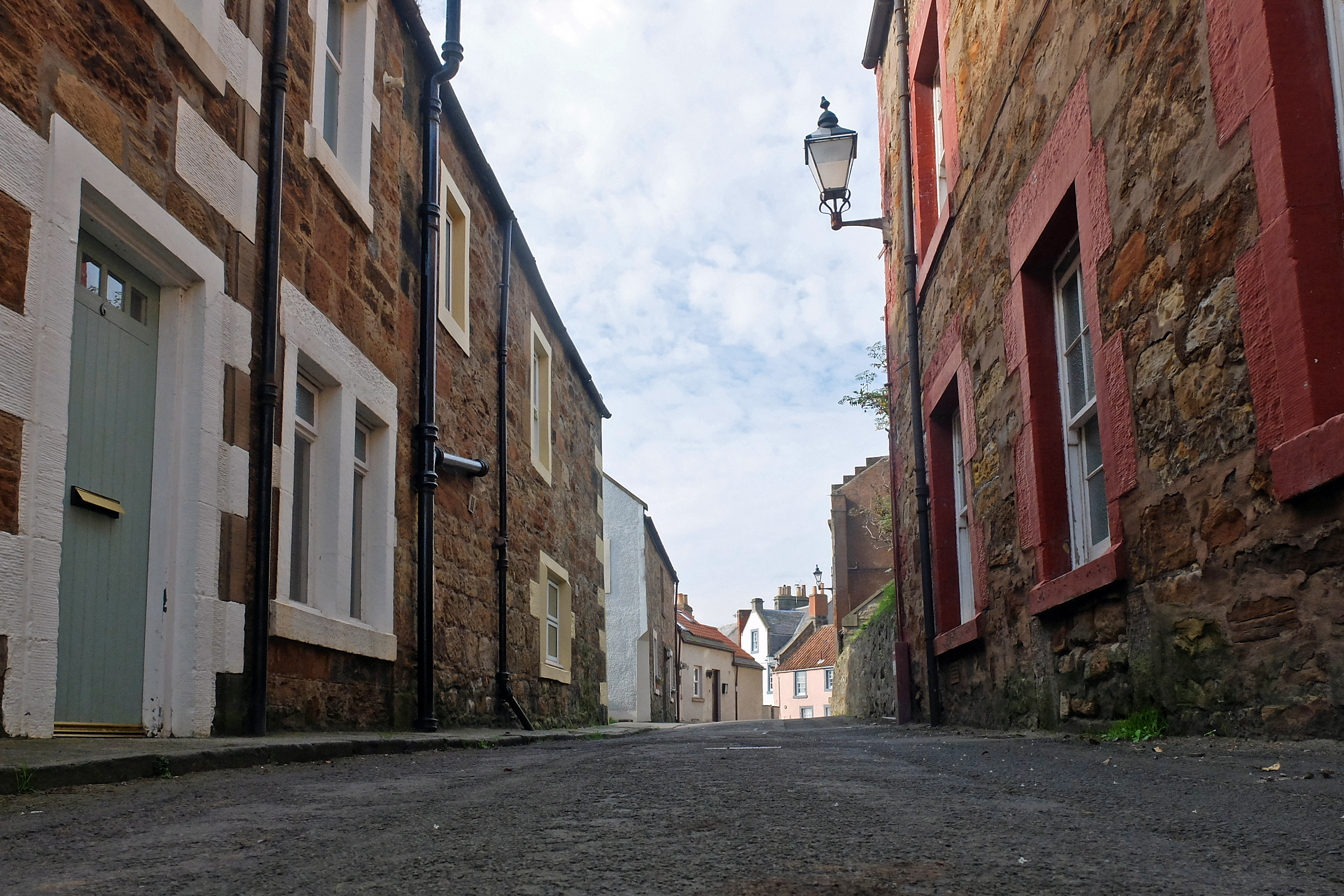
Leaving the bridge and arriving in Queensferry was a blessing. The cobbled streets tucked between the two big bridges on the Forth’s South bank were filled with quaint shops to attract the visitors and the car and coach park was adorned with my nemesis – a piper. Bagpipes were surely designed to hurt the English ear and I was happy to chat to the piper all day if it meant I didn’t have that drone echoing in the pit of my stomach. He was a cracking guy with an understanding of my English failings. He even pointed out that they sound even worse without the drone. A rare but not forgotten Mint Magnum was a worthy sticking plaster and it soon soothed my internal reverberations.

Stage 185, 25th September: Queensferry to Musselburgh

I was now following the John Muir Way for a few days and felt lucky to have another well-marked path. The Fife Coastal Path had undoubtedly been the best marked and best maintained I had come across to date and I had accordingly thanked a maintenance crew I met only yesterday. At first sight The John Muir Way looked as if it might give the Fife path a run for its money. Things were looking up.

An early woodland walk took me through the grounds of the Dalmeny Estate with its very grand house and well-worn cycleways. A quick duck inland for Cramond Bridge and a brief riverside walk to the village of Cramond was all I could look forward to as Edinburgh was soon upon me.

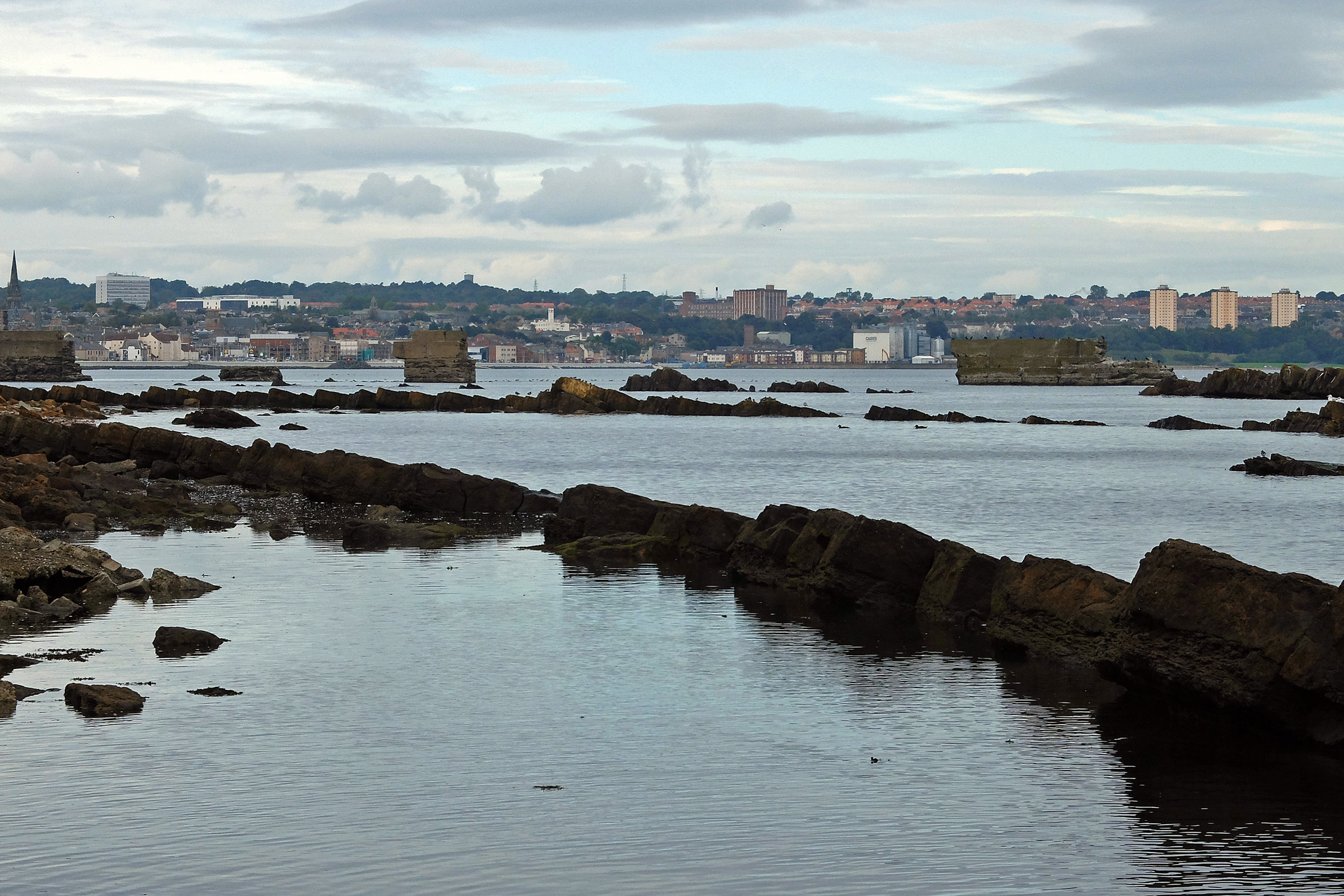
Most of today would be spent skirting Edinburgh. Much of the old city was inland and I was sorely tempted to drift away from the shore to explore somewhere quite unfamiliar to me. I stuck to my task and instead wandered Granton Harbour and the Port of Leith with huge refurbishment and redevelopment projects well underway, if not already complete. Throughout this walk, I have noticed how city docks around Britain have received huge recent investment, turning all of them into trendy places with expensive waterside apartments, bistros and shopping centres. Yet again and again I have also seen how this redevelopment is localised and that as soon as you round the corner towards the outskirts of town the scruffy squalor soon returns and that the ripple of development money has a real need to move out too.

DSCF4680

Once the scruffy trading estates were done a short three-mile walk took me to the now seemingly trendy beach resort of Portobello. Having rediscovered the habit, a mint chocolate chip cone was a must and it did its best to dribble and drip all down my arm as I walked the bustling promenade in the mid afternoon autumn sunshine.

Musselburgh was less trendy – but hello – a golf course. I noted that the East Lothian district proudly displays road signs claiming it to be the “Golf Coast of Scotland”. I suspect it needs to argue that one out with Ayr and Fife first.

Stage 186, 26th September: Musselburgh to North Berwick

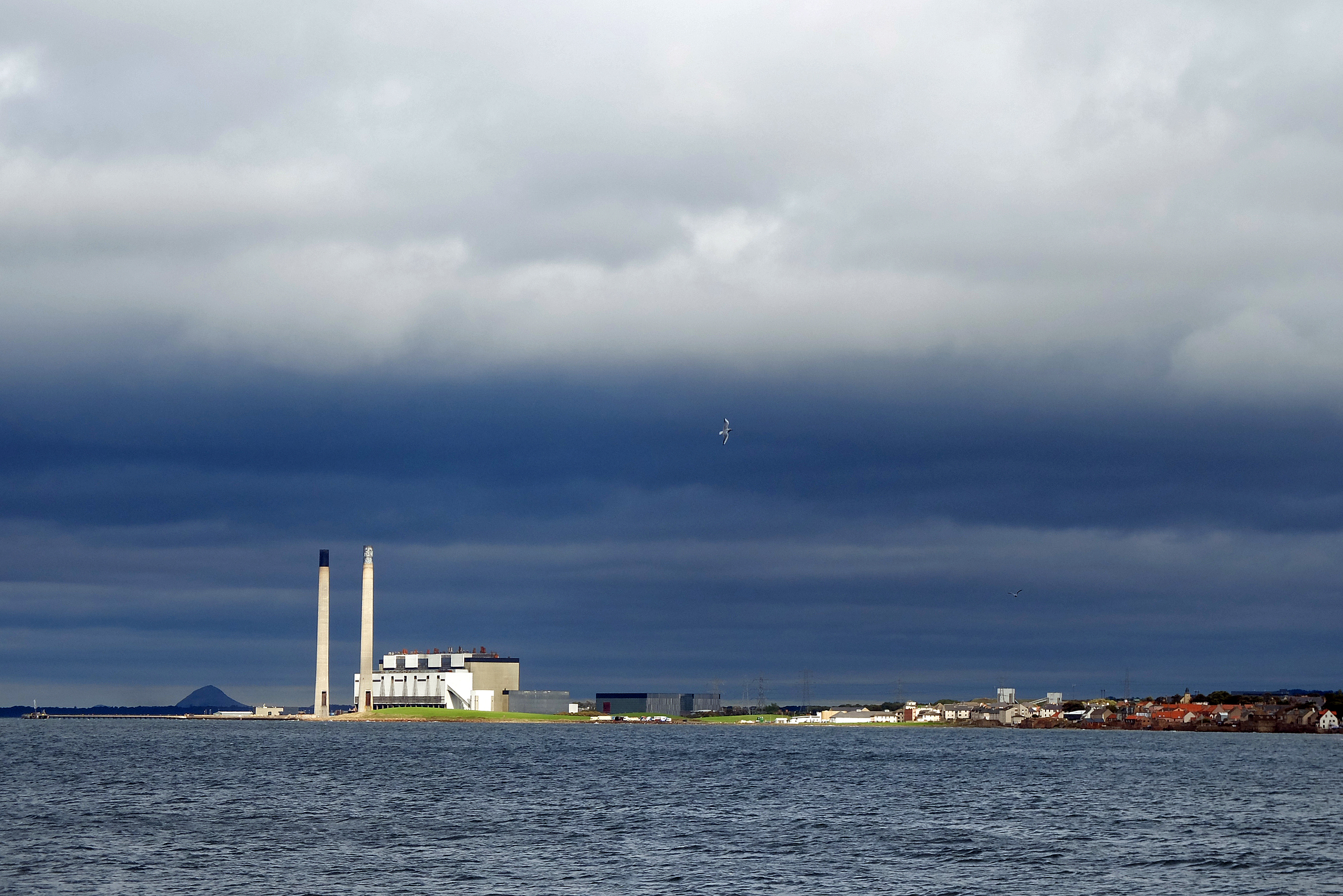
With another dry but increasingly blustery day, I almost flew through Prestonpans with the wind on my back. The decommissioned Cockenzie Power Station dominated the skyline and it’s demolishing was clearly imminent. With further plans for a another new energy park and the construction of even more wind turbines, I was beginning to wonder just how many of the silly things would end up blighting our landscape. Conversation with a local woman brought out a love for the old chimneys and a loathing for the dozens of wind turbines required to replace it. She questioned why on earth we need all these monstrosities when we have so much wave and tidal power sitting all around this island of ours. I couldn’t have agreed more.

DSCF4697

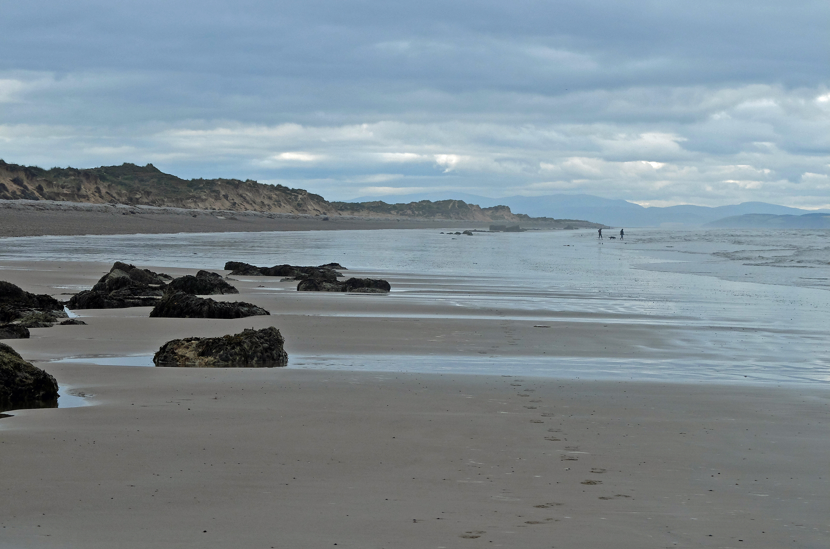
From Port Seton I transferred to beach and dune walking across Seton Sands and Gosford Sands to the wealthy and tidy village of Aberlady. The rich bird reserve of Aberlady Bay awaited and would dominate my afternoon’s attention.

For lunch, I sat overlooking Gullane Bay watching eider ducks idly diving into the shallows from their sitting position atop the waves.  I could have sat for hours in the gentle warmth of the sun but the deserted charms of more dunes and sandy beaches awaited.

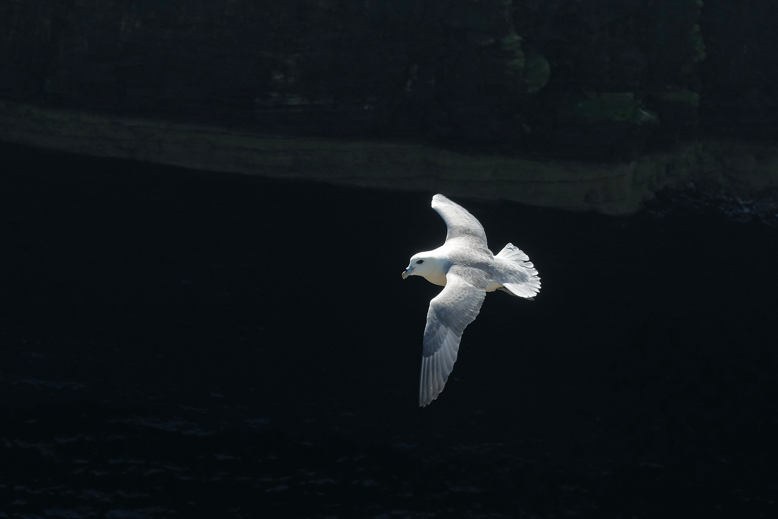
Considering I was still close to Edinburgh, the afternoon was very quiet. I paused again around the Briggs of Fidra to watch the sea birds dipping into the surf, but my eye was drawn to the gannets fighting the wind and tucking their wings in to dive repeatedly for their prey. It was another of those moments when I wished for my nice big camera and long lens to help me but the spectacle of the largest sea-bird in the North Atlantic more than made up for my inability to capture them in high-definition.

DSCF4726

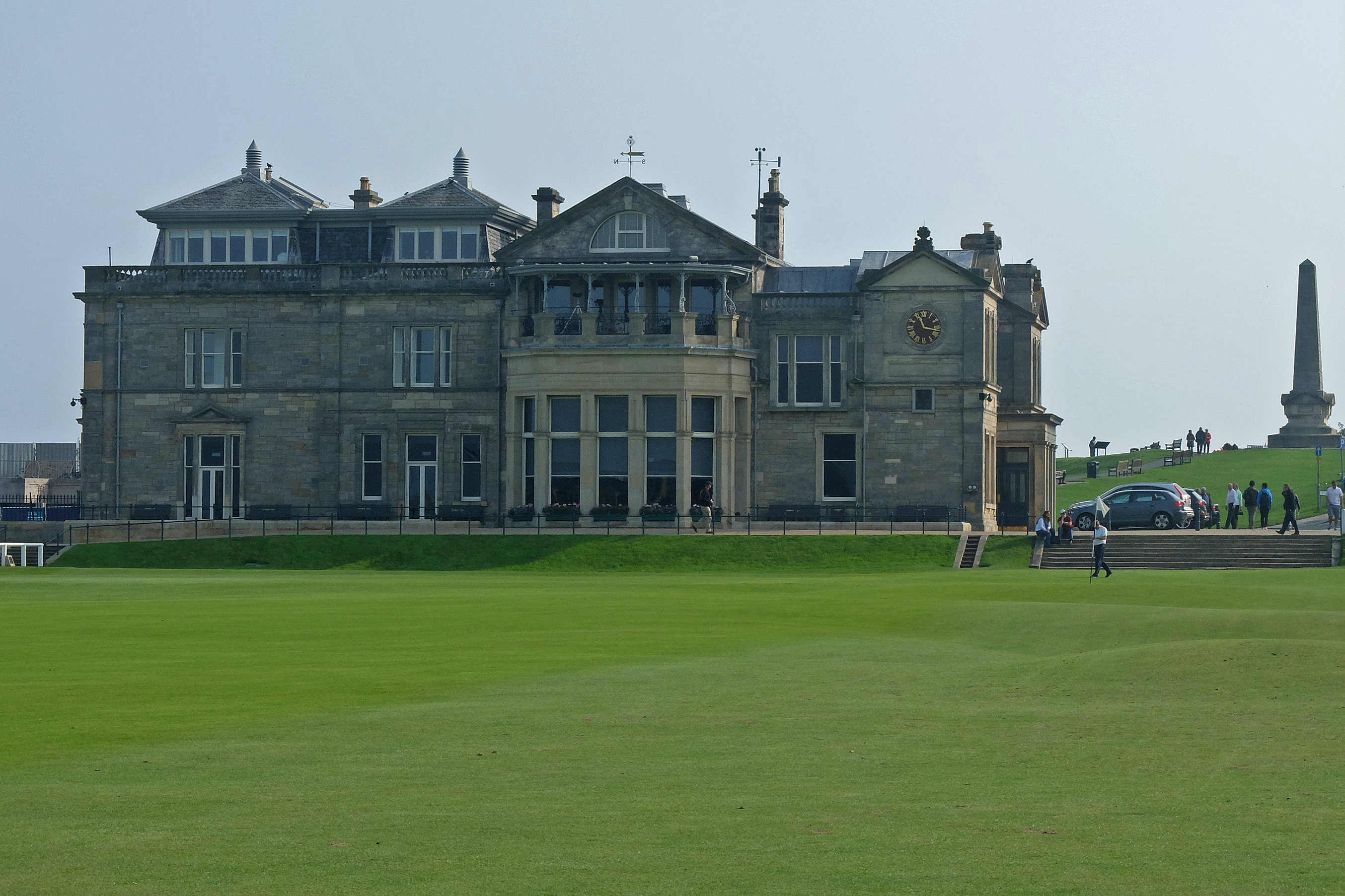
This had been my best day of the week and the stiff breeze had mainly worked in my favour to push me along towards North Berwick with its renowned and well populated fairways. I was in a good and slightly mischievous mood as I approached a carpet perfect and empty green sitting yards from the beach. I could see golfers queuing at a neighbouring tee a short distance away. None of them were looking my way, so I grinned like a big kid as I took a golf ball I’d previously found from the side pocket of my rucksack and lobbed it to within six feet of the flag. I’m sure the next golfer to play that hole would be delighted to see the result of his blind shot into the green….at least for a minute or two anyway.


The fairways of Fife

Rest Day, 20th September: Clayton nr Leuchars

With Bob off and away, I reflected on another week in the company of another stranger who had become a good friend. We had a grand week and his company was certainly fun and always welcome. It also helped to have local knowledge in charge of Snickers and I learnt  much more than I expected about Scottish politics, even if my Sassenach ignorance left me saying “pardon” or “sorry” more than was normal. He left with my deepest thanks.

With chores to do, the day flew too fast and by the time I picked Sara up from the station I was wondering where on earth the day had gone. Sara and I had only met a couple of times, so we too should be classed as relative strangers. But for me the thought of getting to know someone new again was no longer daunting, even if I did have to smile politely when she slipped the clutch on Snickers as we drove away from station.

Stage 181, 21st September: Leuchars to Crail

Sun! Yes, the big round yellowy thing was hanging in the sky as I took a pavement walk to pass a sleepy RAF Leuchars. It wasn’t a particularly warming sunlight as the air was decidedly cool, but it was welcome nonetheless. The airbase was very quiet, even for a Sunday morning. It was as if everyone was hungover and having a good lie in. So I crept by and headed for St Andrews and for the land of golf.

St Andrews was positively heaving with Americans wandering the fairway of the 18th talking animatedly about a difficult position Tiger got himself into and how well he extricated his ball. I think they were talking about golf, but you never can be too sure. I  stopped to take a picture of the 18th myself and got chatting to a group who were over to watch the Ryder Cup later in the week at Gleneagles. I have thoroughly enjoyed talking to Americans throughout this journey. They have always been enthusiastic about where they are and what they hear. I ended up taking their picture standing on the famous Swilcan Bridge leading up to the green. I declined their kind offer of a return favour as I tend to get embarrassed doing touristy things.

DSCF4503

St Andrews was also full of students with maps in hand. Freshers week was on. Their confused but excited faces reminded me of my eldest daughter who was starting her university life at the other end of the country in Exeter. I hoped she was OK and sent her a quick text. She didn’t reply, so clearly she was fine. Indeed, there were so many people to watch in St Andrews. I could have sat for hours. But it was clearly obvious that the pretty people were out and about and that money wasn’t short in this part of the world. It didn’t feel quite real.

On leaving the town, reality returned and a proper rugged undulating coastal path came with it. I had little bits of everything: Small sandy beaches, rocky foreshores and shingle spells mixed themselves with low cliff paths. But one thing was with me all the way today and it was golf. Including the six St Andrews courses, I counted twelve today. Twelve within a twenty miles stretch of the coast? That must be a record.

Stage 182, 22nd September: Crail to Leven

Even more golf courses kept me company today but added to the immaculate fairways were a series of villages, all with their own harbour. I took loads of pictures, but knew that I would struggle to remember which picture was taken in which village. All the villages were pretty and all were competing for visitors. All were very tempting but none stood out as a favourite for me to dwell in.

DSCF4560

The coast path dipped around churches, cliffs and rocky outcrops, many of which were inaccessible at high tide. The tide favoured me and the high path diversions weren’t required. Hence I mainly stayed off-road along that proper coast path again. Nothing really took my breath away today, yet nothing disappointed me. Everyone I met was friendly, yet nobody was chatty. There were loads of walkers, but no hikers. The scenery was always pleasant but not what I would call spectacular. Everything was just gently interesting. Maybe, just maybe, I was spoilt a bit further North and West.

Stage 183, 23rd September: Leven to Kinghorn

I was beginning to wonder if Fife could actually support any more golf courses.  I wasn’t to be disappointed as I woke to the metallic ping of a driver launching another white ball skywards and along the fairway abounding the campsite at Leven. With this apart, the sheer number and density of golf courses just had to dwindle as suitable links land dissipated with every Southwest step up the Firth of Forth.

I soon escaped the rather peculiar prison like feel of a campsite trapped within an unbroken chain-link fence barring access to a pleasant sandy beach below. The coastline was gradually but surely becoming built up and busy as the Methil docks with its huge wind turbine drifted over my shoulder to be replaced by the former mining towns of Buckhaven and East Wemyss. The prettier village of West Wemyss came and went too quickly and enticing sandstone caves were fenced off with ‘danger’ signs.

Instead I was drawn to Dysart, a fully recognised conservation village and suburb of Kirkaldy, with its elegant Dutch influenced housing on the sea front. The whole village was nearing the end of a five-year regeneration project and had retained a delightfully individual character in an area which was beginning to become a little predictable.

From Dysart I was soon around the headland and into the long town or ‘lang toun’ of Kirkcaldy. For me the town arrived with a huge flour mill at the North end and curved gently around a sandy cove with a familiar array of shops and amenities providing what looked like a thriving central amenity town and hub for Fife. It wasn’t pretty, but it wasn’t dull either and for the perfect chickening reason that a good friend was born there and that I might get a slap, I wouldn’t dare say a nasty word about Kirkcaldy. At least I got to see Stark’s Park, Raith Rovers football ground too. Apparently they play in blue and white.

DSCF4595


The Esk. The Tay. Yae or Nae?

Stage 178, 17th September: Inverbervie to Lunan Bay

The murky haar was hanging in the air again and seemed insistent upon staying with me. It was a frustrating view spoiler and with the frequency of “wow’ moments having decreased since I left the West coast, the lingering fog was becoming more than a little depressing. On the other hand my success at following the Nave Nortrail markers had improved with a lovely short-grass path taking me through the fishing villages of Gourdon and Johnshaven from where a slow climb took me to the cliff tops via a perfectly good closed path – “due to safety reasons”.

DSCF4439

Sometimes I’m really not sure what safety reasons make you close an inherently dangerous high cliff edge path, unless a landslip or a rock fall has occurred or is imminent. I wondered whether there might by now be a sign at Everest base camp saying “mountain closed due to safety reasons”. Maybe they should install a handrail.

It wasn’t long before the now reopened path dropped under the cliffs for the rather secretive Sands of St Cyrus and a deserted nature reserve. Undoubtedly everything was underselling itself and even the attraction of a ‘hobbit house’ buried in the turf at the North end of the bay looked like it was hiding from rather than complementing the environ.

I then ducked inland to cross the River Esk and the port town of Montrose. The entrance into the estuary was a notoriously dangerous passage in the past with sand banks to the North and shallow sharp rocks hidden beneath the waves to the South. Another Stephenson designed lighthouse and a series of beacons were constructed in the 19th century for the ships to line up against and guide themselves safely into harbour. Additionally a clever system of launching a life line to any ship stuck on the sand allowed horses to attempt to pull a ship free at high tide. I thought it all rather clever and in a simple way very ingenious.

I was glad to escape Montrose and hear the sound of waves breaking and not the groan of human generated noise in the docks. From the lighthouse at Scurdie Ness it was back to the lanes to take me to Lunan Bay.  I suspected that I had once again lost the Nave Nortrail as I discovered Bob had walked a decent bit of coast path all afternoon. Hmm.

Stage 179, 18th September: Lunan Bay to Carnoustie

The heavy sea mist persisted and now it was supplemented by a good mizzle (not quite drizzle). Nothing to wet me, but damp all the same, as I crossed Lunan Bay to pick up the muddy farm tracks constituting a rather better marked Angus Coastal Path. As I could barely see further than the length of a cricket pitch, I could have been anywhere. Indeed, I felt as if I was back at home in Leicestershire surrounded by well-worked farmland with the occasional tractor with a trailer full of potatoes passing me by.

The tracks became long wet grass and I soon discovered that my newer pair of boots were now leaking…. badly. So from Auchmithie onwards it was another uncomfortable feet day. It was also meant to be a gorgeous cliff-top walk. The tall red sandstone cliffs were etched with arches, caves, stacks and even blow-holes all marked on my map, but all hidden in the murk. I could hear the sea below. But could I see it? Just, but then only occasionally.  My camera must have been feeling unloved, so I tried to capture the odd image when the cloud briefly cleared – but it was a futile effort really.

DSCF4462

The fog lifted for a good hour as I strode into Arbroath and bought a kilogram of Smokies for tea from a woman who didn’t seem overly keen on serving customers or communicating with anything much more than a monosyllabic grunt. Arbroath had clearly seen some tidying up around the harbour and was certainly making an effort to attract visitors, even if the shopkeeper I came across wasn’t.

The path then followed the railway line all the way to a very middle class Carnoustie with its boutiques and smart little shops all selling things most normal people don’t need to buy on a day-to-day basis. By evening Snickers smelt of Smokies and was likely to do so for some time. They were truly great.

Stage 180, 19th September: Carnoustie to Leuchars

What no fog? No Haar? It might well have lifted, but the sky was still very grey as the Angus Coastal Path continued by squeezing itself between the famous Carnoustie golf course and the railway line to Monifieth and Broughty Ferry.

At home Kate had identified that the reduced visibility of the last week had produced a slightly bored tone in my voice and had set me a task of finding a certain bench at the library in Broughty Ferry. It didn’t seem the most thrilling of tasks and it did take me one street inland from the coast, but I duly obliged and it did give me something to think about other than the fallout from the Scottish independence referendum. The bench was worth a quick visit as the sculpture by David Annand depicting a cat disturbing a man reading a book was nicely done with a certain wit to it. I thought that it deserved a better spot than to be hidden at the back of a small library garden.

DSCF4469

The last couple of months I had increasingly felt like a voyeur to the process of the referendum. I had watched as more and more ‘Yes’ signs and stickers cropped up in house windows, cars and fields whilst ‘No Thanks’ signs were notably absent. Yet conversations with locals were telling me that ‘No’ was winning. It had all been getting a bit tense and every time a London-based politician turned up in Scotland it only seemed to fan the flames and raise the passions of the ‘Yes’ voters. I sometimes felt intimidated by the Yes campaign but as it all came to a head I actually felt very sympathetic to their passion and to their frustrations with London. It had become clear to me that the Scottish issues were no different to those in any of the English regions, Wales or Northern Ireland. I was optimistic that the outcome might just bring the Londoncentric country to its senses.

Nonetheless some passions weren’t welcome. As I approached an electronically controlled gate around the port of Dundee. I was told that it was not open to xxxxing English xxxxards and that I could xxxx off home. I saluted him with a gesture well understood in all parts of the British Isles adding a few words enlightening him as to his bigotry and walked down the road racing through the outskirts of Dundee and on to the central walkway of the Tay Road Bridge. I knew the port security guard was an anomaly in this more than friendly country, but isolated abuse lingers and I was more than happy to get out of Dundee.

DSCF4478

I was now in the Kingdom of Fife and joined the renowned and well-marked Fife Coast Path through Tayport. With a forest track taking me inland of the RAF airfield, I arrived in Leuchars with a heavy 137 mile week behind me. The last three weeks had seen me average over 23 miles per day and I was looking forward to a slightly lighter week next week….and maybe even the odd clear sky.

Distance to date:  3,666 miles   Ascent to date:  462,457 feet

Haar dee haar

Rest Day, 13th September: Banff

Having saved my support crew skin by stepping in to cover three weeks in North Scotland, Mike headed off on his long journey home with my deepest thanks once again. Ahead of me lay a few days of rather complicated logistics. After sorting out my chores and catching up on admin, I decided that rather than worry the best thing I could do was go with the flow and let the support crew sort things out among themselves. It worked and over the next couple of days I managed a good catch up with the West coast support gang of Geoff, Lorna, Sue and Diesy as well as Sue’s daughters Steph and Abi. To complete the puzzle, Amy and Glyn were to join me the following day and then Bob was to take over driving duties for the rest of the week. It all rather hurt my brain but at least I was rewarded with a rare but welcome bath.

Stage 175, 14th September: Peterhead to Newburgh

With the weather looking decidedly grey, both Peterhead and neighbouring Boddam were looking more than a little downbeat. The power station set them both off against each other nicely but also set me up for a lovely cliff top walk around the Bullers of Buchan rich with its dramatic arches and stacks. It was very much the end of the sea-bird season, so I saw little of the razorbills, guillemots, kittiwakes and even puffins that frequent the cliffs. Fulmars were still in residence, but I’m sure I would have been much happier visiting this part of the coast in May.

Amy and Glyn joined me just beyond Slains Castle and we shared twelve miles from the sand at Cruden Bay and across overgrown barely used misty coast path. Sadly the with the haar rolling in there wasn’t much to see but their company more than made up for it. Conversation was easy and time flew by as we took back to the lanes around Collieston towards Newburgh.

DSCF4348

The evening was a grand one as I notched up my eighth borrowed bath of the trip so far with the added bonus of a spare bed and dinner at Sue’s place with Lorna, Geoff, Abi and Bob for company. It was all very civilised and warmly welcome even though I plainly admit that I have become more than a little attached to the comforts of Snickers over the last seven months. So much so, that I find breaking the routine to be mildly unsettling and a little confusing in terms of knowing exactly where I am and where things are. My long journey around a big island seems to have shrunk my world into a sharply focused bubble.

Stage 176, 15th September: Newburgh to Cove Bay

With Bob now at the reins we headed back to Newburgh and I ventured straight onto the beach to be rewarded with the sight of a huge seal colony whelping and barking on the opposite shore at Newburgh Bar. With the wind on my back, the showers that drove me down the beach seemed little bother and I thoroughly enjoyed myself as I walked through flock upon flock of gulls and seabirds all taking off with my approaching step.

I walked the beach with all inland landmarks hidden behind the dunes to my right. I knew that there were lines of expensive golf courses hidden back there somewhere, but as I had passed so many already I wasn’t overly bothered to miss a few. I was much happier spending my time strolling along ten miles of empty sand in the middle of a Site of Special Scientific Interest.

Eventually the sand had to stop as Aberdeen was lurking in the gloom. I made for the tarmac and the Bridge of Don for a meeting with the local press photographer outside a seafront ballroom. As I waited for the photographer to arrive I sat on the promenade eating my marmite sandwiches and counted 19 oil rig support vessels sitting at anchor out in the bay. Apparently it’s much cheaper to anchor out there than to cosy up at berth in the port.

With my ugly mug duly snapped, I continued down towards the harbour and around the quaint old cobbled streets of Footdee, neatly tucked in between the docks and the sea wall. The docks themselves were full and busy with their North Sea business and as I walked around to Torry the smell of fish became ever dominant. I was glad to leave the alien sounds of city traffic and industry behind. After my few months of idyll on the West coast it was a bit of a shock to my system. It was therefore comforting to be able to bypass Altens and find an unmarked path to hug the cliffs all the way to Cove Bay.

DSCF4392

Stage 177, 16th September: Cove Bay to Inverbervie

Today’s route plan didn’t really excite me and the weather continued to be dreary if a little drier. It was misty again and with everything an even flat grey I knew that decent photos would be a rarity. I attempted to follow the North Sea Trail, part of the Nave Nortrail project which set itself an objective to have a network of trails across many of the countries edging the North Sea coast by 2006. It looked as if the project must have foundered as the markings were often faded or absent and the paths overgrown or non-existent. Either way, none of it was marked on my map and the trail only worked for me now and again and it’s reliability was beginning to irritate. Twice I got stranded at cliff edge dead-ends and it often petered out into overgrown bramble and bracken. It is well documented that I do not have a predilection for head-high bracken even if it is beginning to die off, so maybe my irritation was justified.

To add insult to irritation I had picked the wrong boots for the day. With knee-high wet grass the best the path could offer, my feet were soon squelching merrily and I was relieved to reach the roads around the popular Stonehaven and it’s attractive oversized geometric harbour. It was but a short walk over the cliff to Dunnottar Castle and a strange but welcome request from a Japanese tourist to take his picture.  It was then lanes and a rather dreaded foggy walk alongside the A92 to Inverbervie and a very tired but welcome evening with Bob and a lasagne.

DSCF4424

‘Local Hero’ saves the day

Stage 172, 10th September: Spey Bay to Inverboyndie

With an absolutely stunning sunrise to bring me to my rather slow and groaning morning senses, I briefly followed the Speyside Way out of Spey Bay, through woodland and on towards my first of many villages and small towns of the day. Despite the gentle warmth of a light breeze and an easy sky, I was clearly not the most observant of walkers today as I almost walked right by a seal colony on the rocks just a short distance from the path near Portgordon. Their mottled grey camouflage clearly worked as they sat on the rocky foreshore watching me wander by as if I were the zoo attraction.

DSCF4249

The Speyside Way soon deserted me as it headed inland at Buckie, a larger fishing town which actually had some semblance of a fishing industry remaining. I couldn’t say whether it was thriving or not, but – to be blunt – it didn’t seem overly busy. Conversely, the next village of Findochty had a very different approach to marine activity. The houses were brightly painted and the harbour had a full marina clearly trying it’s best to attract visitors and even the yachty types. Harbours were undoubtedly the theme of the day as each town or village I passed through had it’s own neat, well maintained harbour, some busy, some empty. All were clearly a reminder of their fishing heritage which dominated this area up until very recently. All, with the exception of Findochty, looked as if they needed something else to maintain their status.

A brief walk out of Portnockie took me along the cliffs to Bow Fiddle Rock. A spectacular arch which, to me, resembled more of a whale’s tail fin than it’s title suggested and in all ways was as grand as any other arch I had come across, including the well-renowned and oft visited Durdle Door back in Dorset.

The next four villages were all former busy fishing villages seemingly trying to find themselves again, but all looking a little downbeat. The unmarked coast path kept me happy as it dipped its way around the cliffs, sometimes edging the cliff top, sometimes tucking in underneath. With a couple of small sandy bays thrown in, it was beginning to become one of my favourite days so far. It was only to be spoilt a little when the coast path vanished at Portsoy and I had to take to the lanes over the well farmed hills to Whitehills and the stopover at Boyndie Bay.

Stage 173, 11th September: Inverboyndie to Rosehearty

The coast path that vanished at Portsoy barely made an appearance today and it was back to the roads and lanes through to Banff and the much more active fishing town of Macduff. From here it was Gardenstown and a reminder of the drab modern Scottish architecture which seems to involve a great deal of beige and pebble-dash (harling). The tiny village of Crovie tucked under the cliffs, it’s houses all in one curving single line around the bay revived some aesthetic pleasure but proved only to frustrate me as I spotted a narrow ledge of a path at the cliff bottom which had wound itself around the coast from Gardenstown. It wasn’t marked on my map and it was too late to walk it now.

It had become a common frustration in Scotland. Paths that exist in reality that aren’t marked on an OS map and conversely, paths that are marked on the map that plainly don’t exist. The OS maps for England and Wales have, so far, proved far more trustworthy. So much so that sometimes I wonder whether the same people do the mapwork. I know that Scotland has much more of an open access attitude, but I have found that open access doesn’t always mean you can get through without losing yourself in a bog, wading through head high bracken or scaling a deer fence. I have often ignored my carefully planned route and gone with gut instinct. I have usually been a good judge, but I’ve not always been successful in my selection and have had a few cross-country adventures which would have seen most people turn back.

When I miss out on a through path like the one around to Crovie, it really does grate. Fortunately, my lingering at the very similar but slightly more starstruck village of Pennan reaped the reward of a Scottish Rights of Way Society path out from the village which Ordnance Survey had failed to document. I readily admit to lingering in Pennan and indulging myself with a pint of….wait for it….blackcurrent and lemonade in the Pennan Inn and taking in a few minutes of a location used for the filming of Bill Forsyth’s comedy-drama ‘Local Hero’ in 1983. I did have some ice in my drink, it was quite a warm day and I couldn’t find a shop selling ice cream. So needs must.

DSCF4311

Sadly I rejoined the dull farm lanes busy with tractor traffic with their grain trailers shuttling to and from the combines working the fields. If it wasn’t for Crovie and Pennan today would have been a very dull day. It was saved by a local hero.

Stage 174, 12th September: Rosehearty to Peterhead

With my planned route not predicting much fun I passed through the rocky shored Sandhaven with the village’s population showing off its underwear on the washing lines strung up along the seafront. The fairly nondescript local hub of Fraserburgh came quickly but just as quickly it gave way to the lovely sandy Fraserburgh Bay for three miles to Inverallochy.

Enthused by the rarity of a decent beach walk I checked my route again and decided, despite the possibility of getting stuck trying to cross three small rivers and a rapidly rising tide, on an attempt to get to Peterhead using beach only. Sure enough the rivers were there and all three required removal of boots, socks and a wade. All three were easily crossed and I had fifteen miles of unbroken deserted beach walk all the way around Rattray Head, down the back of the huge St Fergus gas terminal and to the rocks at Craigewan half a mile North of Peterhead.

It had been my longest unbroken beach walk to date and I’d barely seen a soul with the exception of Ian from Peterhead who was very successfully fishing for flounders on Scotstown Beach. His conversation was the only one of the day and a very welcome one it was too as we briefly shared stories of our common working life.

DSCF4319

Peterhead was the end of another big mileage week with 142 miles covered in six days. It was to be Mike’s last night and we shared a fish supper and a wee dram to celebrate his three weeks supporting me in Snickers. With his long journey back to Exmouth starting early in the morning and a journey back up again for a holiday on the Orkneys in a few days, I did question his sanity along with mine. During his three weeks I had totted up over 400 miles and Durness seemed like yesterday. Things had speeded up.

Military Moray

Stage 169, 7th September: North Kessock to Nairn

For anyone who might actually read this blog and tot up my ice cream intake, it was most remiss of me to forget to mention my Magnum in Munlochy on the 5th. I also suspect I forgot a very early ice cream back in Devon when I vaguely remember a rather nice honeycomb cone that failed to get a mention. That’s it I think. The ice cream register should be well and truly up to date. At this point, I feel I have to admit that I am by no means the champion of ice cream eating coast walkers, not by a long way. Nat Severs surely holds that crown and I suspect nobody will ever come close. His blog charting his walk back in 2010 is a good read, he managed his 7,000 mile feat in an incredible time and makes my efforts look a little namby-pamby in comparison.

Fortunately the heavy rain forecast had blown through overnight but the clouds hung heavy overhead as Kate and I spotted a couple of dolphins out in the bay just as I set off from North Kessock. It was but a few yards up and over the Kessock Bridge to skirt Inverness and the football ground of Inverness Caledonian Thistle, a great name for a club and my adopted favourite Scottish football team, who, as I write, just so happen to be top of the table – until Celtic find their form. I crossed over the A9 to head East and took to some waste ground, well that’s what I thought it was. It turned out to be an old landfill site with pipes crisscrossing it at trip height collecting the gas bubbling through the mounds of rubbish buried just inches below my trampling feet. I don’t think I should have been there. Oh well.

DSCF4179

Once I had established that the soles of my boots hadn’t melted away, I rejoined lanes across to Milton and onto the verges of the A96 for a few miles. It was grand to escape another ‘A’ road and I was soon back on the lanes and diverting briefly towards Inverness Airport for a coffee with Kate. After a fond farewell she headed back South to find out whether her mum still had some sanity after a week house sitting and the company of two chaotic Golden Retrievers.

From there it was back to the lanes for Ardersier and the operational garrison at Fort George, which was hosting the Highland Military Tattoo and had a heavy military presence who were all sporting their normal camouflaged fatigues perversely accompanied by hi-viz yellow jackets. As a result, I skirted the fort and continued on a now deserted lane around the ranges and on to the even more deserted and very eerie Port of Ardersier, formerly a huge oil platform construction yard. Apparently there are plans to turn it into a ‘super-hub’ offshore wind manufacturing facility. Manufacturing wind is a new one on me. Maybe they are planning to build a huge set of electric fans that look a bit like all those white elephants we seem to plant with good intention on every available hill-top that pretend to save the planet by generating the power to run one small light bulb. Ooerrr…..I’m off on one again.

A bone straight equally deserted two-mile road then took me away from the old port and back to the A96 and the last few miles into Nairn, the self-dubbed Brighton of the North……ehem. As I trudged the last couple of miles I couldn’t help but try to think up better uses for the old port – maybe a film set, a sports stadium, another new parliament building, or even a grand spot for Scotland to host the olympics.

Stage 170, 8th September: Nairn to Burghead

Things had become much flatter now. Mountainous backdrops seemed but a distant memory. So it was as I took to the sandy beach from Nairn before ducking inland to find a way up the estuary and cross the Findhorn River. In walking the tracks of Culbin Forest I noticed how autumn was slowly taking hold as colourful fungi sprung into life in the forest litter and track edges.

I emerged onto a lane and quickly came across a friendly couple from my neck of the woods in Leicestershire. They had upped sticks and were living in a caravan as they set about demolishing a derelict house and building new. We chatted enthusiastically for twenty minutes about the many virtues of Scotland and its people and I almost had to tear myself away from a familiar accent and lovely easy chatter.

The Findhorn River showed me some now familiar signs of Bertha’s recent visit. Clearly the normally large river had been gigantic a few weeks ago. The huge size of some of the trees, rocks and debris now beached at the top of the river bank or in the middle of a newly created rocky scar demonstrated once again just how much rain had fallen over such a short period.

More road took me up through Kinloss and turned North towards Findhorn. I would have liked to have lingered at the Findhorn Foundation spiritual community and eco-village, but I suspect I would have stopped a little too long to steal ideas and Mike would no doubt have worried about where the hell I’d got to. So I resisted temptation and stepped on into the old village of Findhorn itself. Findhorn had a Cornish fishing village feel about it, with pubs that deserved a few flagons of warm ale and good sea shanty. It was then time to turn East again, up and over the low dunes for six miles of sand swinging around Burghead Bay with its marooned pillboxes and concrete block war defences now lining the middle of the beach and eroding rapidly with every tide.

DSCF4197

Stage 171, 9th September: Burghead to Spey Bay

A day with very little road walking was a blissful thought. Now the Moray Coast Trail would keep me company and the reward was a day of great variety. A bit of cliff path, a section of cycleway tarmac, a few dunes, a long sandy beach, the odd mile of shingle and a few small harbours thrown in for good measure. Sounds like a perfect day.

A huge maltings warehouse dominated the Burghead skyline as I again turned purposefully East. Soon the sandstone arches and stacks along the Permo-Triassic cliffs took over and stayed with me to the village of Hopeman. From here the landscape gradually flattened until a sandy beach took me to Lossiemouth and its busy military airbase. Very expensive warplanes were repeatedly circling and practising their final approaches time and time again. I lingered a while under the flight path at the end of the runway savouring the rough deep roar of their jets as they kicked the thrust back in to speed away each time they came close to touching down.

DSCF4236

Lossiemouth itself was a busy and pretty small town, no doubt bouyed by the affluence of the airbase activity on its doorstep. It also had a stunning beach continuing both East and West from the town. As I wandered East and peaceful remoteness slowly returned unfortunately a rather proud but also very nude bather made his unwelcome appearance. There are bodies which are designed to be naked and unfortunately the human body isn’t one of them, particularly dangly male bodies. So with my eyes averted, if only to avoid awkward conversation, I strode on down the beach.

With the soft sand slowly dissolving into banks of shingle, I made my way to the back of the beach and a dune-side path. Arriving with the shingle was more of the long defensive wall made up of large equally spaced anti-tank concrete blocks with periodic pillboxes. These World War Two defences were put up when invasion from the direction of Norway was seen as a real threat. The wall stretched on for miles and with what I had already seen yesterday it seemed as if Britain had, once upon a recent time, taken its threats seriously. The Great Wall of Moray maybe? The wall ended abruptly with the arrival of the Spey estuary. For me it was a quick turn inland to cross the old railway viaduct and a walk around the headland again to meet up with Mike camped up alongside the ubiquitous seaside links golf course.

DSCF4244


Calling in at Cromarty

Stage 166, 3rd September: Embo to Tarbat Ness

After an evening comparing travelling notes on a large Parkdean campsite with a group of master drummers touring Scotland from Ghana – ‘Kakatsitsi’, I set out for a lovely beach and links walk edging Royal Dornoch Golf Course and into the pretty, quaint and affluent Dornoch with it’s quintessentially British – oops Scottish – craft fair in the cathedral grounds. My pleasures were soon drained by seventeen miles of tarmac featuring a pretty dreary lane, a short stretch of the A9 over the Dornoch Firth, a fly by of the Glenmorangie distillery and a stroll through Tain. I then took to more lanes, ducking inland to avoid a very active bombing range with Typhoon jets circling endlessly and playing their little war games.

Eventually, I arrived in the very pretty harbour village of Portmahomack and spotted a sign-post for a coast path to Tarbat Ness. It was a rather lonely sign-post and I never saw another as the path was poorly marked and crossed another maze of barbed-wire and electrified fences with inquisitive cattle chasing me along the field boundaries. It might have been a fairly dull day but I felt so much better than yesterday as I met up with Kate and Mike at the red and white hooped lighthouse. Some things on this walk I have yet to understand and why I should feel drained one day and fine the next when I have no clear excuse, illness or injury still baffle me. I seem to have to accept that sometimes I just have off days.

DSCF4097

Stage 167, 4th September: Tarbat Ness to Cromarty

From the “Where’s Wally” lighthouse at Tarbat Ness I dropped quickly down to walk under the cliffs along a low undulating grassy bank of a path topping a rocky foreshore. An utterly deserted stretch of coastline with nobody around at all, not a soul. Even the wildlife was strangely absent. The path lifted up over the cliff as Ballone Castle brought a sign of life, if rather a spooky one. On the cliff edge and restored to a private dwelling, it had tall off-white towers, tiny windows and a feel to it that suggested bats would be circling at night.

From Ballone the now track dropped me back down to the scruffy little fishing village of Rockfield, tucked neatly beneath the headland cliff. For the first time the often seen but barely used tall poles had fishing nets draped from them and a man creosoting his fence warned me of tripping over rocks in the next field. I don’t think he was aware of just how sharp his wit was, but his lack of interest in my venture didn’t tempt me in to a bantering exchange.

I continued under the cliffs for a few peaceful miles till the villages of Hilton, Balintore and Shandwick came and went in quick succession. They flew by so quickly that I barely had time to consider whether they actually had their own harbours and beaches or shared one between them. The cliffs then became inaccessible and topped with arable farmland busy with the sounds of harvesting. Thus I took to the lanes to discover that I now had to master dodging tractors as opposed to courier vans. Their tyres were much larger and for self-preservation, deserved the respect of standing well clear.

My only half-serious climb of the day took me to Castlecraig and a brief chat with a lovely woman from Northumberland who came rushing from her garden with two spaniels and an offering of flapjacks. I then dropped down to the Cromarty Firth complete with a plethora of jack-up and semi-submersible drilling rigs either sitting at anchor awaiting their next job or in dock at Nigg undergoing maintenance. A small turntable ferry took me over to Cromarty where Kate sat on the rocks to greet me on the slipway.

DSCF4126

Stage 168. 5th September: Cromarty to North Kessock

I suspected today wouldn’t be one of my favourites and sure enough it wasn’t. Things started pleasantly enough as I watched three tugs pulling a large semi-submersible drilling rig out of dry dock and into the bay, but from there it was road….all the way. I hadn’t planned it that way as I had hoped to walk along under the cliffs towards Rosemarkie and Chanonry Ness. However, as I left the road and ventured down the hill through a farmyard and towards an OS marked pathway to the foreshore, I found no way through. The cliffs were steep and tangled with trees and overgrown gorse bushes. I had no option than to back-track and if there is one thing I dislike more than anything it is having to retrace my steps. With mood now glum the mile back to the road was in sulk mode and I gave myself one last lift by finding a path following the trickling waterfalls down the Fairy Glen into Rosemarkie.

DSCF4167

From Fortrose I had the pleasure of a new ‘A’ road and the A832 would prove to be a nasty one. Much busier than expected, it also gave me little room to manoeuvre with high walls abutting the road surface. A cut away towards the coast brought brief respite and I soon returned for more of the A832’s pleasures till I reached Munlochy and my first glimpse of the coast for a while with an expansive view over Munlochy Bay. Lanes slowly filling with Inverness rush-hour traffic took me up and over to North Kessock and the end of another six days which had seen me cover 138 miles. Though it had not been all road, it certainly felt as if most of it had been and for that reason alone I was glad of a rest.

Rest Day, 6th September: Inverness

A decent rest day was sorely needed and was thankfully delivered. Kate did the food shopping whilst Mike gave himself time off from me with a bike ride down the Caledonian Canal and a bit of Inverness culture. A brief visit to Go Outdoors allowed me to replace my now shredded gaiters, though I resisted the urge to linger for fear of damaging my bank balance. A take-away pizza was a perfect end to the day as Kate shared stories from her mum’s week of hell house sitting for us back in Leicestershire. It appears that many of our electrical appliances no longer work and that the dogs have a penchant for eating art materials. I suspect that my bank balance may be due another hit.

Distance to Date: 3,387 miles     Ascent to Date: 441,741 ft


The A9 beckons

Stage 163, 31st August: Wick to Dunbeath

My first rather damning impression of Wick improved a little as I left the town behind.  The harbour, though a little tired and lacking in activity did brighten the place up a bit, but to be frank – Wick looked as if it had seen better times. 

My first ten miles took me around the cliff edge and across country. Having planned for a dry warm day I had mistakenly put a pair of permeable boots on my feet. Overnight rain and a heavy dew gave me squelchy toes very quickly, but I wasn’t overly bothered and more than happy to sit on the cliff edge for ten minutes to watch the fulmars riding the rising breeze  as it lifted up over the cliff face. 

DSCF3977

My progress slowed as farmland became more prolific and well defined. I must have crossed a dozen barbed wire fences before finally hitting the A99 and another cut back down to the water via Lybster and a quaint little harbour with its own little lighthouse at Invershore. It was then back to the A99 which morphed itself into the fast and feared A9 for my last three miles into Dunbeath. I hadn’t done a twenty four mile day for a while and it felt a long one, but I was in one piece – as far as I could tell. 

Stage 164, 1st September: Dunbeath to Lothbeg Point

Today was to be a day of ‘A’ road walking and unfortunately it would be more of the A9 too. I was not looking forward to another twenty four miles of speeding nutters and trucks a few inches from my shoulder, but there were a few chances to escape and I would use every one, even if they did add both time and distance.

The A9 was surprisingly wide and fast for much of it’s length. The width was particularly welcome as I felt I had some room to play with if I needed it.  Nevertheless, I still took every opportunity to get away from the noise and avoid my own rising anger at any motorist who came an inch closer than I would have liked. Hence I dropped down to a very pretty bay with a fun and rather bouncy footbridge at Berriedale. I followed this with a couple of contour hugging walks around the occasional hillside and finally made my way down to the sea at Helmsdale. 

Via a local informant, Mike had told me that the beach from Helmsdale to Lothbeg was possible to walk, but that it might have some shingle sections to cross. Some? It was worse than Chesil Beach! All the stones (pebbles / boulders) were of different sizes, so getting a rhythm to my stride was impossible. The achilles and ankles took a pounding. After half a mile of this I decided to cross over a poorly fenced single-track railway and return to the A9. After a further quarter of a mile of a now narrow but ridiculously fast A9, with nowhere for me to hide, I dived back to the beach and grumbled my way slowly along the shingle. 

My decision was a good one as the shingle slowly dissipated to be replaced by a narrow golden sandy beach with firm dunes backing it. I voted for a firm path through the dunes and soon found myself shepherding an ever growing flock of sheep who had probably devised the path I was walking along but who were now scared to venture away from it for fear of a man with a bent walking pole and a silly hat walking a little way behind them.

I have never really cut myself out as a shepherd.  The lack of any vague form of intelligence in sheep would frustrate the hell out of me. This lack of sheep intelligence also made me question why anyone would even vaguely consider reintroducing the wolf to Scotland. Some reckon they would control the deer population and that shepherd farmers need not worry. But I tend to agree with Geoff and Lorna, who supported me a couple of months ago. They reckoned that the wolf would be much happier munching away at the leg joint of the slow, fat, fluffy, white pygmy deer who runs to his friends for nice easy pickings when even remotely scared.

At least the fifty or so grey seals I surprised on the beach made me smile. It took a while for them to realise I was behind them as I emerged quietly from behind a dune. But once they had sussed me all hell broke loose as they churned up the shallow surf to clumsily wallow back to the safety of the water. Once there, they all bobbed their heads to the surface and watched me with what I imagined to be a group of slightly irritated eyes, a little dismayed at having been disturbed during their afternoon doze on the sand. They even followed me down the shore for a few minutes, just to make sure I was leaving. 

DSCF4058

Stage 165, 2nd September: Lothbeg Point to Embo

With another day trying to avoid the A9 ahead, I was at least glad to have had three successive warm dry days. I duly started my day continuing along the beach I had stolen from the seals yesterday. Crossing Loth Burn delayed my early progress but then the sand opened out and I had an empty sandy beach all the way down to Brora some five miles further South. 

Brora was a pretty village and I felt that some significant signs of wealth were beginning to make a reappearance after a week or so of absence. Unfortunately Brora also reintroduced me to the A9 but I managed another escape and took off down a track for more sand and a soft grassy path to Dunrobin Castle, a truly spectacular fairy tale castle and huge tourist magnet.

DSCF4083

Golspie was only ten minutes away and I found it to be a town with its back to the sea. The main street was one street inland and the roadway abutting the sea wall could have doubled as a back alley rather than a well worn promenade. But then again, this is the North Sea coast now. 

With even more sand and a forest track, I was beginning to congratulate myself for avoiding the A9. But my first proper East coast estuary caught me out and I had no option but to return to the road for a few miles to cross the bridge and causeway of ‘The Mound’ over Loch Fleet. One bright blue Renault Megane driver chose his moment to overtake another car just as he was passing me. I only heard one of them coming from behind, but very clearly felt the Megane as he sped between me and the car he was overtaking. I’m sure his wing mirror brushed the hairs on the back of my hand. Hopefully he got sight of the very full on gesture from my other hand in his rear view mirror. 

Fortunately it wasn’t too long before I was walking back down the estuary with its mud-flat birdlife and nice quiet lanes. By the time I reached Embo my third twenty four mile day in a row had hurt a bit and I wasn’t in the best of moods for Mike and Kate’s slightly smug looking greeting with beer and wine in hand respectively. I’m sure they weren’t being smug at all –  it just felt like it to a tired and grumpy me.