Two faces of Pembrokeshire

Rest Day, 20th April: Tenby

Without launching themselves off any cliff, Thelma and Louise packed and headed on their way with hugs of thanks and a strong bid for the best blaggers prize.  There really wasn’t much else for me to do other than sort and upload a few photos, update my blog, catch up on a few phone calls and emails.  However, time goes quickly and former work-mate, Rob, arrived mid-afternoon and I ventured into yet another introduction to Snickers.

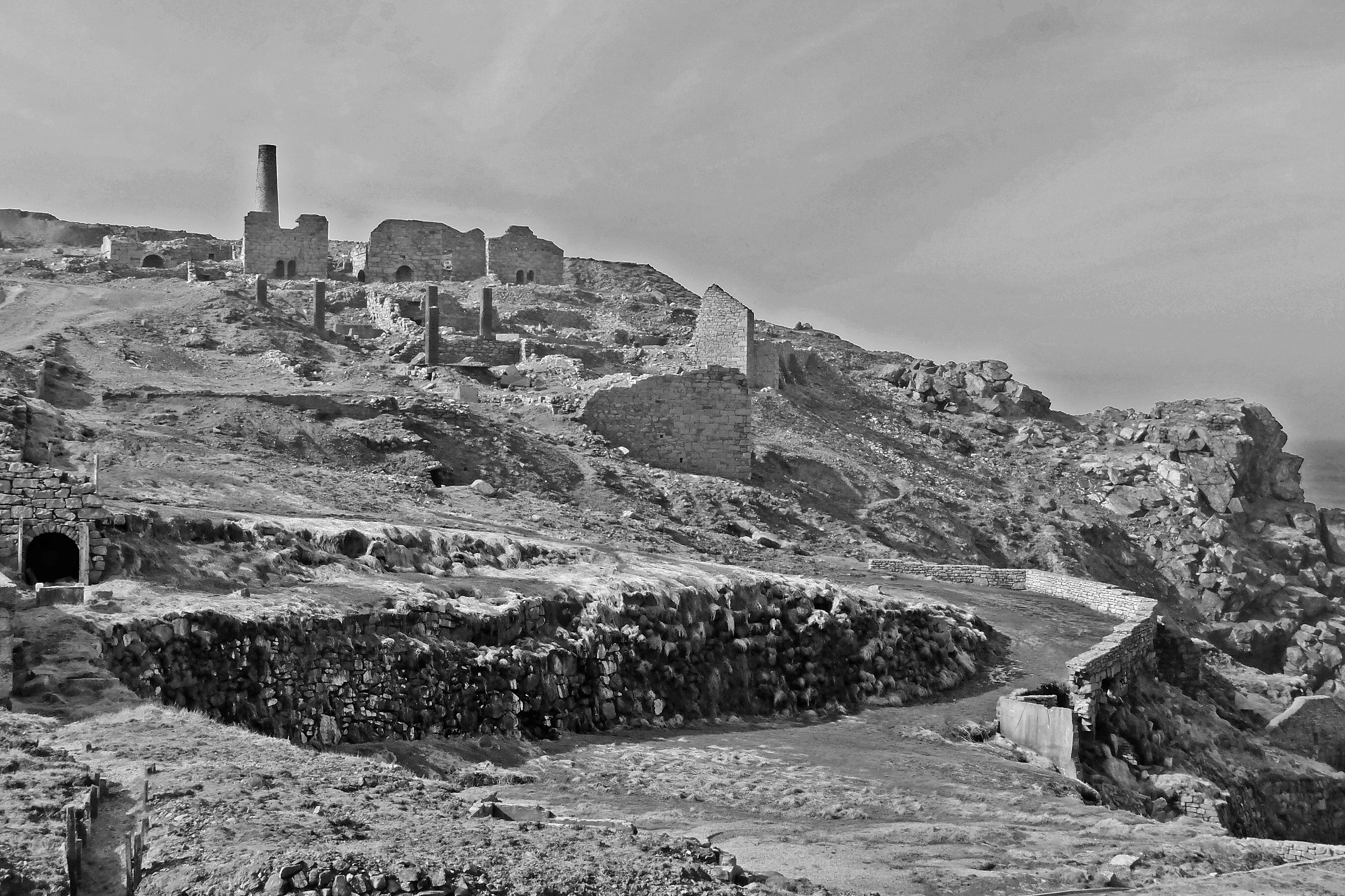
Stage 53, 21st April: Tenby to Castlemartin

Having successfully dodged the heavy rain of yesterday, I headed back to Tenby South Beach to follow the reassuring and familiar acorn sign of the Pembrokeshire Coast Path. I have no idea whether it is a coincidence that they use the same logo as the SW Coast Path or not, but either way I am beginning to find an acorn as comforting as a ragged old teddy bear.

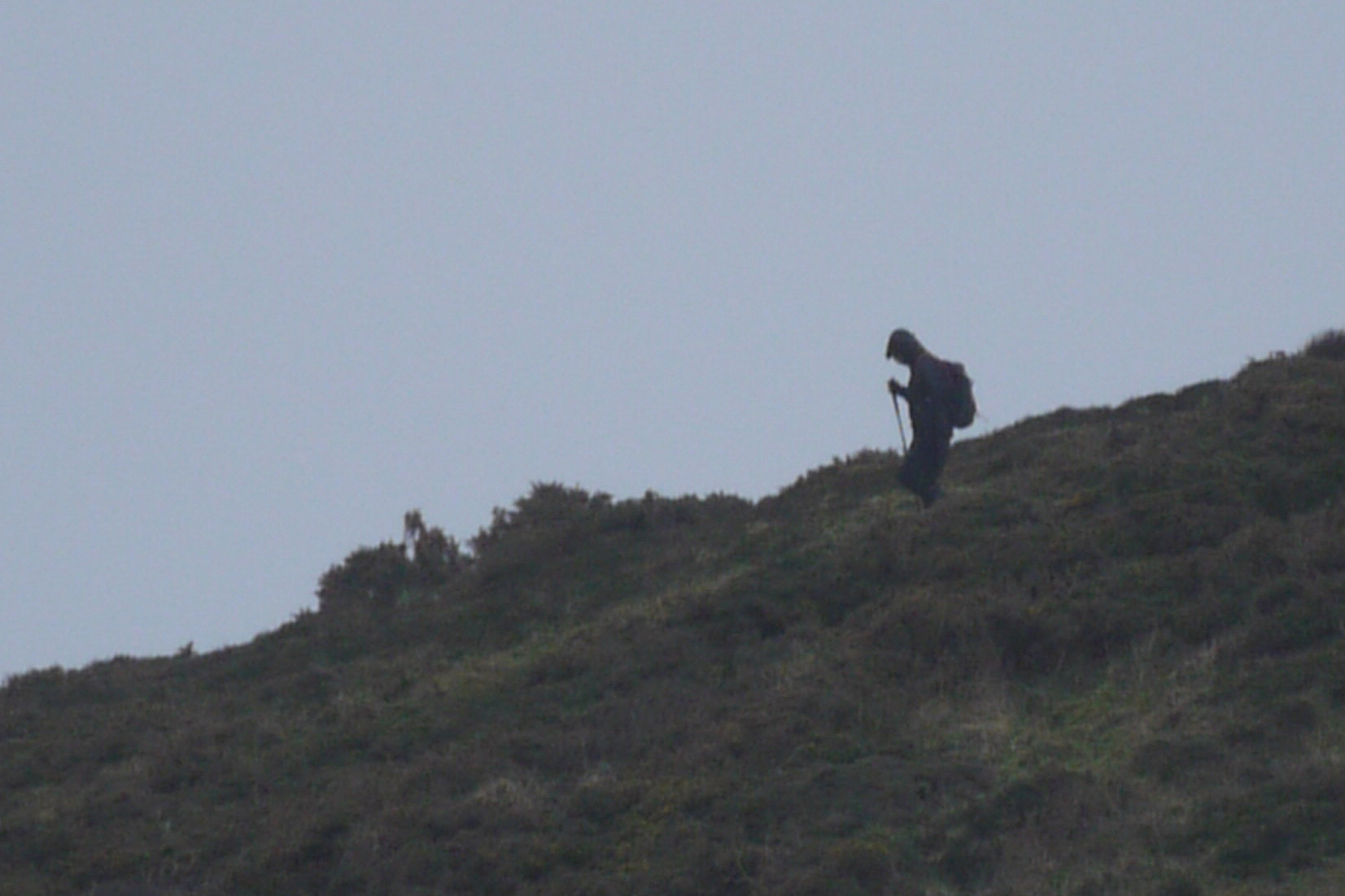
The tide at Tenby was, for me, a rare high. Most beaches I had crossed to date seemed to be when the tide was low and the water lapping around the top of the beach was something almost new to me. Once onto the path, the acorn sign wasn’t the only familiarity. The path was similar if a little more gentile than the SW path and though nothing was particularly remarkable, nothing was disappointing either. A very keen looking walker approached with a broad smile across her face indicating the now familiar recognition of a like-minded long distance walker. A good twenty minutes was spent chatting to Rebecca Morris about her walk around the Welsh coast in aid of Shelter. We compared notes about logistics, kit, difficult sections and injuries and left having swapped cards and contact details.

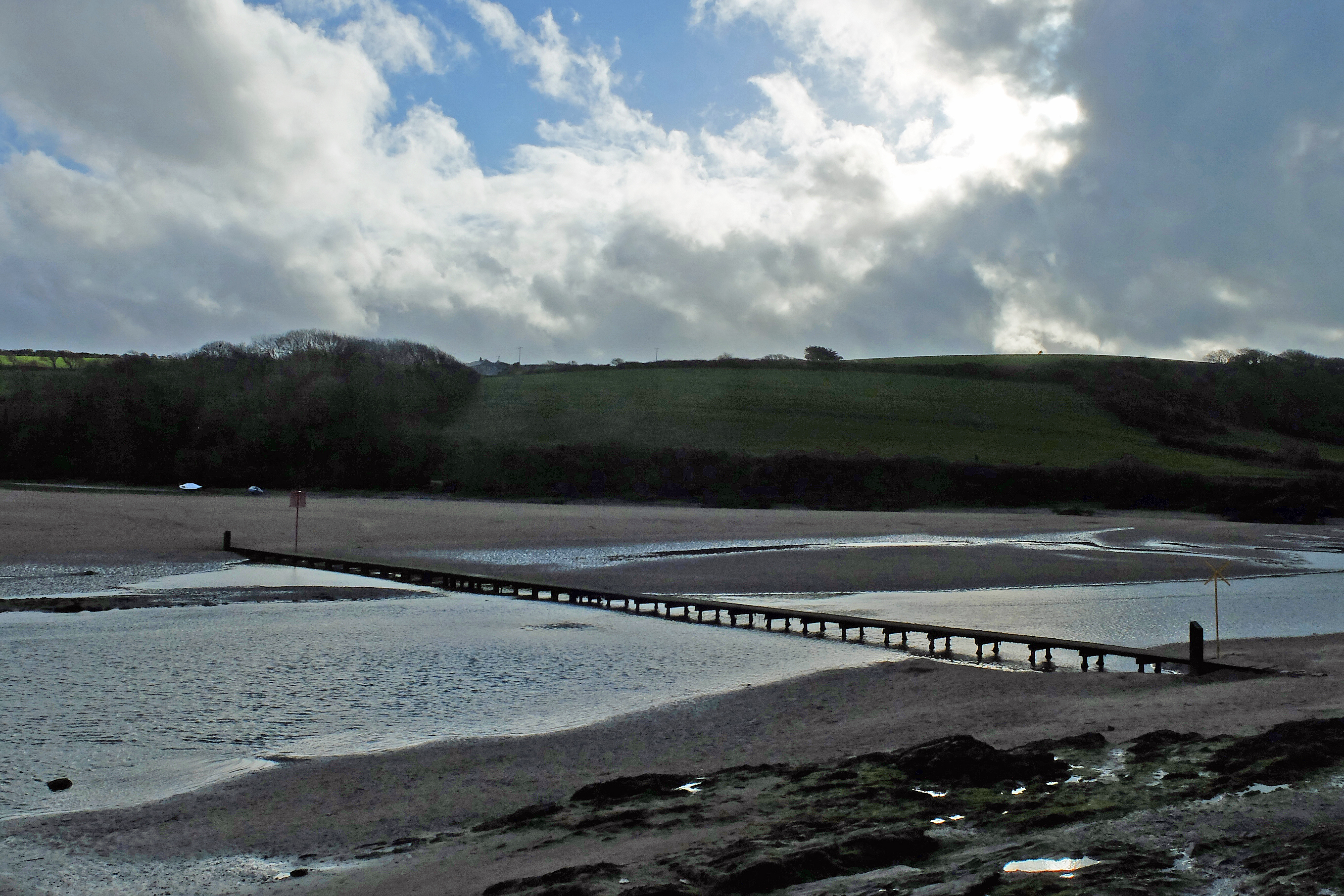
I crossed three lovely little beaches at Freshwater East, Barafundle Bay and Broad Haven and these were separated by rugged low cliffs punctuated with the occasional cave.

DSCF0893

At Broad Haven a strategically placed ice cream van meant I could change tack a little and go for a nice orange lolly as a healthy option and clearly one of my five-a-day. This was a much-needed thirst quencher in the growing warmth of the day as I walked up onto Castlemartin Ranges. The ranges consisted of one very long loose hardcore track which was just far enough inland for me not to be able to hear or see the waves. It was six miles of pretty bleak heathland edged with warning signs about certain death if I ventured off track and the eventual sight of Rob in his day-glo orange top cycling back to meet me was a very welcome sight and a stark contrast to the dull grey track which had mesmerised me since my lolly had melted onto my tongue.

Stage 54, 22nd April: Castlemartin to Pembroke

With thanks to Windmill Hill Caravan Park for another cracking freebie stopover I headed out into the drizzle and along the lane to Freshwater West. Once again the Pembrokeshire Coast Path was trying to say a full hello but as I rounded the headland out of West Pill I got my first sign of an oil tanker with tug heading inland towards Pembroke. Another headland and I got my first sign of the many jetties poking out into the deepwater haven from both sides. In the distance and to the East I caught my first proper sign of the Pembroke oil refinery and its little sister over the water at Milford Haven. Looming out of the low clouds they had a cathedral-like presence which dominated the horizon.

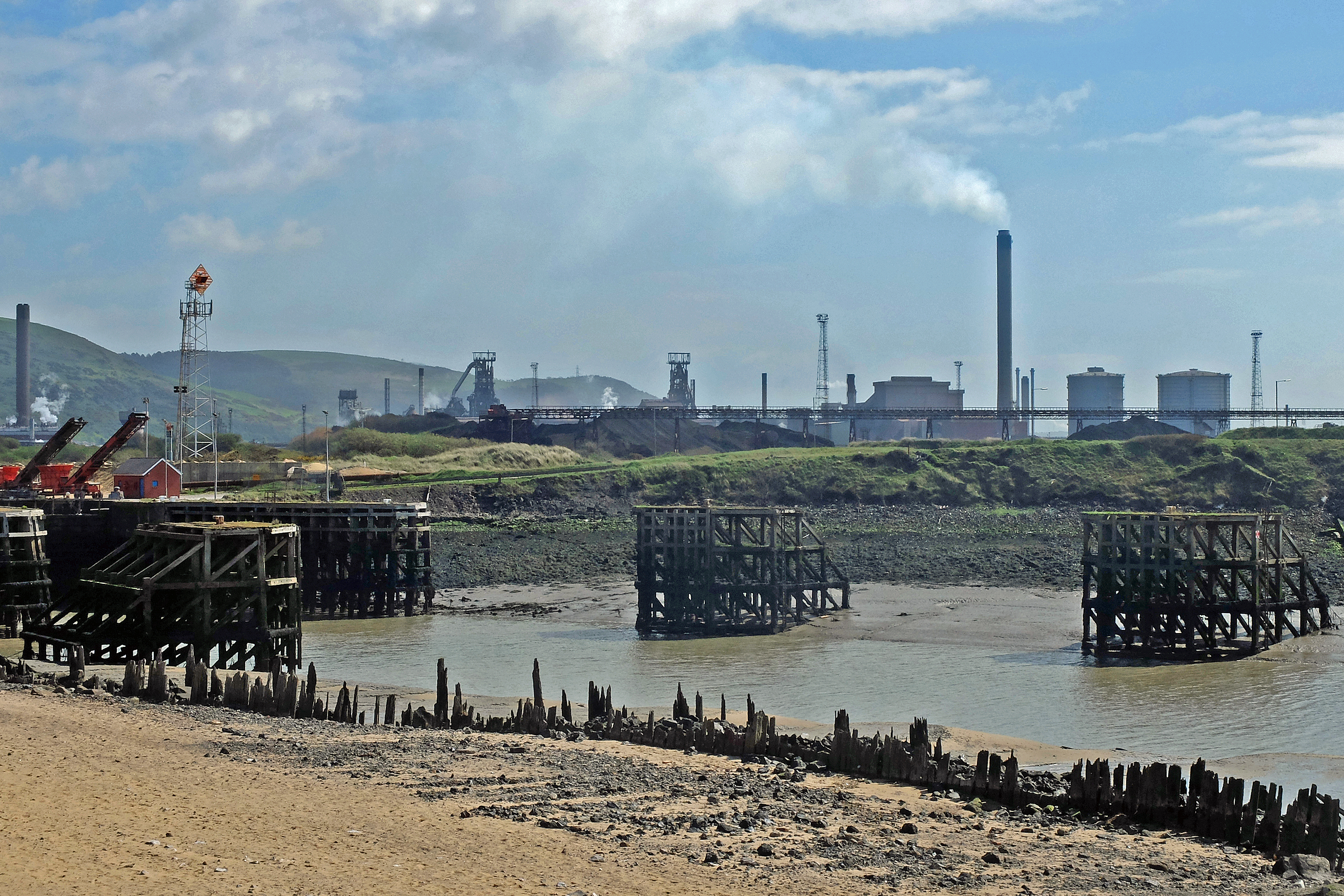
I briefly dipped into the sheltered Angle Bay and sat on a bench to eat my lunch and enjoy the serenity as the water barely lapped against the shore. The peace was only broken by my first cuckoo of the year in the woods behind the bay plus a fisherman muttering to himself as he tidied his boat across the water. However, if I turned my head ninety degrees to the right the Pembroke oil refinery loomed ever closer (photo).

DSCF0912

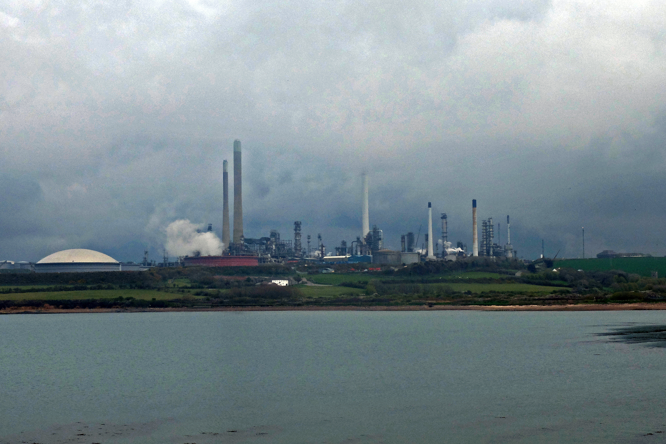
The mass sight of stacks, chimneys and storage vessels was soon supplemented by the low hum of pumps, motors and generators which became an ever-present growl as I made my way around the perimeter and dipped under the jetty where the tanker I saw arriving was already offloading its cargo. The noise was joined by a mild and very familiar petroleum distillate odour which followed me until I reached the relative quiet of the power station and beyond to the scruffy suburb of Monkton. Pembroke was a slightly quaint and welcome end to the day.

Stage 55, 23rd April: Pembroke to Dale

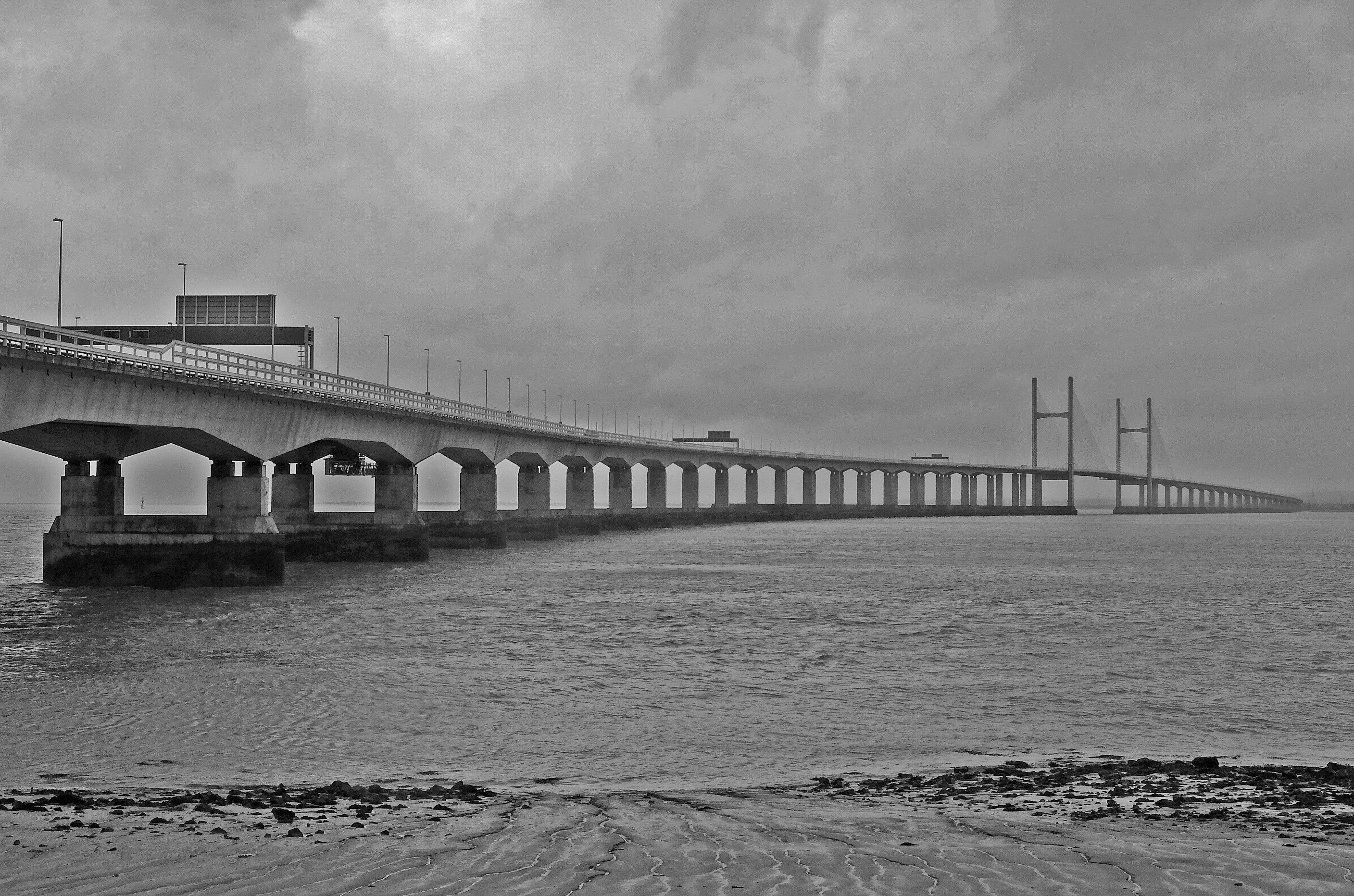
As forecast quite precisely by Kate, the heavy overnight rain stopped bang on the dot of 9 a.m. I left Pembroke for a brief muddy and deep wet grassy start towards Pembroke Dock and a crossing of the Cleddau Bridge. As I crossed the bridge the weather brightened and the sun shone like a spotlight on the multi-coloured picturesque houses of Neyland. I headed West to a slightly disappointing and slowly deteriorating Milford Haven and the third ex oil refinery now used solely as a storage terminal. It was only then that the Milford Haven oil refinery poked its head into view from its hideaway tucked a little way inland. I ducked under more jetties before the proper coast path refreshingly emerged. Now the refineries and jetties only lurked and lingered over my shoulder.

A short while later I decided that the mud and wet grass of the early morning had finally found a way of leaching into my boots and that enough was enough, I needed to stop and change into some dry socks before foot rot set in. I planted my backside on the only dry mound of grass I could find and aired my slightly aromatic toes. As they wiggled in the breeze I glanced down and caught sight of a red ant crawling over my hand. As I lazily flicked it off it dawned on my that he was not alone. A quick check and it was immediately clear that my entire crotch was a seething mass of the little sods! I jumped up and flapped at my legs like an irate and slightly deranged chicken hoping that the little nippers hadn’t found their way in. Luckily, I was just in time, they hadn’t. With a little fortune and a degree of decent haste I avoided a nip or fifty!

At Sandy Haven my map said that there was a footbridge. In truth these were stepping-stones. A further truth was that these were only accessible two and half hours either side of low-tide. Low-tide was still four and a half hours away. Hence I trudged myself up the road for a joyous four mile tarmac topped inland diversion. I had a Feast from a village shop and sulked. I got a nice full view of Milford Haven refinery, my mood was still low. Rob pulled up alongside me in Snickers, I think he got the message and drove on.

On getting back to Sandy Haven the tide was still satisfyingly too high to cross. I bumped into photographer and yet another coastal path walker, Gareth Phillips, who was doing some feature for the Guardian about walking around Wales. He sported a proper wilderness beard and a man’s rucksack indicating that he was doing things properly and not being a big softy like me by living in the comparative luxury of a motorhome. I voiced respect for his efforts, saying that I didn’t think I could carry a rucksack as big as his over such a distance at my age. He responded by saying that he didn’t think he could do 5,000 miles. I’m still not sure if I can but I’ll give it a damn good go.

Estuary days

Stage 50, 17th April: Burry Port to Carmarthen

With another estuary day in store, the sea continued to be a rare sight as I left a slightly unloved Burry Port to the now familiar thwack of golf balls on the fairways of Ashburnham Golf Club and made my way up the River Towy.

Within minutes I was into Pembrey Forest and caught up with ex Welsh Guard and dog walker, Gavin, who warned me of impending doom in terms of an impassable flooded path ahead. I brazenly dismissed it as a minor obstacle to circumnavigate and headed on my way. Over confidence bit back. The flooded path was more than a minor puddle and the ducks setting up home should have given me a clue that maybe an alternative route would have been wise. Nonetheless I attempted to get around it by disappearing into the thick undergrowth of the forest floor laden with three-foot high brambles, hidden water filled hollows and other thorny straggly bits. A machete would have been handy but I hadn’t included one in my kit list, as jungle wasn’t terrain I had planned for. My walking pole therefore doubled up duties and I spent the next forty-five minutes hacking a vague and indiscriminate trail hoping that the big haired man from ‘Deliverance’ didn’t make a show anytime soon.

Having extracted myself from the depths of the wilderness I then left the forest only to be accosted by a herd of very frisky and inquisitive bullocks. Again the stick came in handy in warding off their aromatic approach and the remaining day was spent extracting thorns from my hands and legs, relieved that the blood loss was only minor.

The afternoon was mainly one of narrow lanes, with more than the odd car cutting things a little finer than I might have liked. On reaching Ferryside I thought a Caramel Magnum was well deserved before I headed off-road, across fields, alongside a railway, through farms, down the odd drive full of sports cars and through someone’s back garden, complete with trampoline and children’s toys, for a rendezvous with Thelma and Louise in Morrisons car park in Carmarthen.

Stage 51, 18th April: Carmarthen to St Clears

Yet more estuary walking, this time the West bank of the Towy and the East bank of the Taf. Carmarthen didn’t give me a good start. Though I began the day on the outskirts of town and only needed to skirt it, the route and signposting was bizarre. Not only were the coast path signs often hidden but some were blatantly wrong. I’m sure the rivalry between supermarkets might have been partly to blame as the path which started at Morrisons was also signposted alongside Tesco, but not on my map!

I backtracked and made my way back over the dual carriageway to find the path with workmen sitting down admiring their newly installed gates. When I tried it the first gate wouldn’t open, so after instructions from the man in the digger using a gesture which I think meant “lift” but could have meant “plonker” I got through. Another hundred yards, same again and again and again. By the fifth gate I’d sussed that they had installed the gate opening mechanism completely wrong and that quality British workmanship was alive and well. I didn’t have the heart or the nerve to walk back and tell them, as I suspected the original hand gesture might have meant something a little harsher.

I continued to follow the coast path which insisted on disappearing off in strange directions to avoid road walking. I tried one particular one which was heading in completely the wrong direction and well off my planned route, so I gave up and ventured back down to walking the road verges down to Llansteffan and a Mint Feast on the sea front.

Llansteffan was a picturesque little town and having tucked into my sausage and mustard sandwiches I decided I would not follow the inland coast path and take a perfectly good path along the coast instead. I’m glad I did. The view at Wharley Point across Laugharne Sands was stunning with the swirling tidal patterns of the sand bars offshore shimmering in the bright sunlight (photo).

DSCF0863

After a few more dodgy signs and a walk through Pop Larkins’ farmyard the last joke of the day was on me as the path completely deserted me in the middle of a marsh. Soggy footed and mud spattered, I made my own way up some farm tracks and along the A40 for my end of day rendezvous in St Clears.

Stage 52, 19th April: St Clears to Tenby

Saturday would normally have been a rest day, but the logistics of my support crew meant that for this week I would take Sunday off instead. The weather continued to be bright, but the warmth of yesterday was replaced by a very chilly and bracing wind.

A slightly later start than planned due to a quick radio interview with Monica at BBC Radio Leicester (01:54 in) but at least the coast path seemed a little more thoughtfully planned as it followed the road safely tucked behind a fence which edged long lush grass fields heavy with dew. With my now clean but wet boots I headed down the River Taf to celebrate my first 1,000 miles in the middle of a flowering gorse lined field near Delacorse. I paused to take the obligatory selfie (photo) DSCF0870but felt a little disappointed that I neither had a beer nor company to share the moment. Instead I gave myself a 1,002 mile celebration with a Dairy Milk ice cream at Laugharne.

From the ruins of Laugharne Castle I took the woodland cliffside Dylan Thomas Birthday walk to pick up the road again. Much though I would have preferred to have walked down the vast expanse of Pendine Sands, the military ranges made it inaccessible from the East. So the road was my only option. At Pendine I fancied a few minutes in the grandly titled ‘Museum of Speed’, but my arrival timed with their lunchtime closure and a brief peek through the windows didn’t really urge me to hang around for reopening. Both the building and the number of visible exhibits didn’t seem to reflect the enormity Pendine had played in being the home of the land speed record for so long and I felt it warranted something a little grander.

A couple of steep climbs over Gilman and Ragwen Points then dropped me down for six miles of low-tide beach walking into Pembrokeshire and a seaward skirting of Amroth and Saundersfoot. For the first time I thought that two hours of beach walking needed livening up, so I plugged in my earphones and listened to the football commentary for the afternoon. Dean Saunders swore (mildly) as he summarised for the Cardiff v Fulham match – the BBC apologised!

I met up with Thelma & Louise North of Tenby for the last time. Flip-flop clad, they accompanied me for the last couple of miles into the very pretty but very overcrowded Tenby for a well-earned stop at Penally Court Farm who offered us a lovely free pitch for the bank holiday weekend.

A little bit of everything

Rest Day, 12th April: Porthcawl

Total Distance – 868m Ascent – 156,900ft

Just as it should be, it was a fairly quiet support crew change and rest day as I shipped Clive with my sincere thanks to Bridgend for his bus back to Northampton and stocked up on a supermarket cooked breakfast and supplies before heading back to the Porthcawl campsite to await old school and university pal Mags, her best friend Tracy and their little blue car ‘Snugs’. With three people ensconced into Snickers and a full onboard briefing completed – including probably unnecessary instructions on how to use the onboard loo – the evening was spent catching up on 25 years worth of news and gossip.

Stage 46, 13th April: Porthcawl to Swansea

Yet more bright and sunny weather welcomed the morning as I skirted the expensive and exclusive links of Royal Porthcawl Golf Club, which seemed unusually devoid of golfers. The plush greens and fairways quickly became dunes and gradually morphed into scrub and rough hinterland as I ducked inland to dodge the steel and gas works of Margam and Port Talbot (photo). Margam could not be called a pretty place. The back-to-back terraced houses were not in the best of condition with their own back alleys coloured with graffiti and dotted with the odd discarded armchair and car part. Appearances can often be deceptive and indeed they were as everyone I passed greeted me with a friendly tone despite my very alien walking attire.

DSCF0795

Along one of these back streets a ten strong group of similarly attired men and women spun around the corner in front of me and approached with broad smiles looking a little relieved not to be the only aliens in town. A quick chat revealed their walking plans and my project and within a minute I’d become a z-list celebrity as they snapped a few shots with me as the less than photogenic main attraction.

Port Talbot held little promise but actually delivered a nice little surprise in the form of Aberavon Sands but I was barely across them before I headed inland again to cross the river above the M4 at Shelone. It was on this path that I met up with Andrea and Julie who were clearly on a mission. A similar mission to mine so it seems as they too are walking the entire coastline of Great Britain. A good ole chat ensued as if it were a meeting of old friends and we exchanged website details before bidding farewell and bon voyage. www.coastwalks.blogspot.com

Back down at the coast I met up with Mags and Tracy who were hiding behind their dark sunglasses excitedly people watching a large and growing group of revellers sitting outside the bar opposite their hot chocolate serving cafe. They accompanied me down the beach for the last couple of miles and treated me to a very welcome free room at the local Ibis hotel (thanks Swansea Ibis!!!).

Stage 47, 14th April: Swansea to Port Eyenon

Having finally remembered to put on my boots, Thelma and Louise – as they now like to be known – shuttled me, for a second time, back to my start point. I spent the first hour dangerously casting an eye over my shoulder on the look out for MAMILs creeping up on me on the cycle paths of The Mumbles.

With yet more fine weather a proper coast path with the odd small but steep climb was a welcome change. The bays became increasingly picturesque with the perfectly aligned green and white-painted beach huts presenting an ordered Edwardian frontage adorned with planted palm trees.

The excess of breakfast bacon caught up on me and I just had to indulge myself with a Fruit Pastille iced lolly to satisfy my thirst.

At Three Cliffs Bay I discovered my favourite Welsh beach so far. Pobbles Beach has a name straight out of childrens television series and was just as idyllic with sharp cliffs enclosing neat and even rose-tinted golden sands. A further long walk across the tops of water-filled ripple marks in Oxwich Bay took me ever closer to the ice cream hut oasis at the far end of the beach. My bacon created thirst still needed quenching, so a Mr Whippy cone was supplemented with a bottle of lemonade.

From here it was even pathed and flat all the way to Port Eyenon where a final beach stroll took me to meet with Thelma and Louise for a rather greedy third ice cream of the day (mint choc chip) and a grand and very welcome gratis stop at a camp site overlooking the sea. It would be very remiss of me not to thank Jo Hill at Carreglwyd for her hospitality.

Stage 48, 15th April: Port Eyenon to Llanrhidian

Oh come on….another sunny day in Wales. I’m beginning to feel guilty not to have worn my waterproofs for almost a week.

Today I felt very much like I was an all terrain vehicle or 4×4. It had a bit of everything with winding cliff paths, tourist trail tracks, sandy beach, dunes, salt marshes, green lush fields, muddy farm tracks and a teensy weensy bit of tarmac thrown in.

The Gower is somewhere I’d like to revisit as I felt as if too much scenery went by far too quickly and not enough soaked in. I know I missed out on caves, ship wrecks, nature reserves and castles, but if I’d stopped to see everything I’d be on this walk for two years.

Approaching Rhossili I was met by hoards of midday visitors making their way to inspect the exceptional view towards Inner Head from Kitchen Corner. My mum had forewarned me of the beauty of Rhossili Bay (photo) and I was not disappointed. It was a stunning and very long expanse of nigh on perfect sand. But, for me, it was crowned by the tiny hidden beach at the far West end of the bay at Cat Hole which matched Pobbles Beach for sheer beauty but wins on my part because of its remoteness.

DSCF0819

Heading East the beaches became dunes before I began what would become a long circuit around the mud flats and salt marshes squeezed between the North side of The Gower and the mainland. I finally crossed the deep grassy fields and approached Llanrhidian to find Thelma and Louise hiding around the back of a closed pub sunning their wintered legs and waiting to fill an empty glass. It seems as if their day had held more than a modicum of entertainment. In searching for a stopover they had met fearsome Elizabeth, a man with bizarre hair who reminded them of a character from the movie ‘Deliverance’ and conducted a battle between Snickers and a VERY wide load (photo). But they had successfully negotiated another great stopover and for that I must thank all at Kennoxstone Farm.

DSCF0811

Stage 49, 16th April: Llanrhidian to Burry Port

After yesterday’s variety, today promised little. Unfortunately, it delivered. A flat traipse alongside salt marshes and mud flats gave way to miles of tarmac. The Wales Coast Path tries to avoid the stuff, but unfortunately I’ve seen too much of it already so I tried to soften the demands on my feet and keep them cool on – yes another – sunny day, by walking along the dog-poo laden verge.

Eventually I crossed the estuary to face neat housing estates dressed in my hiking finery and once again standing out like a sore, no broken, thumb.

As I approached the National Wetlands Centre for Wales I parked myself at a bench to eat my pork pie and marmite sandwiches and had a grand chat about Bass fishing with an old gent in his chest-waders as he set up his fishing kit for an afternoon on the mud flats. From here it became a long less than thrilling walk along the cycle path around The Millenium Coastal Park with its broad coloured tarmac and lottery funded bridges.

A meet up with Thelma and Louise brought the best bit of the day as I finally had a small expanse of sand to walk across and a 99 cone as just reward for a pretty dull day.

Sunny South Wales!

Stage 44, 10th April: Penarth to Llantwit Major

After a very civilised overnight stop with full use of the facilities at Penarth Marina, including a comfy lounge and laundry, the weather was pleasantly unchanged and to help my mood the scenery became a little more interesting too. With suburban Penarth Streets to start I enjoyed a brief foray onto the low rolling cliffs around Lavernock Point, only having to dodge inland to skip around the odd caravan park or three.

From Sully I hit roads again and had to grind inland to circumnavigate the chemical works of Barry. More busy suburban streets greeted me and continued at length until I dropped back down to Barry Docks which looked as if much of the area was being prepared for major development works. Barry seemed to drag on a smidge, but really it was the tarmac that dragged on.

At last I escaped up over the cliff close to Cardiff Airport (Cardiff? It’s not even close!). It was low cliff walking with the path edging the seaward side of old quarries sandwiched between Rhoose village and the sea. A concrete path and sea wall around Aberthaw Power Station spoilt things a bit, as did the thin but ever-present orange smoke slick oozing its way east away from the single large stack. It was a genuine relief to reach the rape seed fields and enjoy a very bright Welsh afternoon ramble over to the edge of Llantwit Major and a rendezvous with Clive at the hidden little cove of Cwm Colhuw.

DSCF0761

Stage 45, 11th April: LLantwit Major to Porthcawl

A third bright sunny day made me ponder on one of Rhod Gilbert’s rants about not knowing that he was allowed out in anything other than a cagoule until he was aged fourteen. The weather was so good that it even tempted me to give my blue / grey legs an airing and change into shorts.

A proper coastal walk over cliff tops, crossing valleys and beaches was a real pleasure and a gentler mini-reminder of the South West Path and my days ascending Little and Great Hangman, both of which I could still see across the other side of the Bristol Channel. I was expecting a three-mile inland estuary walk at Ogmore-by-Sea. When I arrived, the tide was out and the river just begged a wade. So, with boots and socks off I duly waded across an ice-cold shallow fan of a river lined with pebbles and stones behaving like a big girls blouse wincing, eeking and ooing with every step.

DSCF0775

A walk across the sand of Traeth yr Afon followed and took me into Newton and Porthcawl which was crawling with visitors and seaside trinket shops knocking off their winter dust and opening up their tills. I ventured to wrapping my tongue around a blackcurrent ripple cone and attempted to get some cash from a cash machine. With the bright sunlight the ATM screen was nigh on illegible and…. after accepting, in error, Welsh as my language of choice I guessed which button I needed to press to get myself a few notes to line my pocket.  Having picked the shortest word on the basis that ‘cash’ in Welsh surely doesn’t have too many Ls in it – my logic worked and my card wasn’t retained for being a complete imbecile.

I met up with Clive in a popular surfer dudes car park next to Royal Porthcawl Gold Club and headed back for a fish supper in town and to nurse my now flamingo coloured legs. I might have slapped the sun cream on my arms, neck, ears and face, but guess which prat forget to do his legs!

Gerroff my land!!!

Rest Day, 5th April: Brean

With a pile of washing dripping from every hanging point in the van, Mike disappeared with daughter Claire and my repeated thanks for the comforts of his home. A brief respite and I headed off to squeeze Snickers into the Tesco car park and pick up my next support driver, Clive, from Weston-super-mare. Clive isn’t someone I have met more than a couple of times in my life but, for me, a big part of this entire trip is getting to know and re-acquaint myself with family and friends both old and new. I’m sure Clive won’t mind me describing him as a morris dancing, real ale enthusiast and ex HSE inspector who is clearly as mad as a box of frogs in volunteering to drive for me, a relative stranger and vague acquaintance. It’s great!

Stage 40, 6th April: Brean to Clevedon

An overcast day with light showers awaited, as did a closed crossing of the fens – thanks to the Environment Agency plus a few large chains and a couple of padlocks. Hence I started the day with a three-mile road detour. However the road detour proved to be one of my highlights to date as I saw a long black tail slink down into the ditch alongside the road. As I approached I heard a very distinctive squeak coming from below me and as I walked on by a juvenile otter crept up out of the ditch and came towards me to within a few feet. I considered bending down to coax it like a puppy, but remembered that otters carry a sharp set of teeth, so thought better of it and gave it a little bit of room. By the time I had thought to dig out my camera it had skulked back into the ditch and sat there looking up at me, squeaking plaintively whilst refusing to make a hasty exit. Its behaviour wasn’t what I expected of an otter as I have come across them a few times on the Scottish West coast, but they are my favourite creature on the planet and even the hardest soul on earth must admit that they are more than a little bit cute.

After that, the holiday towns of Weston and Kewstoke didn’t hold much interest to me and though the walking was flat it wasn’t easy navigating my way through or even around the maze of ditches and drains of the Somerset levels. So much so that after Wick I might have….errrr….committed an act of semi-deliberate trespass. In my defence, the gate was open. OK, so my digital Ordnance Survey map didn’t confirm that the track was legitimately accessible, but it was the only available crossing of a particularly nasty drain that would have required a five-mile detour if I didn’t use it. Just as I made my way across the ditch I peered slightly guiltily over my shoulder to see a tractor approaching at speed. I was within ten yards of the road as he caught up with me for the “gerroff my land” discussion, so I pleaded ignorance and he let me off on the basis that I was only walking one way so wouldn’t have seen the big sign he had posted, which I would only see as I turned around on reaching the road (photo). Why didn’t they buy a sign for the other end of the track apart from the ‘Private’ one I might have….errrr….ignored.DSCF0697

Ten minutes later whilst I was still celebrating my sneaky little victory, my GPS battery decided to warn me that it was about to give up. I took two minutes to quickly note my remaining route to Clevedon by memorising a sequence of lefts, rights, wiggles, turns and u-turns which seemed to work well as I arrived in the upmarket town and managed to squeeze in a quick Mint Feast before finding Clive, rather luckily I suspect, without a hitch.

Stage 41, 7th April: Clevedon to Mathern

Showers and a muddy coast path greeted me in the morning as I headed through the scrubby woodland around the low cliffs of Portishead. Huge houses lined the cliff above Portbury Wharf whilst the wharf itself was now a new development of expensive waterside (mud-flat side) apartments.

I headed inland around more flat lands, big industrial units and up on to the Avonmouth Bridge for a couple of miles in the company of roaring traffic on the M5. This was followed by the pleasures of Avonmouth. I couldn’t find anywhere even remotely decent to sit down and have a bite, so I ate on the fly as I marched the pathway alongside the A403. The A403 is lined with scruffy roughty toughty industry and frequented by truck after truck – horrible.

I was relieved to find the Severn Valley Way and cross under the ‘New’ Severn Bridge (photo), squelch through more very muddy flats in a hail shower and up to the ‘Old’ Severn Road Bridge, my crossing point. Here I briefly met up with my eldest brother Steve and his wife Anita who accompanied me halfway across the bridge in chilling winds with added spits of rain. Steve is future support crew and his week will be welcome, but it was lovely to see them and have a quick catch up with family news.

DSCF0715

Wales and the Wales Coast Path! Another target achieved.

Stage 42, 8th April: Mathern to Nash

Kate’s forecast told me to expect a bright day, occasional showers and a brisk cool wind in my face. Bang on…..thanks again! It was a muddy start down from the village to cross the railway, join the sea wall and cross back under the other side of the ‘New’ Severn Bridge which was smugly and satisfyingly jammed East bound. Along, over and back over the M4, around a small firing range and with yesterdays experiences of trucks in Avonmouth, I found the noisy traffic almost insulting to my wind and wave trained ears. A brief chat with a lovely man and MS sufferer walking his extremely patient labrador was undoubtedly the highlight of my day and our conversation cheered me immensely.

Back onto the sea wall, lined with storm detritus on the seaward side. It was topped with soft short grass and clad with a carpet of flowering daisies but everything else was pretty much featureless. I passed the time looking over to the other side of the channel identifying the places I’d passed through over the last few days. I met up with Clive shortly after lunch and he walked with me around the Newport Wetlands edged with expensively built wooden bird-watching hides. Onto the headland at the mouth of the river Usk we shared a resigned groan and jointly questioned the parentage of flytippers who had carefully dumped their spoils in strategic heaps along the pathway. A grim sight even amid the pylons and wires radiating away from the nearby power station. Nash and the car park (and bar) of The Waterloo Inn awaited. Both were welcome.

Stage 43, 9th April: Nash to Penarth

It was a bright white puffy cloud day with a chilly wind to mask the burning power of the sun, even this early in the year.  I made my way up the river Usk skirting tatty industry units with litter strewn along fences out of sight of their main business and reception areas. The path was similarly littered with the added mix of recent storm debris. It was all a bit grim and rather depressing.

On the other hand the Newport Transporter Bridge (photo) was uplifting in more ways than one. Having declined the offer to walk over the top of the bridge span I waited for the gondola to slide across the river and read up on transporter bridges. This particular one is one of only two operating in the UK and is part of a measly world-wide total of eighteen ever built. I will hopefully use the other working UK one in Middlesbrough later this year. One small one in Warrington doesn’t work and is awaiting refurbishment.

DSCF0739

Once on the gondola to cross the river I chatted with local lad and bridge employee Tom who filled me in on a little more history, the charity status of the operation and a little bit of technical information about the original engines pulling us across. Tom was a very likeable lad who had a great deal of pride in the old bridge. After the brief voyage we wished each other well with a good firm handshake and I disappeared into the streets of Newport.

Down and back to the coast from Newport I passed Duffryn High School where the smokers gathered in the road and a few lads idly kicked a football down the pavement. Not much else seemed to be happening – things were just drifting along in their quiet unassuming way as I equally drifted back down for another few hours of featureless sea-wall walking. It was dull, very dull. I tried to just lose myself in my thoughts and setting the occasional bush as a sighting target, but it was still tedious.

At last I headed back inland towards Cardiff and the sea wall was disappointingly replaced by traffic laden roads. Finally the roads emptied and edged their way around to Cardiff Bay which has clearly seen enormous investment over the past decade or so. The waterfront was not only plush but also bustling with foreign tourists, including one rather strange-looking Englishman sporting a pair of very muddy boots and trousers, a small rucksack, a trekking pole and a sunburnt Swan Vesta like forehead….miles from anywhere muddy.


Flat relief

Stage 38, 3rd April: Minehead to Combwich

With easy walking expected today, it was a pleasant surprise that it was exactly what was delivered. The short promenade of Minehead was dominated by the big tops and chalets of Butlins. Everything resembled a travelling circus and to me was all a little bit tatty and tacky. It was a relief to get out-of-town and head across to Blue Anchor where half a dozen anglers were dangling their rods from the roadside chasing cod, whiting and anything else with fins. I did think their efforts were a little half-hearted as they stood idly chatting all dressed up in their heavy winter gear with their car doors open and copious amounts of hot coffee and comfortable warm shelter inches from their rods. I love fishing, particularly fishing from wave-lashed rocks, so the thought of fishing from the comfort of a car just isn’t on my radar.

At the north end of the bay I found the pathway blocked by temporary fencing and with the ammonite symbol of the West Somerset Coast Path absent, I invented my own diversion via a slippery track, some overgrown woods and a muddy field or two.

Watchet was another run down and slightly sad place that needed a little bit of love and pride reinstalled. I couldn’t decide whether it had any identity or notable attraction to encourage visitors or investors, so I suspect it will just continue to remain an obscure seaside village with potential.

With the path vanishing again I resorted to head along the verge of the busy A39 watching every approaching vehicle closely and ducking into the hedges to avoid the occasional truck cutting things a little too fine. More by luck than judgement, I finally rediscovered the ammonite logo near West Quantoxhead. I thoroughly enjoyed the vista as I spent a few minutes to munch some lunch whilst sitting on Doug’s bench overlooking a valley surrounded by rolling green hills and filled with a couple of grand mansions, a very English church and a herd of deer peacefully grazing in a lush field. Thanks Doug.

After a brief fossil hunting break on the foreshore at East Quantoxhead I was looking forward to having a nose around the nuclear power station at Hinkley Point. However, I was thwarted by another fenced off path and a ridiculous diversion pushing me miles inland and not even vaguely close to the place. The notice on the fence told me that the path was diverted for 6 months from May 2012 for Hinkley Point C development work, but with 2014 well under way I could see little sign of any work and the signs looked a little more permanent to me. Rain was now blowing in sideways, so I resorted to five miles of grim streaming wet roads into Combwich with a note that staff at EDF Energy clearly knock off at 4:30. The Le Mans start I heard as hundreds of cars splashed away from the plant actually made me worry whether they were all running for their lives to escape a radiation leak.

Stage 39, 4th April: Combwich to Brean

I knew that the stretch around Bridgwater Bay required another venture inland, this time via the River Parrett Trail. Yesterday the West Somerset Coast Path was given a grand introduction and offered exciting potential as it took over from the SW Coast Path. In truth it was poorly signposted, occasionally vanished mysteriously and then petered out near Hinkley never to be found again.

I had a long wet grassy stroll across the dyke tops surrounding some of the recently flooded Somerset fields which seemed to be recovering if still very soggy. The song of the ever-present but never visible Skylark followed me all the way up the winding south bank of the river to Bridgwater where a stretch of busy road out-of-town took me back to the same scene 50 yards across river on the north bank. I cut inland to walk the lanes through Stretcholt and Huntspill. Spring was very much on the agenda as the air felt warm and still. Hedges and trees were beginning to show green sprigs of life and the Skylark’s high twitter was replaced by the birdsong of many indistinguishable feathered pals.

The lanes became a nondescript urban road into Highbridge and then a path through a housing estate took me towards Burnham on Sea. Mums and toddlers were out in force in the afternoon warmth. The sound of idle gossip and children playing was a pleasant but very different sound to my ears.

With the stick of another Feast in my hand (well – they are cheap), I made my way onto the sand of Burnham on Sea (photo) and got up a really good stride over the ripple mark tops along the six miles of beach above Berrow Flats. It was a long haul with the tide exposing sand banks a good mile out. Ahead I could clearly make out Cardiff Bay, to my left Hinkley Point was easier to see than it was yesterday. Minehead and the end of the SW Coast Path was still visible and all my thoughts were good ones as I reflected on what I’d done so far and what was yet to come.

DSCF0676TOTAL DISTANCE: 742.4 miles  TOTAL ASCENT: 150,090 ft


The end of the beginning?

Stage 34, 30th March: Westward Ho! to Chivenor

A warm, sunny day greeted me with barely a breeze and walking was easy as I rounded the headland via the golf course only stopping out of etiquette for the golfers teeing off. I found myself rarely striding at full pace and both Appledore and Bideford seemed to fly by.

Mike met up with me on his bike in Bideford and kept me company all the way back up the estuary to Instow with full details of Hamilton’s win in the Malaysian Grand Prix earlier that morning. After lunch and a quick change into shorts at Instow, Graham turned up to accompany me for a few miles of a wheelchair accessible section of the Tarka Trail down to Fremlington. It was four of us in all who took to the trail. Mike on his bike, Graham in his chair, Pippa the sprollie dog and me. It was grand to have some company and it felt comfortably familiar to have a dog on the end of a lead, even if it was on my least favourite tarmac surface.

At Fremlington the usual eclectic mix of Sunday afternoon families were out enjoying the sun and Graham’s new p.a. Rilwan met up with us to join the ice cream queue for well-earned cones all round – just vanilla for me.

Skirting Barnstaple I was on my own again and knocking out quick miles walking in the soft grass alongside the path to ease the ever-present pain in the toes of my right foot. I passed a homeless man without shoes trudging wearily up the path towards Chivenor, we exchanged a few jovial words and I would have happily given up my boots if his feet weren’t two sizes bigger than mine. He seemed untroubled by his lack of shoes and I stopped complaining about the pain in my foot which had been niggling away at me since Dorset.

After a quick shower Graham took us all back to Barnstaple for a quick photo at the local hospital for a future SIA periodical. A trip out deep into Exmoor brought a pub meal at a remote inn which could have doubled for The Slaughtered Lamb from American Werewolf in London, though the conversation didn’t fall silent and the darts didn’t stop in mid-air as we entered. A welcome evening of easy conversation ensued, though as ever an early night was welcome.

Stage 35, 31st March: Chivenor to Ilfracombe

An early start, I was out walking by 8:15 for my optional 25 miles to Ilfracombe. Down the estuary, I passed the Marines barracks and the RAF Air Sea Rescue base. I childishly stood for a few minutes and watched with fingers through the weld-mesh fence as the Sea King helicopter took off on a training sortie.

Further out into the estuary the terrain changed to marsh and then scrub and dunes used as a military training area. It was all pretty flat and not overly inspiring on a grey day. My interest and the scenery dramatically improved once I had rounded Croyde and Baggy Point.

A long walk across more than two miles of Woolacombe Sand made me feel a little like Lawrence of Arabia in his opening scene as I gradually approached Snickers and Mike for a quick rendezvous above the dunes backing the beach. My plan was to originally walk to Morte Point, but I felt that was not enough. With two days of serious ascent to come I wanted to give myself a headstart tomorrow so I elected to walk the extra five miles to Ilfracombe and confirmed the end of day rendezvous with Mike before heading off again.

Rounding Morte Point I was expecting rain. I watched rain ahead of me, behind me and to my left but nothing seemed to be on me. A bright flash and a nigh on instantaneous clap of thunder overhead changed everything. Having regained control of my heartbeat, I quickly stowed my trekking pole as I didn’t think a steel pole and high voltage electricity were a good mix. I also made a very quick change into waterproofs.

I had a damp climb or two and the second one felt particularly long before I finally dropped into an Ilfracombe that was running with water. I dropped so fast, I’m sure my ears popped.

Stage 36, 1st April: Ilfracombe to Lynton

Patchy banks of mist rolled off the moors and into the sea as I left Ilfracombe. In celebration of the arrival of April the ‘Verity’ statue by Damien Hirst which stands proudly at the harbour entrance had gained a pair of stripey socks overnight (photo). Whatever one might think of Mr Hurst’s controversial, but undoubtedly clever artwork, the socks did it proud.

DSCF0641

As with many settlements on this part of the Devon coast, from the west Ilfracombe is invisible. Yet from the east it is very picturesque and tucks in neatly into the cliffs. I was glad that I had done the extra mileage yesterday as the first few miles today were tough with lots of ups and downs. I hadn’t slept well for worrying about home, so I felt a bit leaden footed.

Watermouth was cast with an eerie bank of mist as I approached but as I walked on by it melted away to reveal a pretty inlet dotted with a miscellany of moored boats idling in shelter out of season.

Combe Martin marks the start of the Exmoor National Park and I climb steeply out of the town over Little Hangman and up onto Great Hangman (the highest point on the SW Coast Path). Atop Great Hangman I am joined for lunch by Jill, and her collie Misty from the Yorkshire Dales. Misty shares my lunch as Jill and I look over to Wales trying to identify distant landmarks.

Walking very high over the cliff tops with two steep stream lined valleys to cross, this part of the coast is one of my favourites to date. The path narrows and winds, hugging the cliff face before turning tightly around pinnacled headlands to dip inland through gorse tunnels and skirt waterfalls cleaving into tight sheltered inlets. It would have made a great Lord of the Rings scene and I felt that the movie makers missed a few tricks by not looking a little harder for filming locations in the UK.

Stage 37, 2nd April: Lynton to Minehead

I started the day sporting my full waterproofs expecting a morning of rain. I climbed out of Lynton up Butter Hill and after a quick downpour, I trusted my judgement that the sky was brightening enough to remove the clammy extra layer. This was probably the most interesting part of my day.

After Butter Hill I entered mile upon mile of pre-spring woodland perched high up on the cliffs with barely a sight of the sea. It was becoming dull, dull, dull. Ducking inland now and then to cross the odd stream, dull, dull dull.

Deep in the woods, I met up with Mike Davis who had just started his SW Coast Path walk and was sporting a much bigger pack than me. He too is doing his walk for charity and his just giving site can be found here www.justgiving.com/630MileYomp Which neatly reminds me that I need to start getting a bit more active on the fundraising now that I have nearly completed the SW Coast Path. Donations have passed the £1,000 mark with little effort from me but I now know that every donation is also proving to be quite significant to me in terms of personal motivation. So if anyone reading this wants to help motivate me, you know what to do.

After meeting Mike, I also met an Aussie girl who had also just started the SW Coast Path, having taken a year out to travel the UK. She reminded me of my daughter and was probably of a similar age (18 or 19). On her own, I thought of her vulnerability and how I would worry if my daughter was doing the same thing. But with the people I had met so far, she’s more than safe and is at far worse danger crossing a road in London.

I think I was spoilt yesterday because after the woods I dropped into Porlock Weir for a walk around marshes on a grey day….hmmm thrilling. A steep climb up Bossington Hill followed but the grassy slope wasn’t a patch on yesterday’s cliff huggers and the path across the barren heathland at the top was….errr dull. At this point my left foot started to hurt, mirroring the pain in my right foot which has been nagging at me since February. Also the acorn signs I had been so diligently following seemed much less clear in Somerset than in Devon and I found myself heading significantly off track. I threw a tantrum, swore out loud….a lot, angrily bounced my trekking stick down the track and sat down on the heather to grumble and adjust my boots. The man walking his dog behind me hesitated before walking past reassuringly trying to tell me that he often has days like that. Though a tad embarrassed, he cheered me up.

Minehead – da daaaaaa! And South West Coast Path – DONE!

DSCF0666

An end to a beginning maybe?

If I may be allowed to be a grumpy old git for a moment. Can I offer a quick criticism of the SW Coast Path signs. Please, please put them up in the correct order! It is thoroughly confusing and demotivating to come across a sign to Exemouth saying 3 miles only to be followed by the next sign saying it is 4 miles and the next saying it is 3.5 – I learnt to only use the distance information as very approximate rough guides after a while as it happened on many occasions….doh!

CUMULATIVE MILES / ASCENT:  694 Miles / 146,800 Feet

Ups and downs

Stage 31, 26th March: Boscastle to Bude

A bright puffy cloud day with a biting but light easterly greeted me on the path out of Boscastle harbour. From the start it was all up and down with some really juicy steep climbs. Progress was slow.

I was back in my world of field trip history and the walk around to Crackington Haven evoked memories of staying as an A Level student in the little, slightly run-down hotel on the sea front. It was still there, but I didn’t venture inside to see if things had changed at all as I didn’t really want to update my memory. Both Cambeak and Millook Haven displayed spectacular Hercynian orogenic folding in the rocks and though that might mean naff all to most people, the chevron patterns in the cliffs can’t do anything other than make you marvel at the power of nature (photo).

DSCF0571

Dizard Point offered me the pleasure of a particularly steep climb and at the top I met to share a bench with another SW coast path walker who warned me to expect that tomorrow would be the toughest section of the entire path – hmm cheers pal! I responded by telling him to expect some really steep stuff too.

A bench at the top of the next hill told me that Poole was 500 miles away and that Minehead was a mere 132 miles – yeah, I thought, about right.

The last 4 miles were fairly flat, featureless and easy around Widemouth Bay and I was a little disappointed that the beach wasn’t quite up the standard of others I had really enjoyed through Cornwall. Nevertheless I took a fairly easy if rather exhausted stroll into Bude.

Stage 32, 27th March: Bude to Hartland Point

So – reportedly the hardest part of the SW coast path awaited. The biting cold easterly wind coming off the moors was still nipping at my nose but once we had got a very welcome tow off our slippery but excellent pitch (with thanks to Kevin, Cornish Coasts Camping Park, Poundstock) I was happy to get cracking.

Yesterdays warning was to expect ten steep valleys to cross, one after an another. I counted nine before I was able to get any decent stride on. I then got another four increasingly steep ones and another token one to finish. Fourteen in all! My knees had taken a pounding with all the descent and I could feel them both complaining a little.

As for the vista. It was largely steep craggy cliffs and they were almost becoming monotonous now even though I was very much aware that there would be many other parts of the coast ahead that would be far more tedious. I thus told myself to enjoy them and not even consider the sharp cliff faces as anything even vaguely dull. Even so, with the cliffs opening out after Welcombe Mouth I felt relief at the loss of the peculiar claustrophobic feel the crags and cliffs seemed to have instilled in me.

For me things blossomed considerably at St Catherine’s Tor where, in dropping sunlight, the lush green valley and bubbling stream offered something very new and entirely satisfying.

I met Banger in the car park at Hartland Point where we were to stop for the night. Not voluntarily I might add. Someone had locked us in. Oh well – at least it was a freebie and a good one to enjoy the Cornish greenery and a sky full of stars.

Stage 33, 28th March: Hartland Point to Westward Ho!

I had to don the waterproofs for a correctly forecast (thanks Kate) wet morning. After the deep valleys of yesterday, today was one of hidden valleys as the landscape changed completely. I was now walking through deciduous woodland which, in places, looked and felt like a temperate rainforest. Initially it was refreshing and easy walking with birdsong and primroses still in flower. But there was little else to look at. The trees hung a little forlornly after their long winter and were only adorned with lichen and moss. The bluebells were all green and lush but not yet blue. Maybe this part of the walk would’ve been so much better if I had done it in another couple of weeks time.

I passed a pair of women walking to Hartland, my only human contact for five hours. We had a grand chat and passed a good ten minutes comparing the qualities of waterproofs and trail notes.

Over the top of the tourist and chocolate box village of Clovelly and a walk around the track of Hobby Drive I could barely hear the sea at all and only saw it now and then. I found myself missing it already. Eventually I emerged out of the woods and was greeted with a couple of unexpected steep valleys. I overtook a couple trudging through slippery mud and headed confidently down a steep bank where I slipped uncontrollably to unceremoniously slide bum first. My third slip in nearly six weeks of walking was, for once, not through lack of attention just very, very slippery mud. But my pride was still bruised, my clothes sported a large red-brown stripe and my trekking pole was bent almost double. I straightened it by wedging it between two boulders on the beach below and I think the result made it look fashionably worn.

As I climbed the hill on the other side I looked back to watch the couple I had just overtake try the same slippery descent. I guiltily raised a wry smile as I watched both of them take the same harmless but muddy bum slide downwards.

I met up with Banger at his preferred rendezvous point of The Village Inn in Westward Ho! (apparently the only place-name in Britain with an exclamation mark) and a long drive to the other side of Barnstaple for the only available overnight stop he could find that gave me a chance to do some much-needed laundry. Though a long way – the bonus was a great local pub with a carvery……I took the opportunity to fill my stomach, socks, boots and every available space in my body!

DSCF0588b

Rest Day, 29th March: Westward Ho!

After a quick changeover at the campsite, Banger headed back to Truro, with my thanks and I suspect a little relief to be escaping me, for another night of Cornish greenery with friends and Mike took over for his second week. We decamped back to The Village Inn car park in Westward Ho! and, after a little ham and egg lunch, stocked up for the coming week. Just to finish my rather cold week I just sneaked in a 99 cone from the van on the seafront. It just had to be done!

Tongue in cheek note to Banger…..put kettle on, place tea bag in cup, pour on boiling water, add milk….done!

Doc Martin – not in!

Rest Day, 22nd March: Newquay

OK OK OK – so a night in a hotel is a bit of a luxury. But sharing a room with a hairy a***d scotsman doesn’t make it five-star. Even so, I was extremely grateful for Alec’s generosity and as he slinked out of the room at 5:30am to catch his bus back to London I tried to say goodbye and thank you again – but the door was already closed. Once awake, I had my second BBC Radio Leicester interview with Monica. For some reason I was much more nervous about doing it this time. Maybe I felt a bit of a fraud and a softy sitting on my hotel bed telling her how difficult it was.

After a cracking cooked breakfast, a quick clean up of the van and some grocery shopping, I headed over to meet up with my next support driver Mark (aka Banger), who was staying at friends Paul and Manti’s smallholding near Truro. I arrived at the bottom of a very long narrow track to be greeted by Manti who made me exceptionally welcome and allowed me to park Snickers in their barn. The evening passed with great hospitality in lovely company and I tucked myself into yet another comfy bed.

Oh and HAPPY BIRTHDAY MUM!!!!

Stage 28, 23rd March: Newquay to Trevone

A very cold and blustery north-westerly gave my nose a chill. I set out and watched carefully as the showers seemed to skirt around me. The path felt easy and the climbs gradual rather than steep, so maybe the rest day had done me some good.

A lovely sandy cove greeted me at Portcothan. It was surrounded by post-war houses which would usually make me grimace but in this instance it didn’t and the whole ensemble seemed to work surprisingly well. A further easy walk around the lighthouse at Trevose Head and I met up with Banger and Paul near Harlyn – scene of one of my childhood holidays, spending hours in the sea with my plywood surfboard. We ambled the last half an hour back to Trevone a quick pint and headed back for a second night at Paul and Manti’s.

Stage 29, 24th March: Trevone to Port Isaac

After a quick but heartfelt thanks and goodbye to my new friends, Paul and Manti, it was back into Snickers and off to Trevone with a weather forecast from home sounding decidedly grim.

The forecast was spot on. Hence there was not much for me to see today as it was very much head down and walk into the wind and the rain….ALL DAY! Over the last few days I had clearly tempted fate by saying that all day rain is actually quite a rareity. Yeah – that’ll teach me. The wind was very much in my face as I made my way down from Stepper Point to Padstow. At one point, the wind was gusting so strongly that I even found myself pushing hard against my trekking pole to proceed forwards downhill. At Padstow I jumped straight on to the ferry for a bumpy little ride over to Rock which I happily bypassed. It’s a place that isn’t particularly pretty, is vastly overrated and hugely overpriced. The rain suited it.

I continued forwards to Portreath where I am sure the wind direction had swung round to be in my face again. Though not easy in the circumstances I did manage a quick shouty telephone interview over the wind for the local paper back home and a hot pasty (not ice cream weather) from the first shop I found was very very welcome. I then trudged my increasingly sodden self around the headland at Pentire Point and made my way into ‘Doc Martin’ land.

Port Quin was first. A tiny hamlet with an equally tiny castle, used in one episode when the local chemist went AWOL with ‘Baby Martin’.  Port Isaac was a blissful find at the end of the day and I’m afraid I had no urge to do any more Doc Martin spotting or sightseeing and instead just wanted to dry out and get warm. In a masochistic sort of way – I actually enjoyed today.

Stage 30, March 25th: Port Isaac to Boscastle

What a difference a day makes! Though I had planned a short day to even out the expected height gain efforts over the coming week, it still felt more than a little tough. After confidently taking on five short but steep climbs I was more than a little annoyed that the cliff top path was so deep and narrow that it was difficult to put one foot infront of the other. Add in some mud from yesterdays rain and progress was slow.

The track became decidedly slatey as I rounded Delabole with its famous and incredibly deep quarry hidden out of sight a little way inland and as I arrived at Trebarwith Strand I was disappointed that the tide was in as I had wanted to revisit a good example of some honeycomb weathering in the limestone on the foreshore (nerd again). Teenage field trip memories again – huh! At least the rolling and crashing waves made up for it. They were very refreshing waves. Refreshing in a mouthwash advertisement sort of way.

DSCF0543

Tintagel was closed, but for a few early season souls who tried to look around the castle despite a locked iron gate. I then met up with a few fellow friendly walkers on my way round to Boscastle and a few minutes of snatched chats made a bright end to the day. I do like the odd chat on the path and I aways like to know where they are heading.

500 miles, 100,000 ft ….and counting!

Stage 25, 19th March: Cape Cornwall to St Ives

After yesterdays lethargic effort I felt much better today but the going proved to still be quite tough. The early tracks around the old mines at Botallack, Levant and Geevor were well-worn paths and were thus easy walking. The mining landscape was eerily beautiful and I couldn’t help thinking that if the light was better it would have been a great area for taking some stunning industrial landscape photographs – but I tried (photo).

DSCF0478

Across to Zennor the terrain became bleak heathland and was utterly deserted with barely a sign of human civilisation let alone anybody else on the path. After Zennor a few serious walkers appeared and during one brief conversation we jointly spotted what looked like a pair of dolphins breaching the waves and heading purposefully northwards. The path became a real hands and knees scramble over numerous boulder fields, up and down and around headland after headland before St Ives finally came into view and I met up with Alec on the seafront who led me to a stunning campsite overlooking the bay with full facilities – including a shower block with underfloor heating!

Stage 26,  20th March: St Ives to Portreath

An early start direct from the campsite was intentional as the weather forecast (from Kate my own personal and trusty home based weathergirl) was for heavy rain and high wind later in the day.  Once again the early path was easy and it got even easier as it turned to tarmac to walk inland around the causeway at Hayle. The first shop I had passed for a few days tempted me in and I indulged myself with my first ice cream for a few days (a Feast). I wolfed it down in seconds, wary of predators as I scanned the sky for marauding sky rats.

A three-mile walk along the hard sandy beach from Hayle across St Ives bay to Godevry Point was a treat. Fortunately the now growing wind driving sand along the beach was on my back as I don’t think I would have enjoyed that stretch one bit if I had gone the other way.

Though the wind tried its best to make me look drunk ,walking around the headland and along the cliff tops was relatively easy. As I checked my progress against the map I picked up on fantastically evocative names such as Hell’s Mouth and Deadman’s Cove. But it was here that the rain caught up with me and I belatedly donned full waterproofs for the first time.

It was only just after 3pm when I descended from the gloom into Portreath car park (photo) for my rendezvous with Alec and Snickers. This was far too early for camping up, so we killed an hour by treating ourselves to a proper coffee in the harbour cafe and watching drenched dog walkers heading for shelter from the comfort of a rare but welcome sofa.

DSCF0486a

Stage 027, 21st March: Portreath to Newquay

HAPPY BIRTHDAY RACH!!!!

I severely underestimated today and headed out with the thought that my estimate of 18 miles and 3,000ft of ascent was but a walk in the park. With a quick climb out of Portreath and then three more in quick succession I hadn’t even rounded St Agnes Head. Another sharp drop and climb towards Cligga Head and I was beginning to suss that today wasn’t going to be that easy. Adding into the equation were occasional heavy showers accompanied by blustery winds which blew me sideways as they gathered pace over the cliff tops.

To entertain me I had miles of more dramatic industrial ruins comprising spoil heaps, old mine shafts and stone walls and buildings poking their heads through the heather clad ground. This time they were supplemented by pastel shades of red, yellow and green in the rocks on the cliff face.  For most people the colours would be enough but I geekishly like the mineralisation around the granite margins in Cornwall and found myself irresistibly slowing my pace to pick through the spoil heaps for a pretty pocket-sized momento or two. At one point a large flash of rich green in the rocks at the bottom of the cliff sorely tempted me. From distance I suspected a huge chunk of malachite had recently been exposed by the storms and I so wanted to get down there to investigate and maybe snaffle a tonne or two. Alas, my climbing skills aren’t that good and there was no way you could reach it from sea level either.

Reluctantly moving on, I was soon rewarded with another glorious beach walk across Perran Sands but this pleasure was soon negated by the joyless experience of walking up and over the dunes at Holywell. I had a brief but close encounter with a stunning Red Kite in the marram grass. It flew up infront of me like a startled pheasant but then opened it wings and showed its true style as it headed off inland.

A walk inland from Crantock Beach brought me to cross a tidal footbridge into Pentire (photo) and on to Newquay where Alec had booked a night in a hotel to meet his demands of a 5:30am start to get home the following morning.

DSCF0512My arrival at the hotel brought me crashing back to real life as some pompous prat was complaining at reception about not having a king-size bed in his room. Welcome to the real world eh! After nearly 23 miles and 4,700ft of ascent I was sorely tempted to plant my trekking pole where the sun doesn’t shine.

My evening was greatly cheered by Skypeing my family at home. It was great to see them all, particularly as I was missing a birthday. Can I just formally apologise here and now for winding the dogs up….oops sorry Kate!

MILESTONES: Over 500 miles and 100,000ft of ascent so far!!!