Three more corners

Stage 160, 27th August: Reay to Dunnet

Three consecutive days of sunshine, three consecutive days of mainly road walking and I still haven’t fathomed out whether I would prefer rain for road days or cross country ones. Wet roads and traffic spray aren’t nice, so maybe I should just count my blessings. Nonetheless I was a little aggrieved that the scenery was now a tad bland and that a few sunny days over the last few weeks might have given me greater opportunity to appreciate the stunning Northwest landscape that I probably missed as I took cover beneath my blinkering hood. 

With each mile eastbound, the road was becoming busier and I took to verge hopping for the first time in ages to avoid the usual selection of speeding plonkers who are too selfish to slow down their metal box and give me a bit of room. I have identified a brand of person and type of vehicle they drive as the ones to really be aware of, but I won’t name them here for fear of generalising, other than to say that all the high top vans driven by couriers aren’t to be messed with.

Thurso was my first proper town since I visited Oban and Fort William back in early July. It felt strange and very impersonal to pass people who now avoided eye contact or gave any acknowledgement of my existence, yet at the same time the general bustle and the loud chattering cries from children playing in the school playground was strangely reassuring.

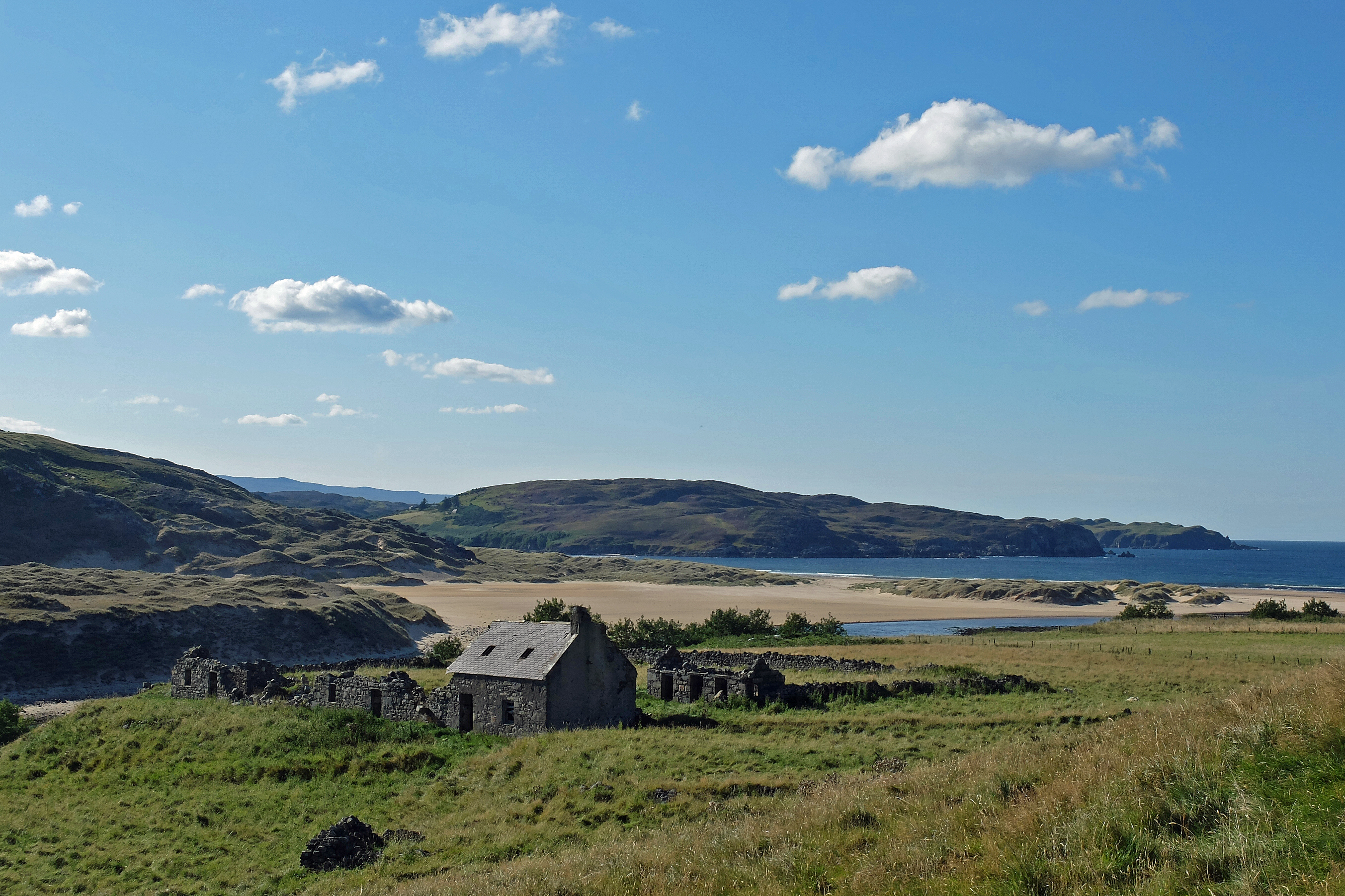
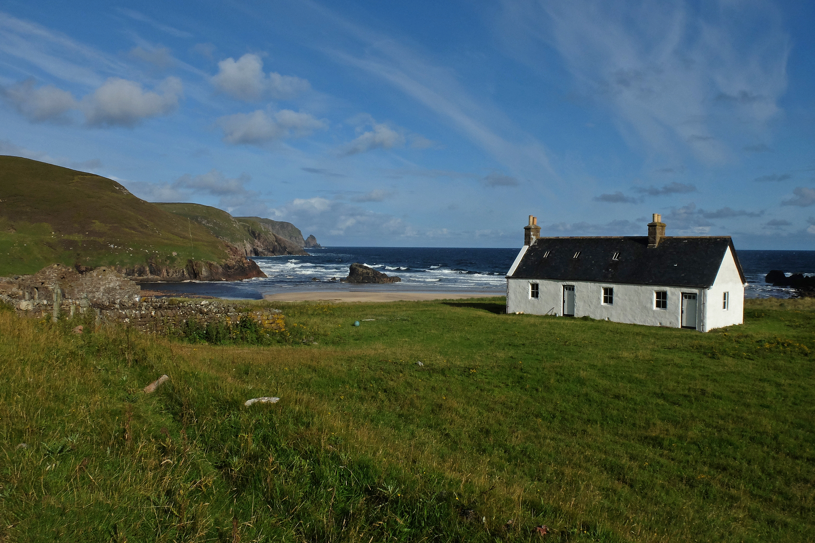
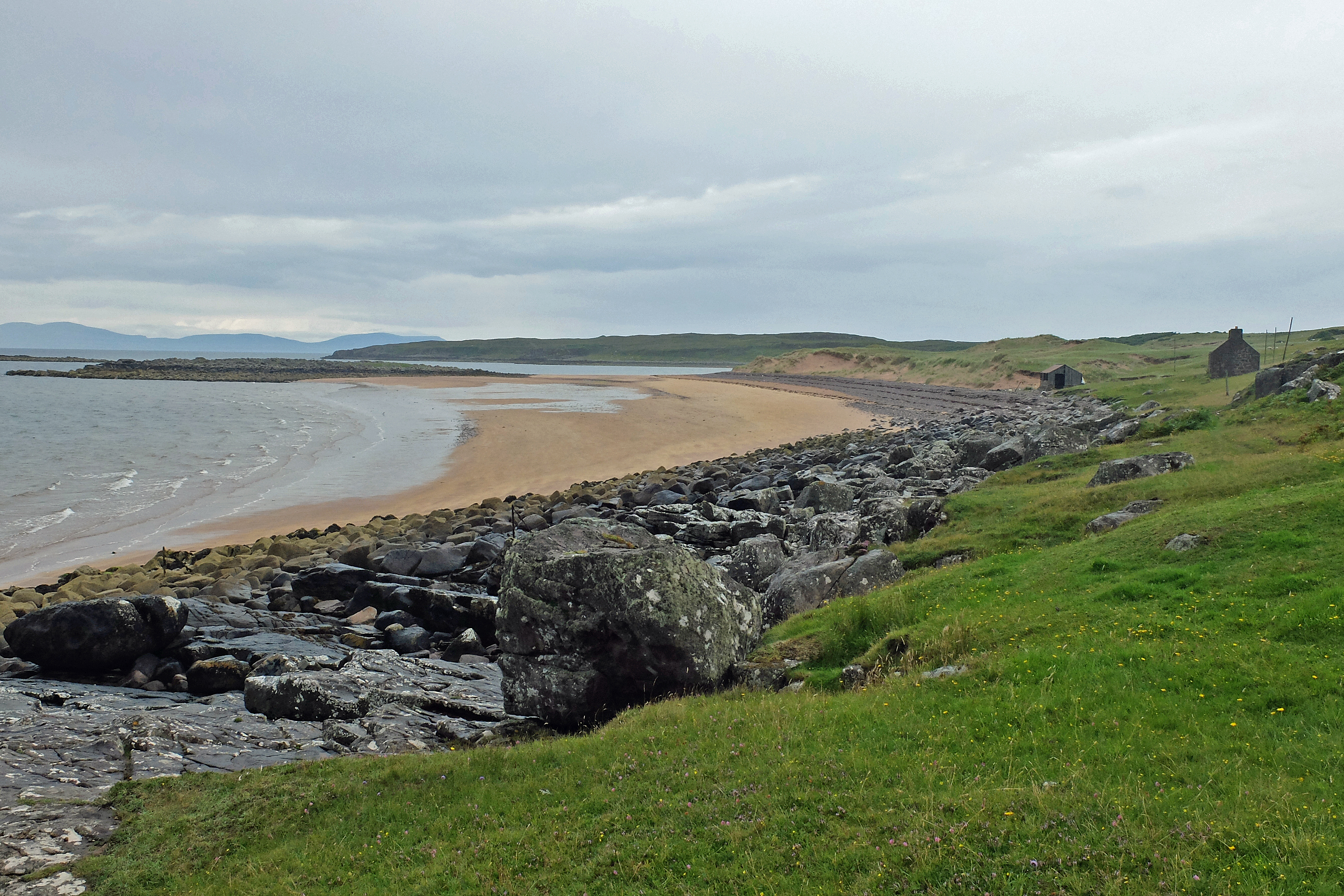
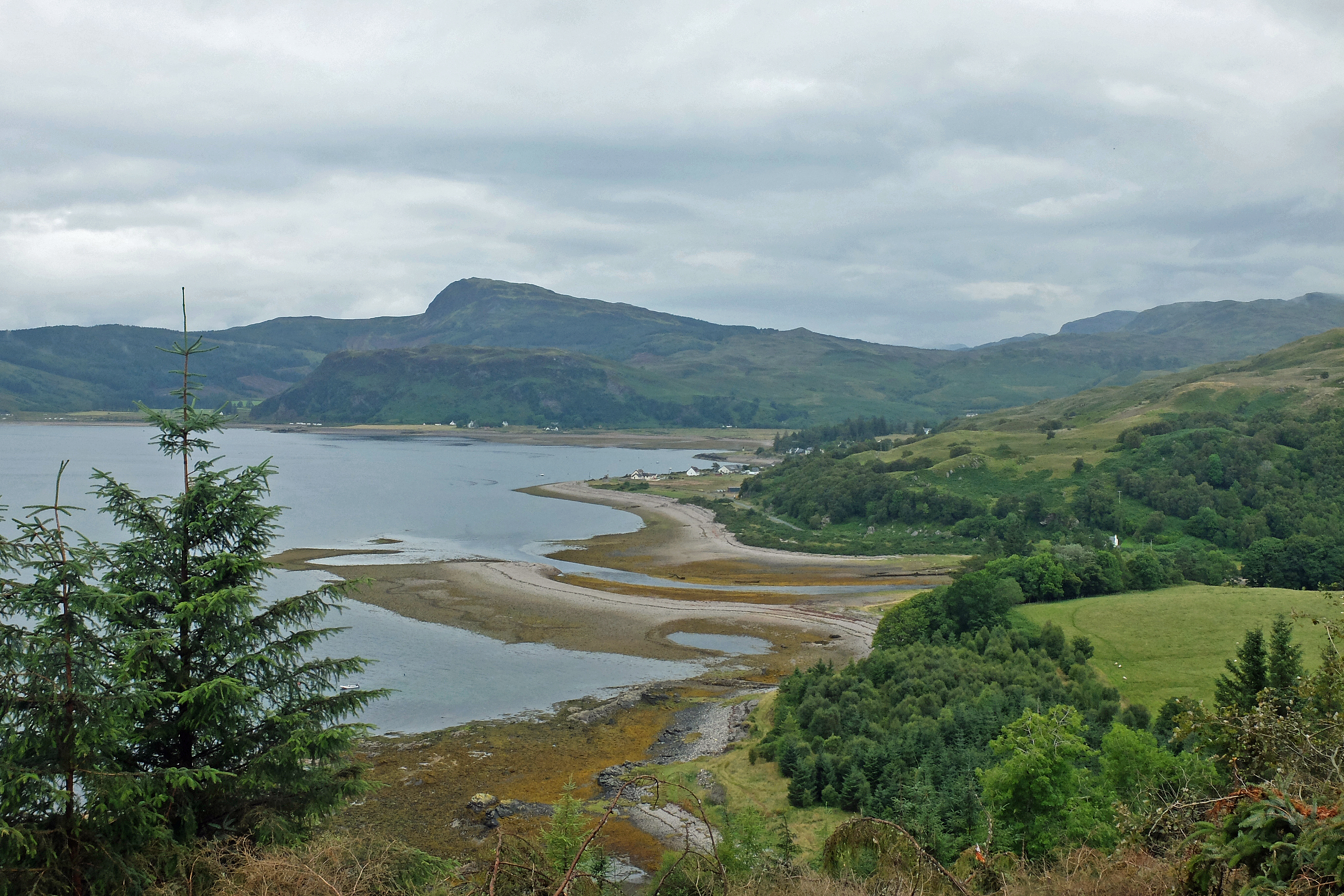
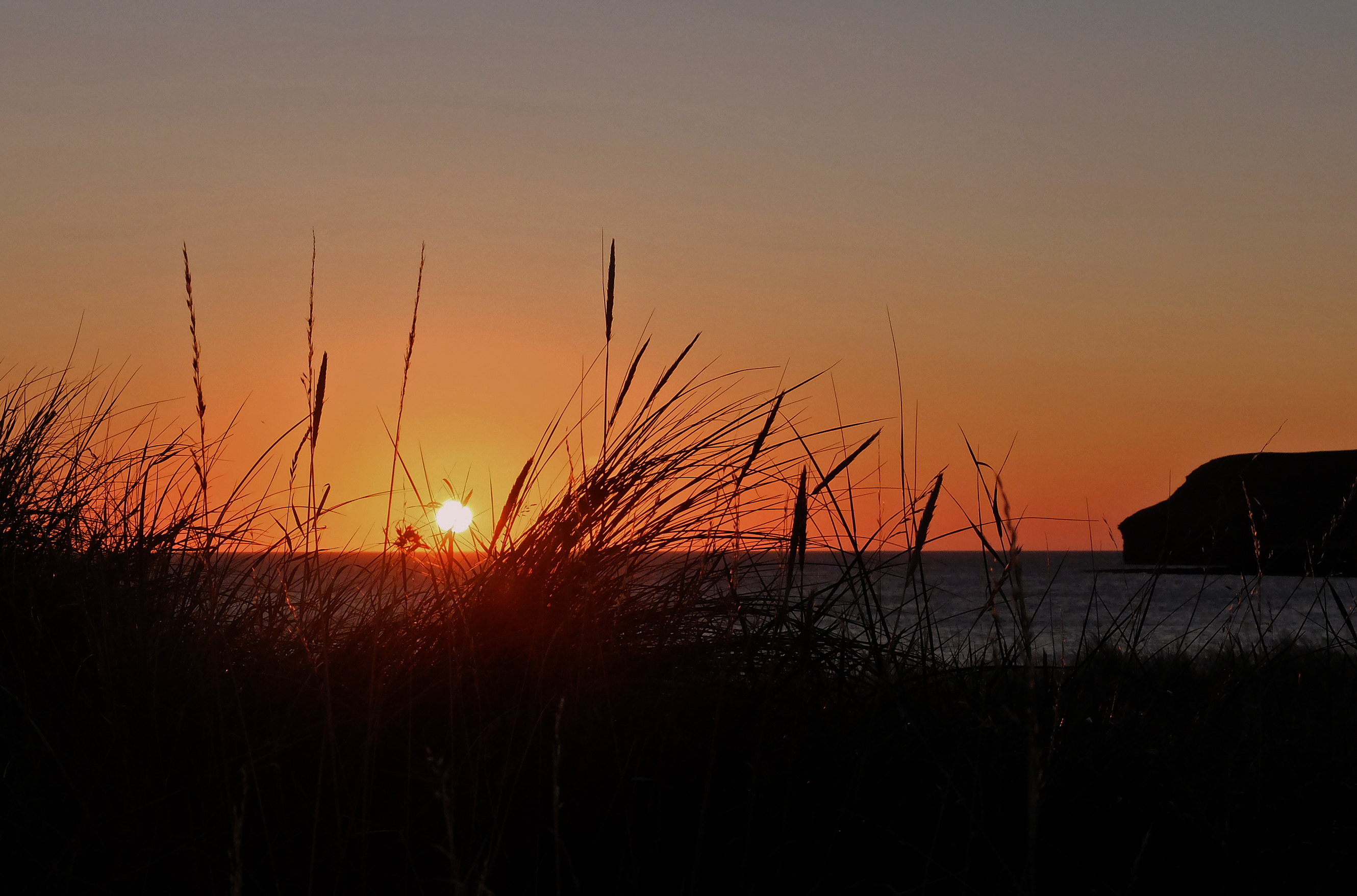
From Thurso, five miles of bone straight road over blind crested switchbacks gave me a stumbling hack through the soft grass of a narrow verge to keep out of the way of the peculiarly endless stream of traffic frequenting this remote corner of Scotland. Eventually and thankfully I dropped off the A836 at Castletown and passed through the ruins of the old flagstone works and tiny narrow harbour to cross two miles of sandy beach at Dunnet Bay. My reward was a very welcome tub of Orkney chocolate ice cream and a grand clear-skied sunset to finish the day. 

DSCF3870

Stage 161, 28th August: Dunnet to John o’ Groats

With a dubious forecast looming, I made an early start back on to the sand and a cut across the peat bogs to Dunnet Head and it’s obligatory lighthouse at the Northern most point of the British mainland. The first of three marker points in two days was little more than a brief photo stop and a quick chat to two very friendly American tourists from Las Vegas who were “doing” Scotland in three weeks. I felt guilty deleting the photo they took of me on my camera posing at the lighthouse, but I thought I was getting a little self-obsessed at all these landmarks and that maybe the views are more interesting than my grimacing mug peering out from beneath a woolly hat. 

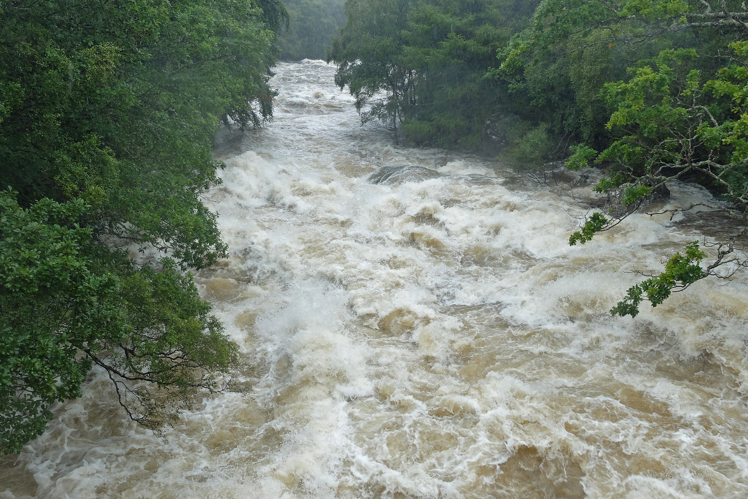
As I turned South away from the lighthouse, the wind strengthened and the rain began to catch up on three days of absence. It was pizzle, horizontal pizzle and straight in my face. All I could do was batten down the hatches, pull my hood tight in and put my head down. I spent the next four hours cocooned in my own little waterproof world without a view other than that of my own feet getting wetter by the minute. I was lost in my own thoughts but found these were mainly about how my clothing was performing and whether I should publish some kit reviews. Some kit was undoubtedly great but others were just not living up to expectation and the waterproof claims of my glove and boot makers were a complete fail! Scottish rain is clearly much more finding than the manufacturers’ test lab. 

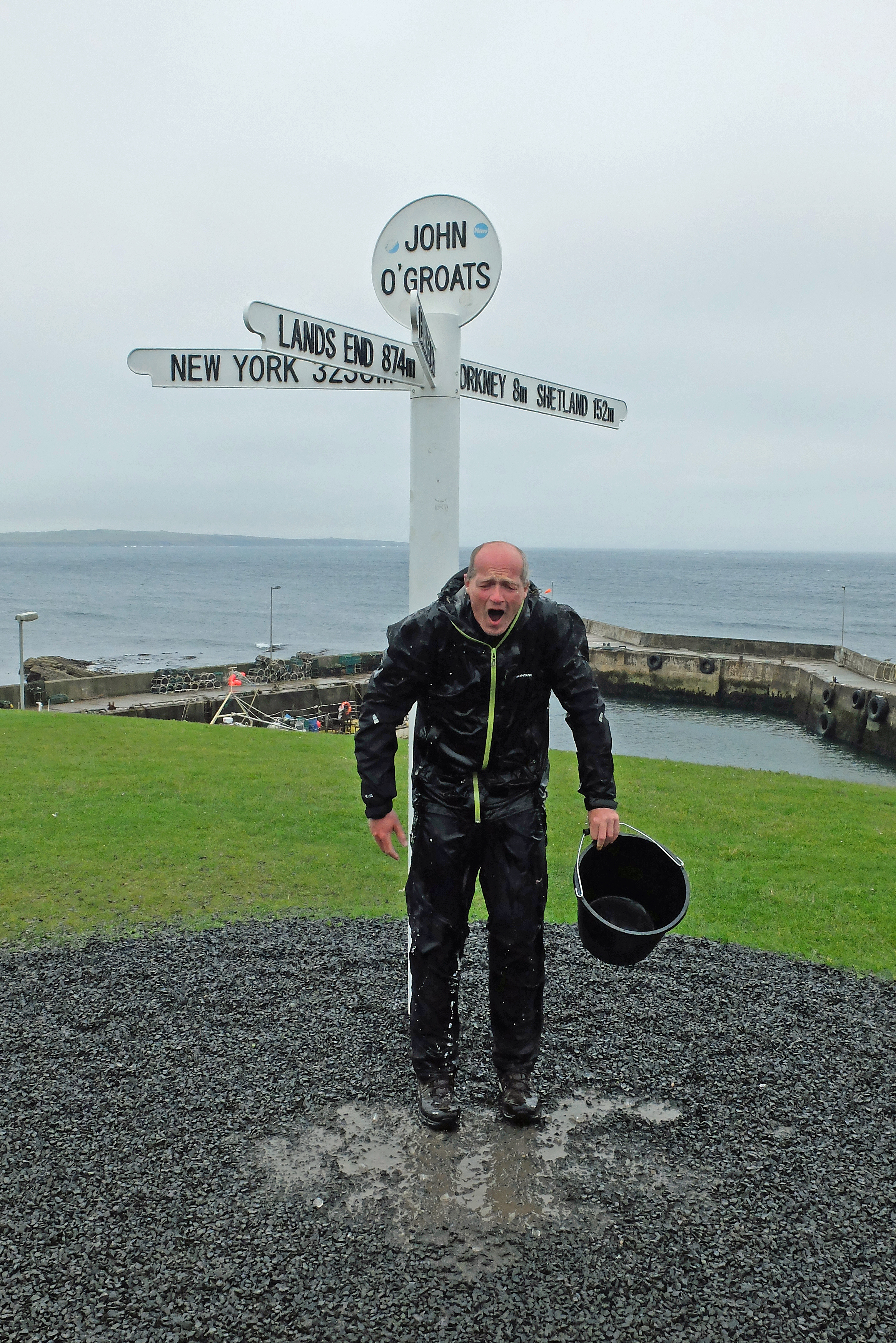
Now and again the gusts stopped me dead in my tracks and it was an uphill battle to make progress, but after a quick break for calorie loading behind the shelter of a high dry-stone wall the rain finally abated and I could make my way to John O’Groats for a posh coffee with Mike at the cafe. Here we met up with two guys, Tom & Rob, from Derbyshire who had impressively just cycled LEJOG in ten days. They were collecting for the MS Society and were rightly basking in the post match glow of completing something well beyond my capability. With the appearance of a bucket of ice filled water for their end-to-end celebratory duty it dawned on me that I too had been nominated to join in the charity social media led craze sweeping the nation and do ‘The Ice Bucket Challenge’. Without wanting to steal any of their thunder I took my turn and opportunity to fulfil my challenge and to dowse myself under the well photographed signpost. Recent conditions must have toughened me as I’m sure it felt warm….as if!

DSCF3893DSCF3916

Stage 162, 29th August: John o’ Groats to Wick

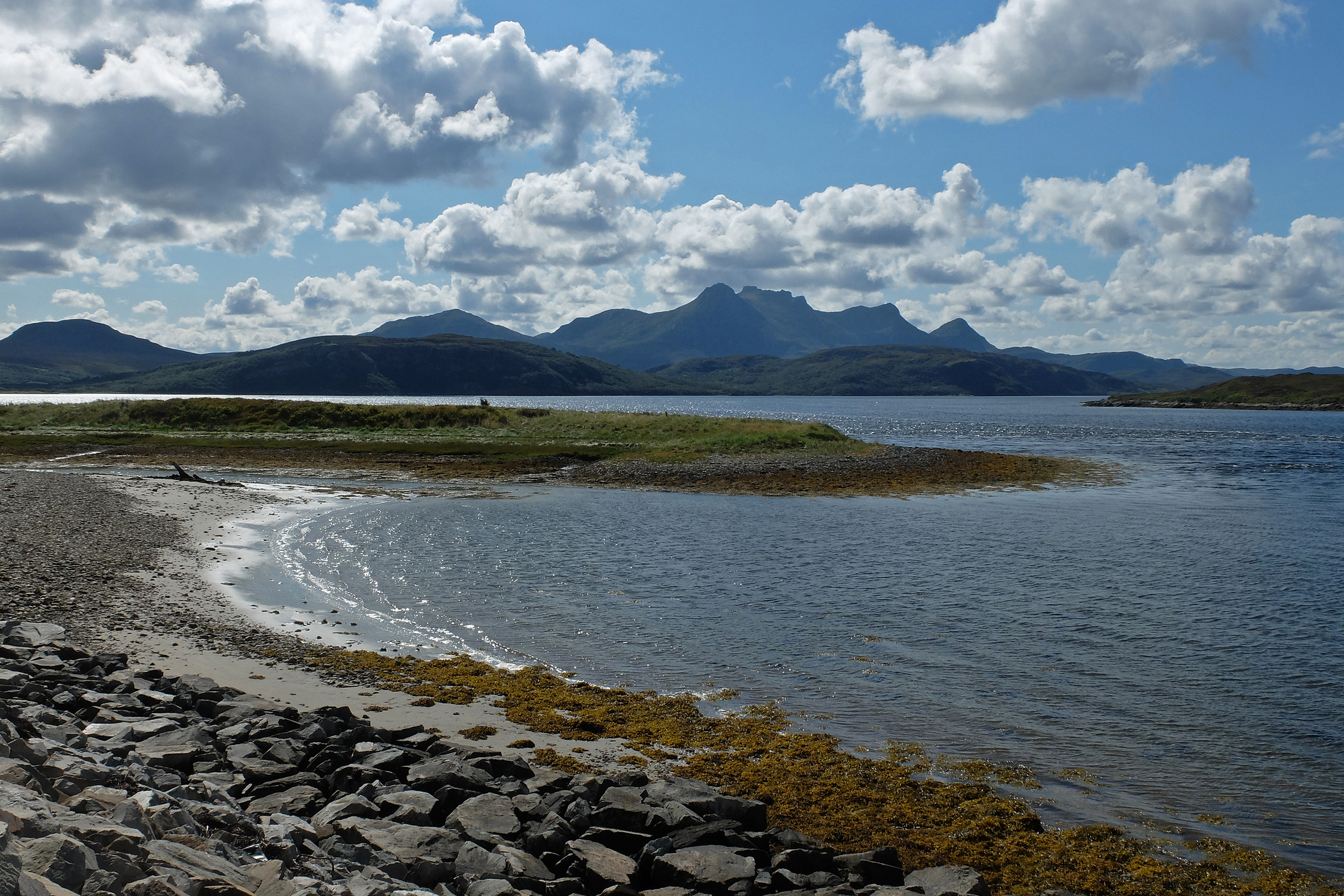
Though it didn’t feel it at the time, it dawned on me that John O’Groats was actually quite a big personal marker and corner. I had completed my own LEJOG and my route had been completed over 2,785 miles of my 3,228 total so far. For many John O’Groats was also the end of a very long journey. For me I felt as if it was the start of a very long journey home. As a result it was quite a depressing thought that I had probably already walked the most spectacular bits and that the journey South wouldn’t hold quite so much in terms of scenery. Hopefully it would prove me wrong. 

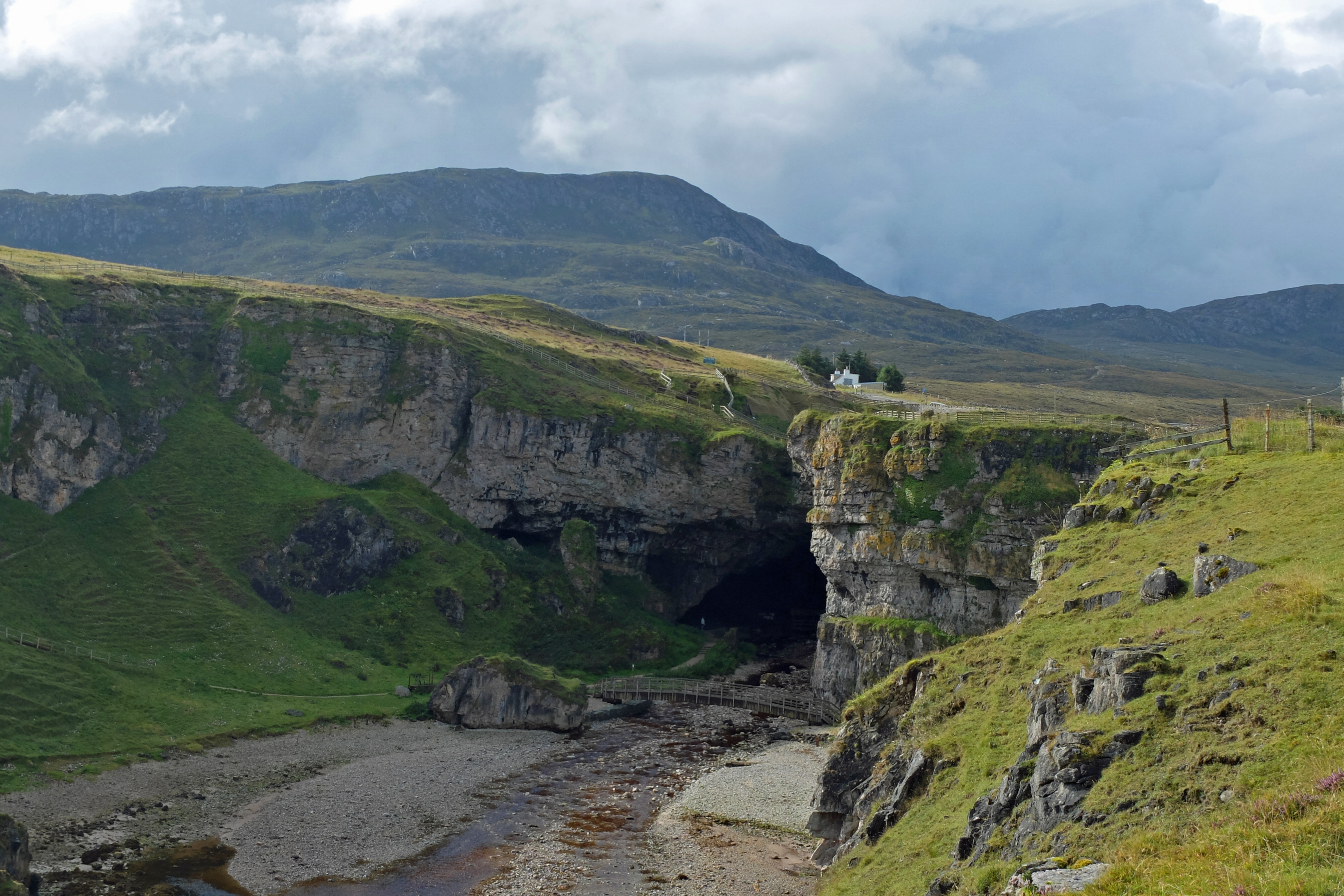
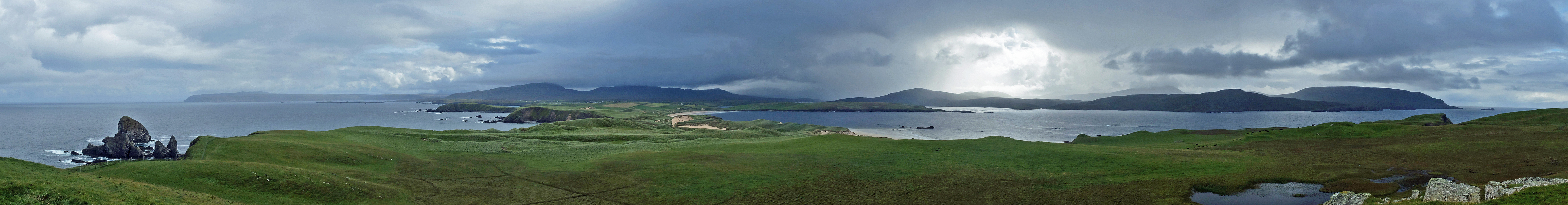
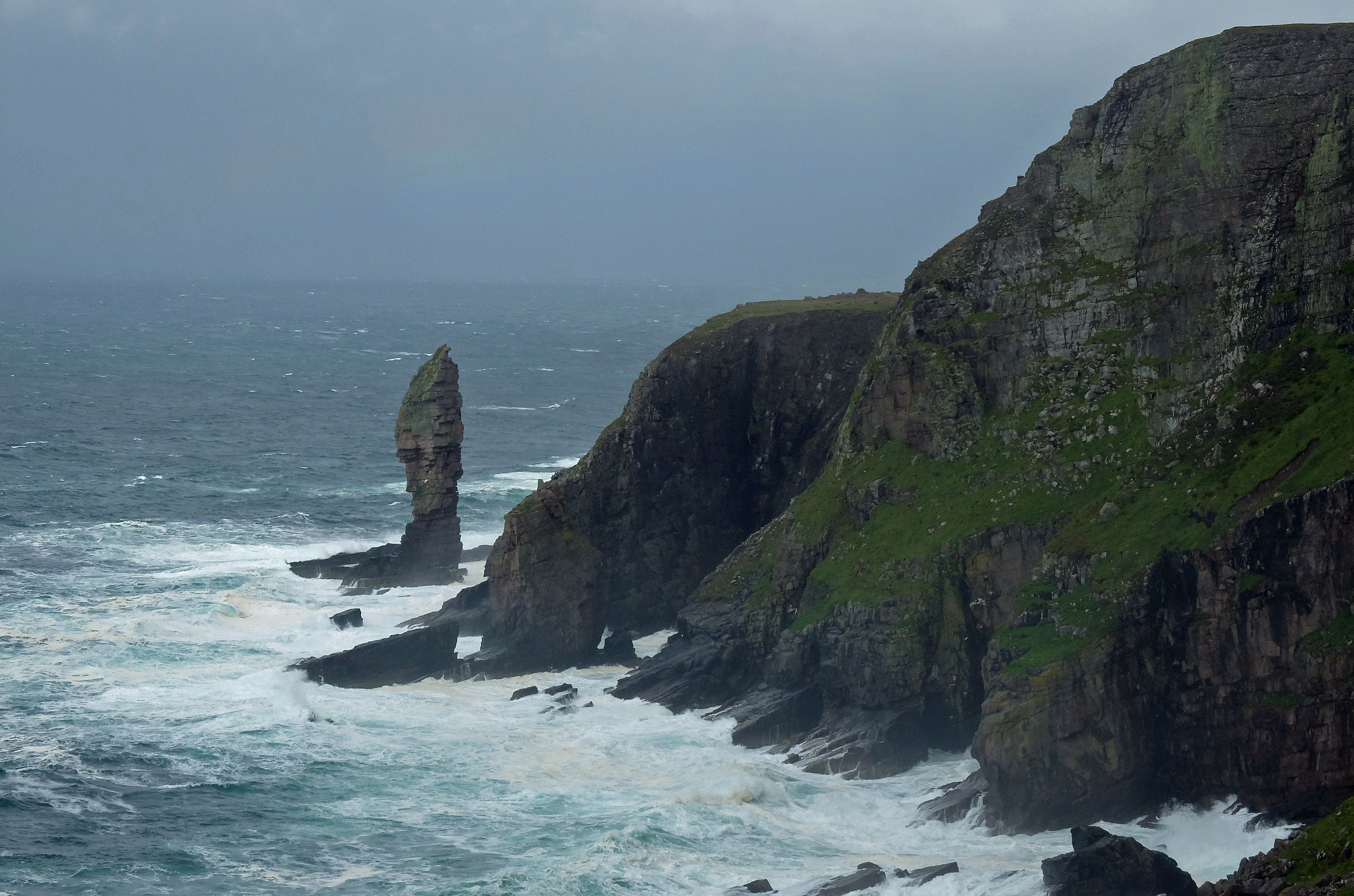
My next compass point came quickly as I ventured across country saying goodbye to the Pentland Firth and hello to the North Sea. Dunscanby Head marked the most Northeasterly point of the British mainland and I now properly turned South to walk along the edge of the sandstone cliffs. Despite the lack of a marked path, I stayed close to the cliff edge and watched the fulmars as they soared the wind around the Stacks of Dunscanby. The high cliffs were peppered with caves and arches and were clearly popular with nesting birds, even if I was there out of season. I reminded myself to bring my big camera and a long pointy lens back one day. 

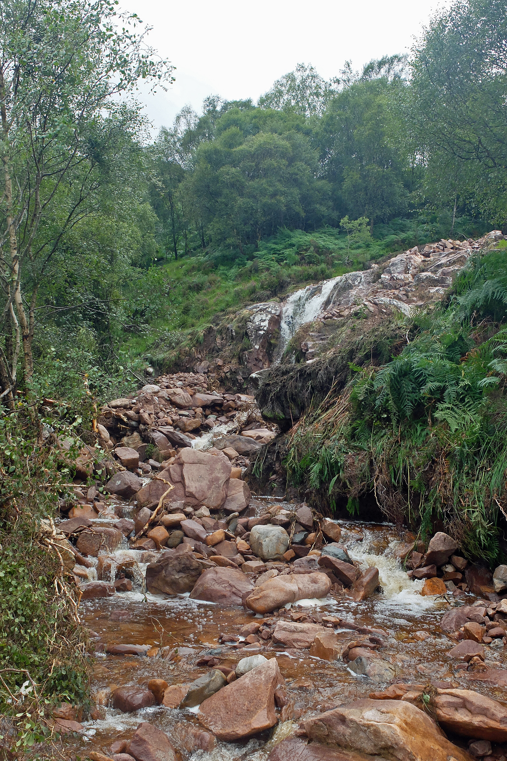
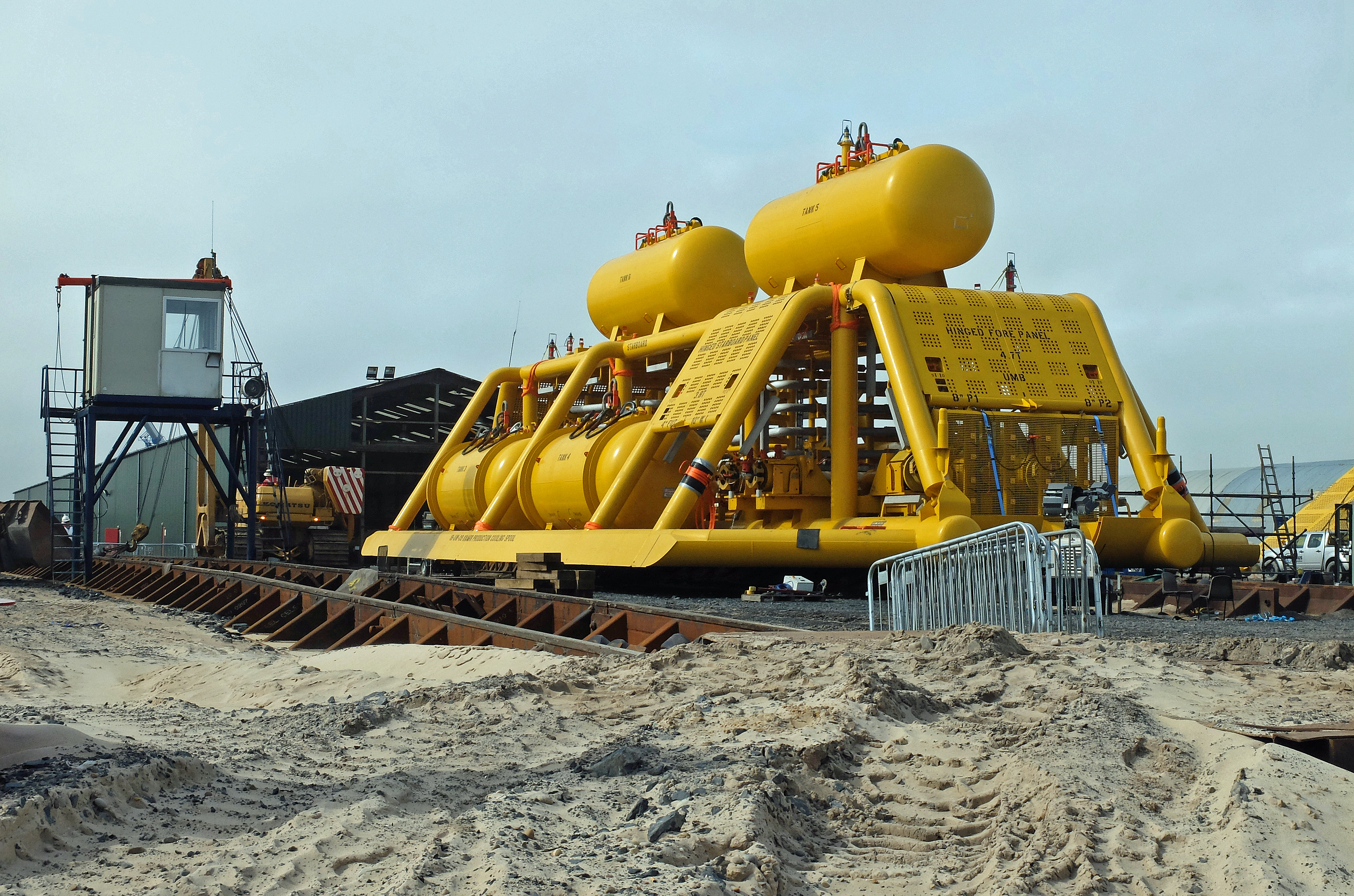
I could have walked to Wick via the A99 but in keeping to the cliffs around Dunscanby Head I had nicely avoided a chunk of ‘A’ road. Unfortunately I had to rejoin it for a few miles, but quickly made a bee-line for Sinclair’s Bay and a stretch of beach walking. The tide was in and I found myself dodging the waves as they drove their way up the sand and pushed me towards the shingle of the high tide line. I passed a huge engineering project in the form of a sub-sea ‘pipeline bundle’ and marvelled at the size of kit they were preparing to launch into the sea to lay on the sea-bed and return gas back for us to burn. I then had a small river to wade, my fourth of the journey so far….I think. 

DSCF3952

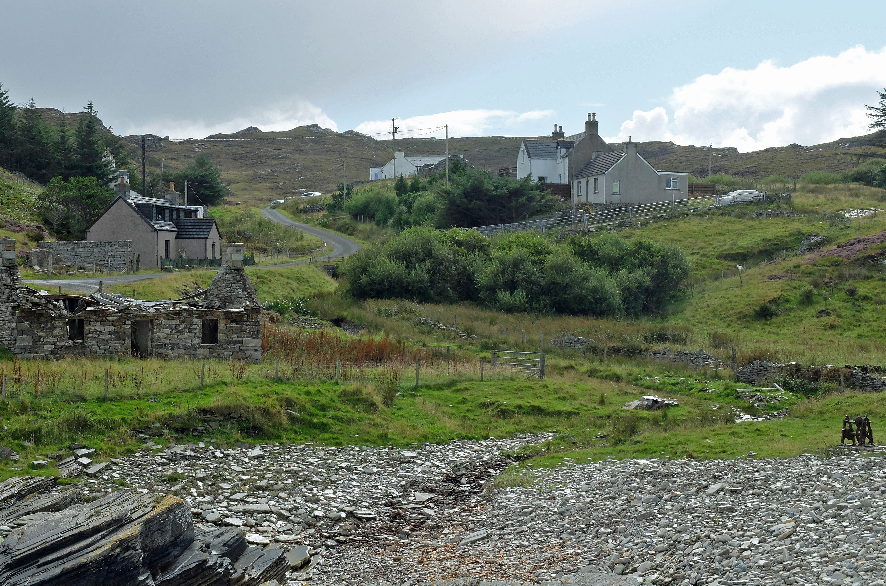
Off the sand, I returned to the main road for the last few miles into Wick. As a huge out-of-town supermarket loomed over the horizon a man approached wearing bright red gaiters and dragging a one-wheeled sled laden with kit. I had been forewarned of David Barnes. He had set out a couple of weeks ago from Inverness to walk the British coast anti-clockwise. I surprised him a little in greeting him by name and we stood to compare notes and chat enthusiastically at the roadside for a good while. He was carrying / dragging 50kg of kit, mostly fishing kit, as he intends to take two years foraging for food and fishing his way around the coast. If anyone thought my trek was extreme and that I had lost the plot, this one really must be nuts. Despite having some serious doubts whether he could drag that thing over some of the deer fences, through deep bogs or over some of the incredibly steep terrain that he will undoubtedly face, I wished him the best of luck and genuinely hoped that he was quick on his feet to be able to drag his sled out of the way of the courier drivers. 

Rest Day, 30th August: Wick

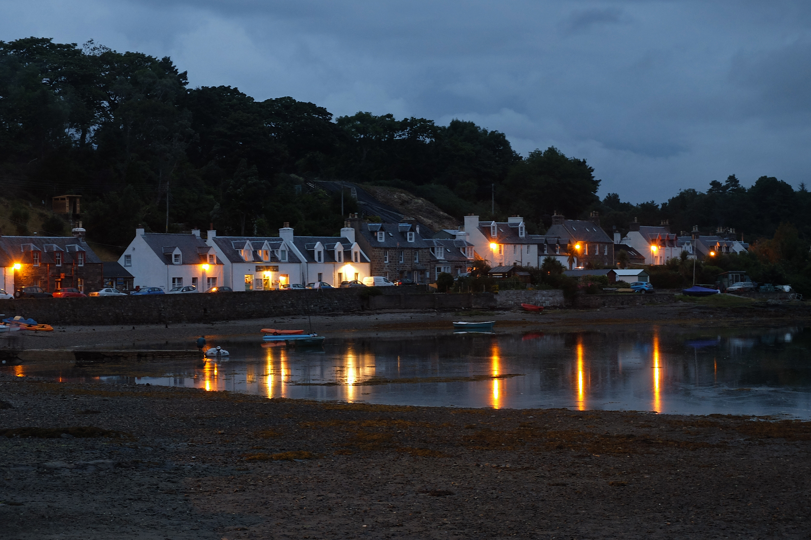
Last night had brought the very welcome arrival of Kate for her fourth visit and another full week in Snickers. With Kate having just missed out on my LEJOG landmark we returned to John O’ Groats for a more leisurely and almost languid lunch before spending a few minutes doing the touristy bits. We returned to Wick and briefly wandered the streets of town which were redolent of a men’s urinal whilst also retaining an air of former affluence. It was more than a little depressing even in the sunshine. In writing this Mike, Kate and I have been debating whether to head into town for an evening meal, but the sound of a man’s screaming coming from the direction of the police station last night added to the possible echo of two gun shots in the streets during the day might have swayed our decision. 

Distance to date: 3,248 miles     Ascent to date: 430,137 ft

Here comes the sun – hopefully

Stage 157, 24th August: Durness to Hope Bridge

After my cross-country adventure rounding Cape Wrath and Feraid Head, it was sorely disappointing to have to get back to road walking. So to up my spirit I gave myself a small early departure from the tarmac and dropped down to have a quick look inside Smoo Cave. Sadly the photogenic waterfall chamber was closed due to a storm damaged walkway. Bertha was beginning to annoy me now, so I climbed my way back to the road and made my way South along the banks of Loch Eriboll with a metaphorical cloud over my head.

DSCF3770

In truth the cloud wasn’t metaphorical at all. The sunshine that was forecast to dominate the day looked as if it was doing just that back in Durness and ahead on the other side of the loch. Instead, I had a nice heavy grey cloud hanging off the hill due West of me and the light wind was nudging it my way. It nudged a bit and stopped, hanging over me like a ‘cloud of doom’ whilst sporadically delivering its contents at intervals just big enough for me to consider removing my waterproof coat.

Coat on. Coat off. Coat on. Coat off again. After four or five occasions, any trust I had in cloud judgement deserted me and as I made my way North up the other side of the loch I took to regularly peering over my shoulder to try to time precisely when the next shower would arrive. I got quite good at it and could give myself a good two-minute warning to batten down the hatches and make sure I stayed dry underneath.

Sure enough, by the time I reached Hope Bridge the cloud had gone and it was as if it had never been there. I suspected that Mike, sitting waiting for me in his shorts, might not believe that I had a rainy day.

Stage 158, 25th August: Hope Bridge to Bettyhill

Today felt like my first fully dry day in August, even if it wasn’t. Checking back in my records I knew that it hadn’t rained on the 1st, the 5th and the 14th August. Apparently that’s a dry month in these parts. So it was another road trip along the A838.

With a slight tinge of disappointment at failing to find a good route to round the headland at Melness, I made my way up and over the pass taking as many old-road offshoots as I could to keep myself entertained. Much of the old road was overgrown and flooded in places and this is when I discovered that the pair of boots I was wearing no longer had any waterproof qualities in anything more than a shallow puddle. The uppers had now departed from the sole in a few places and I vowed to keep these boots aside for dry road walking days only until they fell apart completely. It looked as if two pairs were now assigned to the bin unless I could cheekily convince Salomon that their two-year warranty would get me some free replacements.

I dropped down to the short bridge and long causeway over the very pretty Kyle of Tongue with its grand views inland towards Ben Loyal on one side and the softer winding channel with wide sand banks heading out to sea on the other.

DSCF3806

I stayed on the road to briefly meet up with Mike who was shuttling his car and Snickers by cycling back and forth along the route. By halfway he called it a day and left Snickers at the roadside for us to pick up later.

The road consisted of one slow climb and drop after another. Each one felt steeper and tougher than the one before. In truth they weren’t, but for some reason I was clearly tiring. The scenery had lost its rugged edge and the number of “wow” moments had fallen back as cultivated fields and gentler crags with low boggy moorland hills took over. By the time I arrived in Bettyhill I was already missing the West coast and this area also seemed to have lost its appeal to the band of tourists who had kept me company for the last month or so. The end of the holiday season was nigh, but I also felt that the beauty was diminishing too. It was a shame for Bettyhill because the estuary was utterly beguiling and Torrisdale Bay could easily have doubled for a tropical resort if it wasn’t for the lack of palm trees and a chill East wind on my face.

DSCF3822

Stage 159, 26th August: Bettyhill to Reay

The journey East along a sunny coastline with very few accessible coast hugging routes continued. Hence more up and down road was my company for another day. The routine was becoming familiar as five long slow climbs took me over hills and down to another estuary with its understated rural hamlet. But very gradually the road was becoming busier and the terrain flatter.

From Strathy I was often passed by trucks delivering concrete to a new wind farm under construction nearby. I couldn’t help but think just how much fossil fuel was getting burnt in the making of the concrete, the delivery of it by truck and in the fuel tanks of the cars of the construction workers. It all seemed a bit barmy to me that, as a nation, we seem to spend a fortune blighting our landscape with ugly wind farms which are highly inefficient, unlikely to last and which will probably cost a fortune to maintain after a few years. Yes we live on a windy island, but we also live on a very wet one with huge hydroelectric potential. Plus, if I should forget, we also happen to have rather a long coastline with a fair few waves and two tides per day with huge power potential. I just cannot fathom why on earth we haven’t put more effort into options that might be a little more complicated to engineer than shoving up another dozen concrete housing estates for Windy Miller and his family. The environmental lobby seems to have created a knee jerk political attitude to renewable energy which I suspect will be a complete waste of time and money when we look back in twenty years time. See….I told you my mind wandered when I get bored with road walking.

At least I got an excellent view of the nuclear power station at Dounreay. It was probably lucky that I got this view at the end of the day as I approached my first open shop for ages. It sold ice cream and a Magnum Infinity was much more attractive than a one-sided debate on the merits and failings of nuclear power.

DSCF3841


Goodbye to the West

Stage 154, 20th August: Claisfern nr Scourie to Blairmore

A shortened day was planned to compensate for an extra few weather juggling miles completed yesterday. In other words, today’s forecast was worse than yesterday. I have often tried to take advantage of the weather forecast and lengthen or shorten days accordingly. The only objective I have always really wanted to maintain has been that I compensate to be where I planned to be for the weekend and the support crew changeover. So far, it’s worked.

However, rain dodging hasn’t been possible for the last month and once again I stepped out into the now obligatory light rain. It was entirely a road walking day and with only a couple of unknown headlands with dead-end roads I couldn’t afford to venture off-piste with the possibility of not getting through, particularly when the rivers were so full and the ground so very wet. I would have to do so tomorrow to Cape Wrath, but I couldn’t gamble with my schedule today.

The rain soon eased and it brightened enough to actually warm my bones enough for me to remove my woolly hat. The road was still open, empty and fast and I spent the time thinking up a challenge for the Top Gear presenters and I reckon I came up with a good one that Mr Clarkson would definitely lose.

Sadly the scenery was as grey as the featureless blanket of cloud which covered it and I felt robbed of views and photo opportunities. By midday the rain closed in again enough for me to don the waterproofs for a soggy walk away from the main road and down the side of Loch Inchard. The last seven lane walking miles took me through the rather downcast fishing village of Kinlochbervie with its oversized fish market, noticeably devoid of activity. The next villages of Oldshoremore and finally Blairmore told me that wilderness was approaching and you could feel it.

Stage 155, 21st August: Blairmore to Kervaig Bothy (via Cape Wrath)

My journey out to Cape Wrath was always a little daunting. My worries had mainly been about military activity on the bombing range up there and not being able to cross MOD land. But a check a few days previously had cleared that obstacle and now it was the recent weather which gave me concern. The overnight rain had been phenomenal again and I not only knew that the rivers and streams would be very full, but so would the bogs and marshes. With no marked paths to follow and a heavy rucksack to carry for a night out, I expected a tough day.

Jeff accompanied me along the first couple of miles of track North towards Sandwood Bay. When we reached a loch now overflowing and straddling the track, he turned and headed back waving me a farewell as I picked my way around an early obstacle offered up as an easy starter.

After a brief meeting with two German guys on their way out, who had elected not to go across country into the Northern wilderness, Sandwood Bay welcomed me with splendour.  I was alone on a beach with pristine sands to die for and the stack at Am Buchaille just had to get some photographic attention. The river flowing out from Sandwood Loch was a torrent and to cross my second obstacle I had to remove my boots and wade, keeping close to the sea so that I could span the flow as it spread out into a shallower manageable depth. The bay had more to offer as the climb up the cliffs presented more stunning views and I paused more than a few times to admire the spectacle.

DSCF3630

From here the terrain became a little more challenging and with no marked path I had to resort to old fashioned methods of contouring around hillsides to pick my way around saturated bogs. I took aim for a footbridge spanning the river at Strathcailleach Bothy. It was clearly marked on my OS map, but in reality there was not even a sign of it ever having been there. The river was in full flow and I wandered up stream for half a mile before finding a vaguely safe place to cross. I made the last leap from a slippery midstream rock and crossed with only one wet leg to spoil the success.

From here it was a succession of tricky bogs, streams and more bogs to cross and navigate through or around. To add to the now soggy toes, I was hit by a succession of squalls coming through to batter me head-on. By the time I reached the track to Cape Wrath lighthouse I was close to exhaustion but also exhilarated at having made it through. The squalls gave me a break and I reached the lighthouse with dry trousers and a modicum of respectability. I was greeted in silent anonymity by ambling tourists plus Jeff and Jenny who asked what had taken me so long and snapped a couple of pictures of my bedraggled state before boarding their minibus bound for the ferry to Durness. They drove off and I was left to wander four miles back down the track for a night at Kervaig Bothy.

To arrive at Kervaig is to arrive in one of the most peaceful and beautiful places on earth. As I turned the corner down the steep track the small sandy bay opened out before me. Edged by steep cliffs and fed by a winding, fast flowing river the former white painted croft was all mine….and I didn’t have to pay a penny. 

DSCF3683

I would have paid top money to stay in a place as gorgeous as Kervaig, even if it didn’t have a bed, toilet or running water. But it did have enough fuel for a fire and after a filling pasta meal I made my bed on the floor infront of the flames and watched as my boots steamed their way to sleep in the light of the glowing embers.

DSCF3685

Stage 156, 22nd August: Kervaig Bothy to Durness

My exhaustion of yesterday had sent me to bed by sunset and I woke early. With first duty of the morning due, I opened the front door to venture outside. I was greeted by a pair of black beaded red deer eyes not a cricket pitch length away from me. Equally shocked, we both stood and stared each other for what felt like minutes. By the time I had the nowse to reach back for my camera she had gambolled off to join her friends who had congregated around the bothy and had clearly spent the night silently chewing the cud within yards of my oblivious self. With no sign of a single stag, I assumed that they had now broken away from their groups and were now preparing for the rutting season. Autumn must be approaching.

I collected water from the stream and after a light breakfast made my way back to the track for the eight mile trek to catch the ferry across to Durness. The weather was cool but bright and within the hour the solitude of last night was broken by the minibuses taking tourists to the lighthouse and a pack of cyclists on the last leg of their Dover to Cape Wrath marathon. The buses all stopped for a chat and Stuart, the driver who had escorted Jeff and Jenny to the lighthouse stopped for a second time as if we were the oldest of pals. Once again the remotest places had offered me the friendliest people.

After a leisurely hour waiting in the cool sunshine, John the ferryman took me and some of the clearly happy and relieved returning cyclists over to Durness. I briefly met up with Jeff and Jenny to dump my rucksack for a lightweight afternoon around Feraid Head. Please excuse me the nerdyness of this next bit: The geology had starkly changed the landscape and the hard Pre-Cambrian Lewisian Gneiss of Cape Wrath now gave way to flatter more fertile land of the Cambro-Ordovician Durness Limestone. The prominent headland of Feraid Head is comprised of harder Moine Series metasediments and is joined to the mainland by Scotland’s largest expanse of dunes and corresponding deserted sandy beaches. A high point cairn at the North end of the headland gave me one of the best 360 degree views I have ever had as the headland narrowed back towards Durness.

DSCF3736

A few squalls caught me and soaked me from the waist down as I waded through the wet marram grass of the dunes, but with the squalls short lived and a good drying wind it was only ever minutes before I was dry again and ending the week on a high with Jeff and Jenny meeting me at the camp site in Durness.

Rest Day, 23rd August: Durness

With Jeff and Jenny on their way with yet more profuse thanks and a very long journey home, Cousin Mike returned for a full three weeks of further punishment in my company following an even longer journey from Exmouth. Having thought he’d had the longest journey to support me, he considered jumping off the cliff into Sango Bay when I told him that John D had travelled from Oman for a week with me around Liverpool. Nevertheless it was grand to have him back on-board and together we did some stopover reconnaissance with a drive over towards Tongue and he allowed me a little family holiday reminiscence from the 1970’s as we visited the Melness headland and Port Vasgo. Unfortunately I was due to cut across this headland as I couldn’t find a legitimate route around it, so at least I had a chance to see it for the first time in 35 years.

Distance Walked to Date: 3,125 miles      Ascent to Date: 417,718 ft

DSCF3757

Entering barren lands

Stage 151, 17th August: Inverkirkaig to Culkein

As Jeff left the car park at Inverkirkaig and waved me off for another day, the heavens opened wide and a colossal  shower hit me full in the face as if waking me from a deep slumber with an ice-cold flannel. By the time I reached Lochinver the rain took a break for twenty minutes and just enough time for my trousers to dry out in the wind. Then it threw it down again, dried, rained, dried – and so on. In all I counted seven heavy squalls and three light showers whilst I was out, but on a positive note at least I could stay warm and get dry between them.

The path from Baddidarach to Ardroe was another purple heather beauty but also rather splashy. I had another muddy splash across country from the sandy windswept beach at Achmelvich to pick up the coast road near Clachtoll and my first sight of proper foaming roaring surf for what felt like and could well be months. I’d walked around most of West Scotland with the coastline sheltered by nearby islands or tucked up along the side of the deep fjord sea-lochs and other than the sound of waterfalls I’d missed the reassuring ‘white noise’ of big breaking waves. I sat on a damp grassy bank to eat my lunch and reassuringly absorbed the sight and sound as each wave crashed against the shore.

The single track road continued ever on and took me all the way to the Stoer Head Lighthouse before leaving me to squelch my way along a very blustery cliff top to meet up with the Old Man of Stoer. With the rain laden clouds looming in, I quickly took my statutory photo as evidence of my visit and cut inland to contour around a small hill and pick my way through the marsh and bogs. As I did so, the heavens gave me one last battering of the day. But this time and with a little help from pathless bogs, the elements won. I was officially soaked for the fourth time on this journey. Some parts of my base layer shirt were dry, but all other items of clothing, yes all, were best suited for a tumble drier. I’m not sure Jeff and Jenny were overly impressed at a bedraggled soggy walker sitting in their car at Culkein. But I was told that they had waterproof seat covers.

DSCF3462

Stage 152, 18th August: Culkein to Kylesku

Today I managed a full ten minutes of walking without rain, but all too soon a heavy shower got me  thinking along the lines of “here we go again”. But no, I was wrong. The rain relented and my skill at battering down the hatches quickly to keep dry weren’t really needed as occasional light showers are but a breeze these days. Though talking of breezes,  I was accompanied all day by a very autumnal chill blustery wind that necessitated a woolly hat pulled down over my ears to protect what’s left of my precious hair from blowing away.

I completed the loop of Stoer Head and joined the Drumbeg road for a single track walk full of ever-changing views, perspectives and curiosities. At Clashnessie I had the double of a sandy bay on one side and a flourishing waterfall on the other. At Drumbeg I had open views across Edrachillis Bay whilst inland at Gleann Ardbhair I had stark hills and temperate rainforest draped with cloud.

By the time I reached the main road overlooking Loch Glencoul near Unapool, I also had a bit of a geological conundrum to get to grips with. How did a quartzite band end up sandwiched in the bread of Pre Cambrian gneiss? Some reckon it was a process akin to riffle shuffling a pack of cards when a huge thrust in the earth’s crust took place, others reckon some form of hydrothermal intrusion. Answers on a postcard please. In all honesty I preferred the sight of a stag watching me intently before my approaching odours had him bounding across the hillside to escape. All in all, it was one rather lovely road walk and well worth a leisurely drive if you have no reason to wear boots.

DSCF3527a

Stage 153, 19th August: Kylesku to Claisfearn nr Scourie

I started out with a few miles along the main A894 from Kylesku crossing the bridge which had looked very much like an alien spaceship when I saw it from a distance yesterday. I briefly came across Lindsay, who parked up and came over for a quick chat, as I stood by the side of the road responding to texts from home that had sprung through all at once as my phone signal kicked in. As we discussed my route ahead and made our farewells, I truly felt that another new friend had been made.

The road was open, wide, nigh on empty and ideal for speed. I suspected that Jeremy Clarkson would like this one but also rather hoped that he wasn’t heading my way. Just in case he was out testing a new Ferrari, I turned off left and took a couple of minor headland jaunts to escape.

First I followed the old coast road which was very overgrown. Though now only fit for single file walking traffic, it still had ‘Passing Place’ signs partly buried in the deep undergrowth which seems to reclaim our human laid tarmac very quickly. As the now obligatory heavy shower caught up with me I bumped into a chap taking shelter under a tree and out collecting insects with his trusty net as his steed. With my trusty, but now very bent, walking pole as my steed we made an equally mad looking pair and chatted for a few minutes whilst waiting for the rain to abate.

My second jaunt took me up a track where I was approached by a man in green overalls with three friendly terriers. In a thick Essex accent he warned me off trying to get through as the path on my map beyond the house was overgrown. Thinking that he might just be trying to keep me off his Scottish land, I vowed to give it a go and left him saying that I’d as likely be back in five minutes. So when I came across a lovely path, I began to believe my instinct was correct. It wasn’t. The path soon dissolved into thick bracken and a tangle of young trees. Though I could see a path of sorts it disappeared completely at a rather tall deer fence. Once I’d scaled this, the bracken was thicker and deeper and at one point I tripped over a hidden rock and fell head first into a thick bracken bed. I lay there for a few seconds like a helpless tortoise on its back. After a combination of swearing and a fit of the giggles, I got to my feet and scrambled my way to the lane. I might have won through, but I was glad nobody saw me win this one.

I had lunch in Snickers parked up at the campsite in Scourie. I lingered a little longer than normal and changed out of some wet clothes for an afternoon cross-country walk to Tarbet. Anything across country was now very wet, extremely boggy and also strewn with rocks and boulders. The terrain had become bleak and very barren. What soil there might be was thin and little more than heather and marsh grasses seemed to thrive. Every little crag and hill was mainly bare rock and the higher hills often bore the illusion of snow cover as the wet rock glistened in any stray ray of sunlight. By the time I reached the rendezvous point I was much later than planned and because a phone signal was a rarity I couldn’t tell Jeff and Jenny of my delay. They were a little worried and came driving up the lane to look for me. I apologised, but I suspect they were a little relieved and not angry.

DSCF3591

Postie’s Path and 3,000

Stage 148, 13th August: Dundonnell House to Ullapool

With yet more heavy rain overnight, I was surprised to see that the river levels had significantly dropped back . To me, this fact only demonstrated just how much water Bertha had dumped over such a short period of time and I was beginning to appreciate that even that much rain isn’t normal for this part of the world. Needless to say, more showers were forecast for today.

At least I didn’t have to start on a main road and I headed out up a narrow lane to cross the peninsula splitting Little Loch Broom from Loch Broom. The climb up the side of the hill and over a pass to make the crossing was a gradual but long one and eventually I left the road to follow a steep track down to the old jetty and former ferry crossing to Ullapool. At the bottom Castaway Cottage, now a holiday let, sat a little sadly among the debris delivered by a once raging but now rather innocently bubbling burn. The storm had left a huge, twenty metre wide scar of boulders, rocks, stones, branches, trees and flattened bracken, The stream now barely filled a few metres of the wound it had created. The damage around here was more substantial than anything I had expected and clearly the storm had been a very rare event.

DSCF3313

The path edging up Loch Broom was marked on my map. It may have been a path once, but was no longer recognisable as anything quite so civilised and that was when I could even find it. It now comprised mud, bog, running streams and splashing puddles. Clearly the thin soil hadn’t completely drained and crossing some of even the smallest streams proved to be quite a task. Progress was ridiculously slow and the next two miles took me nearly two hours to complete.

Back on the road I soon found that it too had been breached by a landslip and water was still cascading across the tarmac as locals in high spirits exchanged deliveries by hand across the new gulf now marooning anyone on the North side of the landslide. At the head of the loch I turned on to the main road. It was clear that normality had resumed as the road was busy with trucks and heavy vehicles shuttling their goods to and from Ullapool and presumably via ferry to Stornaway. With the odd shower to accompany me, it wasn’t a pleasant couple of hours into Ullapool but interest was maintained as I passed another house which had lost it’s entire driveway, a heavy stone front wall and probably much of the downstairs furniture to another very muddy flooding river. Ullapool itself seemed oblivious and the trinket shops selling the usual mix of tartan bric-a-brac were brimming with American tourists being happily and probably extortionately relieved of their dollar.

Stage 149, 14th August: Ullapool to Acheninver

What? A dry day? Is that possible? Apparently I was due one and I was genuinely trying to remember the last time I had had a completely rainless day and was surprised when I worked out that it wasn’t that long ago when I climbed over the Pass of the Cattle. But to me it felt as if it had rained every day for months and I thought I was due a break.

I left Ullapool to great news from home and paused for a personal celebration by buying myself some waterproof socks to trial on some of my wetter off-road walks. The fact that my eldest daughter had achieved better A Level results than I ever did and had got into her university of choice left me proud, delighted for her, generally ‘well chuffed’ and ready for a grand day out.

It was more ‘A’ road for the first few miles before tracks took me around the estuary at Keanchulish and up onto the renowned Postie’s Path. Despite a sign warning me that I was entering dangerous mountain country I still hadn’t twigged that I was actually on the Postie’s Path until two rounds of Marmite & Dairylea sandwiches dislodged something in my brain as I sat down for lunch at the top of a steep climb. The path was less than eight miles long but comprised a series of spectacular views across to the Summer Isles supplemented by rocky scrambles, steep cliff drops, more boggy patches and the occasional landslip to keep my attention. Fortunately the streams were now nearing normal levels and were safe to cross.

I’d heard much about this path and the views over Horse Sound to Horse Island and Tanera More were truly spectacular. This walk was very much on a par with my walk last week into Lower Diabaig, though it felt a little easier on the ankles and knees which were no longer complaining. However, I did wonder if the postman who walked this path twice a week until the 1960s ever had knee trouble. The waterproof socks also got a good test and I can certainly vouch for their ability to keep water out. But they also keep it in, which isn’t great if your feet get a smidge warm.

DSCF3326

Alec met me by car at Acheninver and he demonstrated his rally driving skills as we took a one hour drive to catch up with Jeannie at Unapool and an overnight park up outside their cottage. We had a grand evening sharing a hearty dinner and musical entertainment at the table of Alec and Jeannie’s friends – Lesley, Lindsay and their children Ben and Ewan. Even the thick clouds of midges didn’t get me. Maybe I am becoming immune. Or maybe they no longer recognise me as English as I’m sure the midges sole purpose in life is to prevent too many English from inhabiting the West coast of Scotland.

Stage 150, 15th August: Acheninver to Inverkirkaig

It was almost perfect walking weather as I set out for twenty four miles of mainly single track road. It was cool, but not cold. There was enough of a breeze to keep the midges at home and it was overcast enough to allow me walk hat free without the risk of sunburn on my bald pate. The only thing missing was enough of a break in the clouds to give me an occasional burst of sunshine to brighten my photos. Most of my recent pictures seemed to have the backdrop of a leaden sky and I suspect that many stunning vistas had been missed due to the inclement weather.

It was a long lane walk edging Badentarbat Bay with gorgeous scenes out to the Summer Isles, Lewis and Harris with far reaching views back to the Torridon Hills and even the very distant Cuillins of Skye. I had a brief escape off-road and around a small low headland with a two mile stretch of purple heather lined path from Dornie to Old Dornie. It was cracking little route and I wanted it as my own. Pete’s Path sounded rather good and especially as it would be around here that I notched up my 3,000th mile.

DSCF3368

Old Dornie was popular with visitors out to cruise the Summer Isles. It was a sheltered, if not picture postcard bay, littered with small moored boats of all shapes and sizes and I climbed out of it to walk the tarmac again ticking off every white diamond shaped ‘Passing Place’ sign as I counted down the miles to Inverkirkaig. When the signs got a bit tedious, I ticked off the lochs and lochans instead, but the slog seemed longer than expected today and I ended up almost angrily route marching the last few miles into Inverkirkaig and a very welcome end of week meal with Alec, Jeannie, Lesley and Lindsay in Lochinver. Oh yes, I forgot to mention that it rained too, how silly of me to forget.

I said my goodbyes and profuse thanks, particularly to Alec who had spent the last two weeks suffering the musky damp smell of my boots and socks which undoubtedly needed a few days of decent weather to dry out properly. He had also got to grips with the vagaries of Fiat electrics and for once everything on board the bus seemed to work. We even had a stock of spares.

Rest Day, 16th August: Achmelvich nr Lochinver

A windy night had rocked me to sleep and then woken me at retaliatory intervals with a heavy gust, but in all I slept well and woke late for a day of laundry and various stuff. I hung around for Jeff and Jenny to arrive at lunchtime. They had elected not to sleep on board but to treat their week as a holiday and move Snickers along parallel to their B&B plans. It suited me to have some space and to be able to hang my socks up without too much guilt. I also noted that the campsite shop sold ice cream and because I hadn’t had one all week I might just have indulged myself with a good old-fashioned Mint Feast.

Miles to Date: 3,013         Ascent to Date: 401,218 ft

Bertha’s bite

Stage 145, 10th August: Gairloch to Cove

With the tail-end of Hurricane Bertha threatening for later in the day, I set out under a blue sky and North along the road towards the lighthouse at Rubh Reidh. The Isle of Skye was now disappearing over my left shoulder and had been replaced by the isles of Lewis and Harris across The Minch.

DSCF3225

The single track road was littered with camp sites and holiday cottages but with every mile the road gradually quietened and eventually became a silent and deserted strip of tarmac which terminated at the lighthouse. I now had to venture across country to reach the road on the East side of this latest peninsula and for much of my planned route there was no OS marked path or track. On the ground however, I did find a path of sorts and it went in the direction I wanted it to go. I doubt it was a man made path, but it suited my needs perfectly. It took me around the isolated beach at Camas Mor with its stacks and natural arches at one end. The waters were rich azure, crystal clear and very inviting, but the air temperature was taking a nose dive and I kept my pace in expectation of the weather to come.

From Camas Mor the route took me across bleak heather clad peat bogs via, what looked like, two very isolated but inhabited makeshift homes or shelters. One was a substantial former croft with a polythene roof and homemade windows, the other was little more than a shack on a rocky beach. Neither made it to my ‘must buy’ list.

The rain began to fall mid afternoon, gently at first but gradually harder as I met up with Alec near Cove on the shore of Loch Ewe, the departure point for the Arctic Convoys in World War Two. Concrete foundations and former gun emplacements were dotted around the headland as was a memorial to the thousands of men who lost their lives trying to get critical supplies through to the Russians.

Stage 146, 11th August: Cove to Laide

Overnight and well into the morning, Bertha did her worst. Our pitch in Poolewe seemed quite sheltered compared to many others on our site and many campers and caravaners were hurriedly packing away before Bertha could take their belongings and throw them into the loch.

Kate had forecast from home that things would ease around 1pm, so I hung around till midday before moving out. The drive back down to the headland to drop me off at Cove was a hairy one with heavy gusts of wind and the road awash. The small burns of yesterday were now raging peat tainted torrents and bridges were seriously close to overtopping.

As I walked back down the lane I couldn’t help but notice a huge plume of red sediment spreading out across the loch where one particularly large torrent of water entered the sea. I wondered if it would be even vaguely possible to try the cross country route I had ventured down yesterday. The bogs would by now be full blown waist deep lochans and the streams I crossed would no doubt be impassable. But for me the heavy Northwesterly wind was on my back and sped me down the lane into Poolewe.

DSCF3245

The rain eased as I met the main road and crossed the head of Loch Ewe towards Aultbea. The evidence of the Arctic Convoys still haunted the water with the jetty of an old but clearly operational and well painted fuel depot sitting stoically at the waters edge. From here it was a brief inland walk over the hills, a drop into Gruinard Bay and a meeting at the next waterside camp site with Alec. Our neighbour on the site was the cousin of the vicar in my village at home – small world eh?

Stage 147, 12th August: Laide to Dundonnell House

The glorious 12th didn’t feel quite so glorious to me. I stepped out into – guess what – rain! It was very definitely pizzle again and lots of it. It was cold too. Yesterday’s high winds made me don my woolly hat under my waterproof hood and slip into my new waterproof gloves to replace my less than successful previous pair. Today I wore them again but only because it felt very autumnal. I had dumped my waterproof trousers as I had found them pretty useless due to the condensation and sweat which build up when you are wearing them. My normal walking trousers suffice in that at least they air-dry in ten minutes flat if the rain gives them a break.

So it was off and along the road around Gruinard Bay and it’s small island. The island was once contaminated with Anthrax as part of an MOD experiment and was abandoned afterwards. It was left forgotten by the London based civil servants and was never likely to be cleaned until Greenpeace dumped a bit of the island soil in Westminster and threatened to dump more in the parliament canteen. Needless to say – it was cleaned up. I never thought I would agree with a Greenpeace action, but in this instance it certainly sharpened a few minds.

It was all ‘A’ road walking today, but fortunately the A832 was only sporadically populated. It was apparent that the blue lights and sirens heading this way yesterday were to deal with landslips and flooding and that many drivers still held the belief that the road was closed. Yes the waterfalls were still very full, but they didn’t have the roar of yesterday and had clearly fallen back from their peak of 24 hours ago. Nonetheless the flow was still impressive and the damage was only just being dealt with.

DSCF3284

I passed through a few villages with peculiar names such as First Coast, Second Coast, Badcaul and Badbea. I couldn’t help but laugh at the Gaelic spelling for Badcaul at “Bad Call” and thought the signage was just a little patronising. By the time I had passed the workmen clearing the landslip and mudslide near Dundonnell I had learned from Alec that the rain had been the worst in this area for 32 years and that in 1982 it was supposedly the 200 year storm. The maths just doesn’t seem to work. Either way, it was very much a storm of biblical proportions around here and what is more the rain was still sodding well falling!

Sou’Wester Ross

Stage 142, 6th August: Applecross (Toscaig) to Ardheslaig

Though I had finished in Applecross village the night before, I was dropped off five miles further South to complete a short leg of coast I would otherwise have missed if I had carried on. It was also an excuse to look at a house I’d had the details of a few years ago and I wanted to see just what the location was like. It was rather nice. A private rocky bay and just yards from a deserted pier in a much larger but very sheltered South facing bay. But if I’m being picky, and I am, I wasn’t overly enamoured by the Applecross area and felt it a little overrated and given a grandiose introduction to visitors who travel over the Pass of the Cattle to get there. With its large commercial camp site it felt like it was trying a little too hard to attract tourists rather than retain its true identity. So I walked back along the coast road, around the red sandy Applecross Bay and up onto the gently sloping cliff for a long road walk North. The rain started and gradually increased in intensity but only as far as a heavy drizzle on my back. The rain didn’t really worry me but it did annoy me that the scenery was featureless, flat and grey. I don’t know if it was the weather but I found this part of Wester Ross just a little bit bland. Eventually I turned the corner and made my way East up Loch Torridon and everything changed. Though the weather had cleared a little, it was by no means the driving factor. The scenery just seemed to blossom with hamlets such as Kenmore and Ardheslaig providing a pretty foreground to the serenity of the loch and the ruggedness of the mountains to the Northeast. DSCF3162 We spent the evening parked up at the waterfront in Shieldaig. Kate had seemed to developed a skill at blagging me washing facilities. Tonight was a special treat and after the tremendous shower at the hotel in Plockton a bath at the Tigh an Eilean Hotel in Shieldaig was tops. It was the first bath since Cumbria and I fully indulged myself with a very deep wallow. I only hope I didn’t leave a bad ring mark.

Stage 143, 7th August: Ardheslaig to Lower Diabaig

With Kate alongside me, getting my reliable daily weather forecast from home wasn’t an option. Instead I checked my phone app which informatively predicted “intermittent clouds”. With a forecast about as useful as a chocolate fire guard, I put my waterproofs in my bag with the expectation of wet stuff falling from the sky. My experience of the last twelve days had brought me crashing back to the reality of a Scottish summer after I had been so spectacularly spoilt in Ayrshire and again near Mallaig. I took to the road with the enthusiasm of a slug, but with the scenery continuing to surpass my expectations who was I to complain. I managed to escape the road for a loch side walk with the angular branches of Scot’s pine woodland giving a new dimension. Near Annat I passed through an area where work was well underway to clear the woods of Rhododendron. They were making great progress with chain saws, wood chipping machines and fires. I couldn’t help but notice the new young sprigs of Rhododendron cropping up with a smirky grin. Given another ten years I’m sure the area will be swamped again with what is considered an invasive weed in this part of the world. It was a brief excursion back onto the road through Torridon before a more challenging trek off and initially through the Torridon House estate. I had another minor skirmish with head high bracken and an invisible waist-high wall – I initially lost and ended up on my knees trying rather pathetically to stand up again in the tangle of bracken. Having extricated myself from the undergrowth I eventually took to a proper and very rugged coast path from Inveralligin. The path was little more than a goat-track and a mountain goat one at that. It became rougher by the mile, with uneven rocky ground, hollows, bog and a very steep section of high heather clad cliff to traverse. By the time I reached the path above Lower Diabaig I was exhausted but also exhilarated. It was a very steep drop into the tiny harbour village and I could see Snickers parked up and waiting. I had to resist the urge to hurry down as it was a serious rocky descent with more knee wrenching and twisting steps to add a little discomfort to the goat-track ones of the previous couple of hours. At one point there was even a rope anchored into the hillside to help me, but a zip wire might have been more appropriate. DSCF3208 By the time I reached the bottom I had unfortunately missed my Kate arranged shower slot at the local restaurant but instead we fell lucky with a cracking meal at Gille Brighde and some truly generous support from the owner Aart Lastdrager and his customers. It has been noted more than once that the more remote I am the more friendly, supportive and generous people seem to be. I truly hope that genuine people like Aart can make his business work in such an idyllic and quiet location. For what it’s worth – he has my recommendation.

Stage 144, 8th August: Lower Diabaig to Gairloch

With Kate and Alec left to do battle with the rather precipitous road back towards humanity, I headed out North along the barren coastline with its carpet of heather and the craggy slopes scattered with glacial moraine. It was tough going but the goat track was thankfully a little easier on the joints. At Craig I passed a very lonesome house. It was totally inaccessible by road and not much easier by sea. I was tempted to nose around but the windows looked a little too clean and I suspected it might actually be lived in, so I kept going and crossed the river to follow the path along the coast. With my first sight of the sea a White Tailed Sea Eagle lifted off from a nearby rock and flew low across the water in front of me to perch a safe distance away on a cliff edge. Though my camera did record the moment, it wasn’t my big camera with a juicy long lens on it so unfortunately I recorded little more than a few pixels of the bird as it made its exit left. The sea eagle has been very successfully reintroduced from Norway with the first pair independently breeding on Mull back in 1985. Since then the project team has spread their work to Wester Ross and clearly its beginning to reap rewards for this truly stunning and instantly recognisable bird. After the eagle excitement, I looked over my shoulder to see the mountains vanishing into a thick mist of heavy cloud and calculated that I had about twenty minutes before the rain hit me. I wasn’t wrong but made it to the golden sand beach at Redpoint without getting soaked. DSCF3218 By the time I had reached the road again it had settled into a persistent drizzle and the midges had calculated that it actually wasn’t falling too hard to be out and about, but felt safer under the shelter of the brim of my hat. I was aware that dark clothing isn’t wise when it comes to midges, but with them now using me as shelter was taking the michael. I decided there and then that if I had a preference for heavy rain or midges, I would take the rain every time. The road gradually became busier and busier as I passed the many settlements dotted along the loch edge. Holiday cottages seemed to abound in Port Henderson and Badachro and the main road into Gairloch was a few miles of hell to end a decent day. And just to add injury to insult, my left knee cracked into a very familiar sharp stabbing pain, probably as a result of the wrenching goat tracks followed by twelve miles of unforgiving tarmac. I limped into the campsite with exhaustion having hit me hard in the last mile. I was glad for a day off and even more glad to have a really hot shower.

Rest Day, 9th August: Gairloch With Kate sadly making her long journey back to Leicestershire, I tried to cheer us both with the promise of her return in only a few weeks. I don’t think I succeeded and as neither of us are good at goodbyes, Kate crept away early insisting I didn’t walk her to the bus stop. Her communique from the bus journey to Inverness airport suggested that the bus driver had had rally training and that she much preferred Alec’s driving on the road to Lower Diabaig. Life is a scale of woes sometimes and the next woe isn’t always easier to cope with. Alec’s wife Jeannie arrived early afternoon and left soon after to head for her week in a holiday cottage a little further up the coast. We would hopefully rendezvous there later in the week, that is if the tail-end of the approaching hurricane Bertha permits.

DISTANCE TO DATE: 2,895.6  miles    ASCENT TO DATE:  386,136 ft


Hamish & Highlander

Stage 139, 3rd August: Shiel Bridge to Plockton

Heavy overnight rain had left the air still and the hills draped with shrouds of wispy cloud. Loch Duich had a mirror like calm and I was half expecting a sea eagle to swoop down and take a salmon right in front of me, but maybe that was a little over optimistic with my enthusiasm for the quality of the light and the photogenic qualities of the loch.

DSCF3068


It was pretty much all road walking today and the A87 didn’t hold too much excitement for me. But it wasn’t a white knuckle ride like many of the previous A roads. This one seemed to be edged with footpath for much of it’s length and when not, wide firm verges made the going fairly relaxed.

As I approached Dornie everything pointed towards the tourist heavy castle of Eilean Donan. The castle so named as king of the otters sounded a peaceful place to visit, but with a car park nigh on full and coaches welcome I skipped on by to let Alec and Kate give me the low down on its history. Apparently it had a complex history, but when I asked them for details to add a bit of intellect to my blog it became clear that they had only absorbed a few spasmodic facts but rather liked the one that apparently 2 McRae’s and a postman had managed to hold the castle against 500 Macdonalds. Beyond that they both suggested that I try google for more information. My only additional cultural fact absorbed was that apparently scenes from Highlander were filmed there.

So onward for my only other bit of culture for the day and the pretty loch-side village of Plockton……where Hamish Macbeth was filmed…..ho hum.

Stage 140, 4th August: Plockton to Lochcarron

Another night of heavy rain pounding the roof of the van two inches above my nose wasn’t great for sleep, but at least it was dry even if the clouds still looked very heavy as I left Plockton. The dry weather lasted for about 20 minutes and then the rain set in like only Scottish rain can. Sometimes it was light drizzle, sometimes even a mizzle but mostly it was lightweight drops falling in a very high concentration. Something I now call a “pizzle”.

It was a shame that the rain refused to relent as it spoilt any view across Loch Carron, any view back to Plockton and any view at all apart from the surprisingly high number of cars using the almost, but not quite, two laned A890 which followed the railway alongside the South shore of Loch Carron. The only joy I got out of the walk was my appreciation of just how many foreign tourists there were on the road. In my own straw poll league table the Germans were definitely first, followed by the Dutch and the Italians almost equal second with the French, Spanish and occasional Swiss and Danish making up the numbers. Americans weren’t obvious but were probably still trying to master a “stick shift’ on a right hand drive hire car and hanging around the castles talking loudly about their Scottish heritage to anyone who might be able to overhear. Only one hire car tried to kill me, but I never did identify the nationality of the driver. I hope they understood Anglo-Saxon.

When I eventually turned the corner and headed a short way up the North side of the Loch to the camp site the rain miraculously stopped and in the few minutes of warm sunshine I dried up sufficiently to meet up with Kate and Alec looking like I had never seen a drop of rain and feeling a complete fraud.

DSCF3105

Stage 141, 5th August: Lochcarron to Applecross

With dry weather tenuously forecast, I made my way back down the lane edging Loch Carron towards North Strome and Ardaneaskan. It was pleasing to be able to see the other shore and the views gradually opened out and back towards Plockton and Skye beyond.

I rounded the headland to cut back North, inland and off-road along a well-trodden path over a low pass and down into Achintraid. The slightly foreboding but also welcoming Pass of the Cattle followed a thin zig zagging line up into the mountains on the other side of Loch Kishorn and when I finally turned the top of the loch I too followed that line and started the climb.

The road was heavily populated with tourists, some of whom clearly had no idea how to properly use passing places or reverse a car and as the pass wasn’t inordinately steep I was a little surprised to see some fairly abject vehicle manoeuvring going on further up the road. However, the views from the top were grand both back to the East, where the road itself made an impressive sight winding its way down into the valley below and to the West where the coast opened out to reveal Skye and the Wester Ross shoreline far below.

DSCF3143

The pass climbed up over 2,000 ft and I managed to get to the summit in just under two hours and descended into Applecross another hour and three-quarters later. I had even surprised myself at how easily I kept my pace up the hill and happily sang along to my iPod without losing breath. My fitness had clearly improved since February and undoubtedly so from when I last sat behind my desk at work last year.

I arrived to find Snickers ensconced on a busy campsite and Kate and Alec whispering at my early arrival. Alec disappeared and re-emerged with three Magnums in hand. My choice was the mint one again and I had enough time to enjoy it in the warmth of the late afternoon sunshine just before the midges said hello for the evening.

Inch by inch North

Stage 136, 30th July: Kinloch Hourn to Arnisdale

With a couple of shortish days ahead there was no hurry to start early and with plenty of overnight rain continuing as showers my logic told me that every drop of rain that fell before I started was one less falling on me as I walked. It also helped that the drive back to Kinloch Hourn from our campsite at Shiel Bridge was a long one down the supposedly longest dead-end road in Britain.

The coast along Loch Hourn was inaccessible so a sharp climb inland took me up through forestry and across very wet and boggy moorland. There were plenty of full streams to find a dry route across and every waterfall was equally full. I wasn’t high for long and I soon began to drop down following the upper reaches of the River Arnisdale.  With every yard walked, bubbling streams, trickling gullies and dripping bogs quickly turned the river into a deepening torrent and I could see the track I was following wanted to cross to the other side. The point at which it decided to do so did not appeal to me, so I followed the bank downstream looking for an alternative. The ground was saturated and my feet were too, but I thought better of leaping waterfalls and continued downstream until the river shallowed as it approached a loch. Any thought of dry feet had long gone and I had little option but to wade knee-deep across the river to rediscover my long-lost track.

The track now rather arrogantly followed the river with ease and dropped steeply down Glen Arnisdale passing waterfall after waterfall until everything quietened and flattened as I reached the valley floor near Corran. The view back over Loch Hourn towards a very dark and moody Knoydart told me that I was no more than a few miles from Airor and my walk of two days ago. This had been a common theme throughout this walk and I was only now getting used to it.  Though it had often been frustrating in measuring progress, it wasn’t really bothering me anymore.

DSCF2983

Stage 137, 31st July: Arnisdale to Glenelg

It was damp and miserable again and I was beginning to worry for Ray and Suzie’s happiness in having a week-long holiday with me, a cramped motorhome, eternally damp days and frequent midge clouds. However, their spirits were undoubtedly up and they seemed to be enjoying themselves eagle spotting and stopping off at every spectacular vantage point.

For me today wasn’t much of an adventure at all as I spent pretty much all day walking along the lane with only occasional forest track to keep my interest. I had a grand final view back towards Knoydart and Airor Bay as I turned the corner to edge North along the Sound of Sleat with the Isle of Skye beyond. Once the trees and headland opened out Glenelg Bay and its small pebbly beached foreshore tempted me down for a few minutes of beach combing.

DSCF2999

I met up with Ray and Suzie in the village of Glenelg and offered to buy them an ice cream. Alas, the local shop freezer was devoid of anything other than a couple of unappetising milk lollies and a smartie pop-up and even I didn’t fancy that. Instead Ray and Suzie indulged me with some tourist stops at the brochs nearby. I couldn’t work out whether the information boards displayed at the brochs describing the life of the Iron Age Picts inside these conical double walled towers / houses was fact or merely a rough guess. I suspected the latter.


Stage 138, 1st August: Glenelg to Shiel Bridge

After two fairly easy days I was beginning to worry that I might need toughening up. A lane walking start didn’t offer much in the way of a challenge but it was only a couple of miles before I left the road at the small turntable ferry to Skye. The Lochalsh Way along Kyle Rhea to Ardintoul gave me the change I wanted as a nice marked coast path wound its way along the water’s edge.

From Ardintoul Bay everything changed. Ordnance Survey had a nice clear path marked on the map, on the ground it was very different tale as I attempted to get up into Ardintoul Wood. First it was thick head-high bracken underlain by invisible rotten wood and tree stumps. Next it was bog and heather, underlain by invisible rotten wood and tree stumps. Then it was just rotten wood and tree stumps but up a very, very steep hill and into thick, and I mean thick, nigh on impenetrable coniferous forest. My GPS told me that I had crossed and recrossed the path more than half a dozen times, but I hadn’t seen it so I climbed higher to try to find it one more time, only to discover hidden cliffs tucked away among the trees.

And this wasn't the path either!

And this wasn’t the path either!

Eventually I found a path of sorts. In places it looked as if it had been used as a mud-wrestling ring and that they were trying out consistency and depth in each pit as some form of bizarre experiment. None was labelled, so one pit might be barely tread-deep but the next would be knee-deep, but the only way you would ever know was through trial and error. I emerged a little grubbier than when I went in and the forest occupants had undoubtedly heard some good old-fashioned Anglo-Saxon shouting but at least the path eventually got a little better and a path marker even made an apologetic appearance.

I dropped back down and passed by another broch to reach the lane at Totaig and a cracking view across Loch Duich to Dornie. It was then an easy six miles East along the loch-side road to meet up with Ray, Suzie and, da daaa, my Kate who had made her way up from sunny Leicestershire since stupid o’clock this morning to spend a week embedded in my little world. I just had to buy them all a Mint Magnum to celebrate.

Rest Day, 2nd August: Shiel Bridge

A huge and well deserved restaurant meal with Ray, Suzie and Kate at Shiel Bridge kept me “busy” for much of the night, so Kate had a grand welcome to life aboard Snickers. Ray and Suzie departed South with profuse thanks even though they had only had to endure my close presence for a few nights after I had vanished into the Knoydart wilderness. So it was down to another day of photo selection, blogging, editing and shopping – though Kate did this bit – whilst we waited for Alec to arrive at Kyle of Lochalsh station for his second stint, the first being what seemed like years ago back around Land’s End.

Distance to date: 2,765 miles     Ascent to date:  367,000 ft